Skip to content

Flood Map Check

  • Privacy Policy
  • About Flood Map Check
  • Contact
  • Editorial Policy

Fema Flood Maps

Fema Flood Maps guides.

FEMA Map Changes Since Last FIRM: Read the Comparison Report by Address
August 31, 2026August 5, 2026 by Flood Map Check
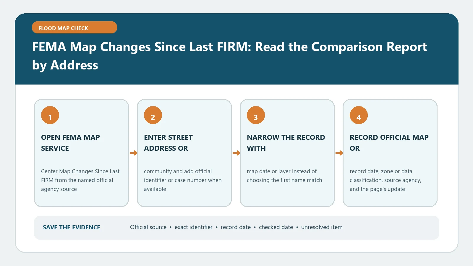
FEMA Map Changes Since Last FIRM: Read the Comparison Report by Address verification workflow showing official source, exact identifiers, result fields, date, and escalation step

The Map Changes Since Last FIRM report compares an address against a newer effective FIRM. Verify the matched location and both map dates; a change shown nearby may not cover the structure.
Categories Fema Flood Maps

Harris County Flood Map by Address: FEMA FIRM, FEMT, and Live Gauges

August 5, 2026 by Flood Map Check
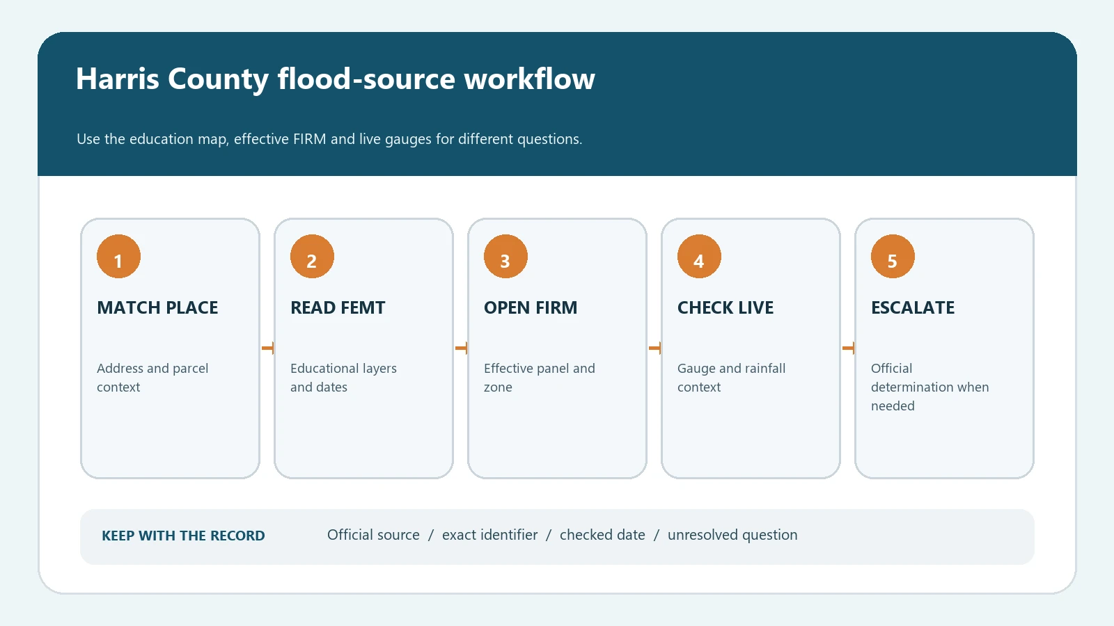
Harris County flood map workflow from address matching through FEMT layers, FEMA FIRM verification, and a separate live gauge check

Search a Harris County address in FEMT, verify the effective FEMA FIRM, and keep live rainfall and stream gauges separate from the regulatory map.

Categories Fema Flood Maps

Newly Mapped Into a FEMA High-Risk Flood Zone: Insurance and Lender Steps

August 5, 2026July 28, 2026 by Flood Map Check
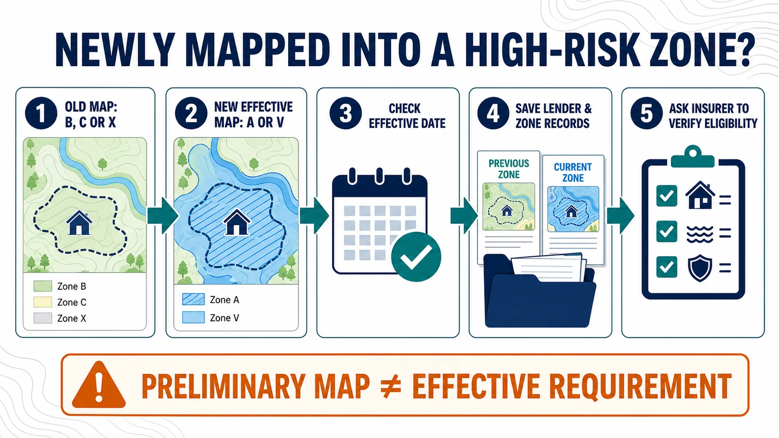
Five-step workflow comparing an old B, C, or X flood zone with a new effective A or V zone, then checking the effective date, records, and insurer eligibility

Confirm the effective FEMA map date, lender determination, NFIP Newly Mapped eligibility, policy timing and evidence after a building moves into an SFHA.

Categories Fema Flood Maps

Is Your LOMA Still Valid After a New FEMA Map? Check the Revalidation Letter

July 28, 2026 by Flood Map Check
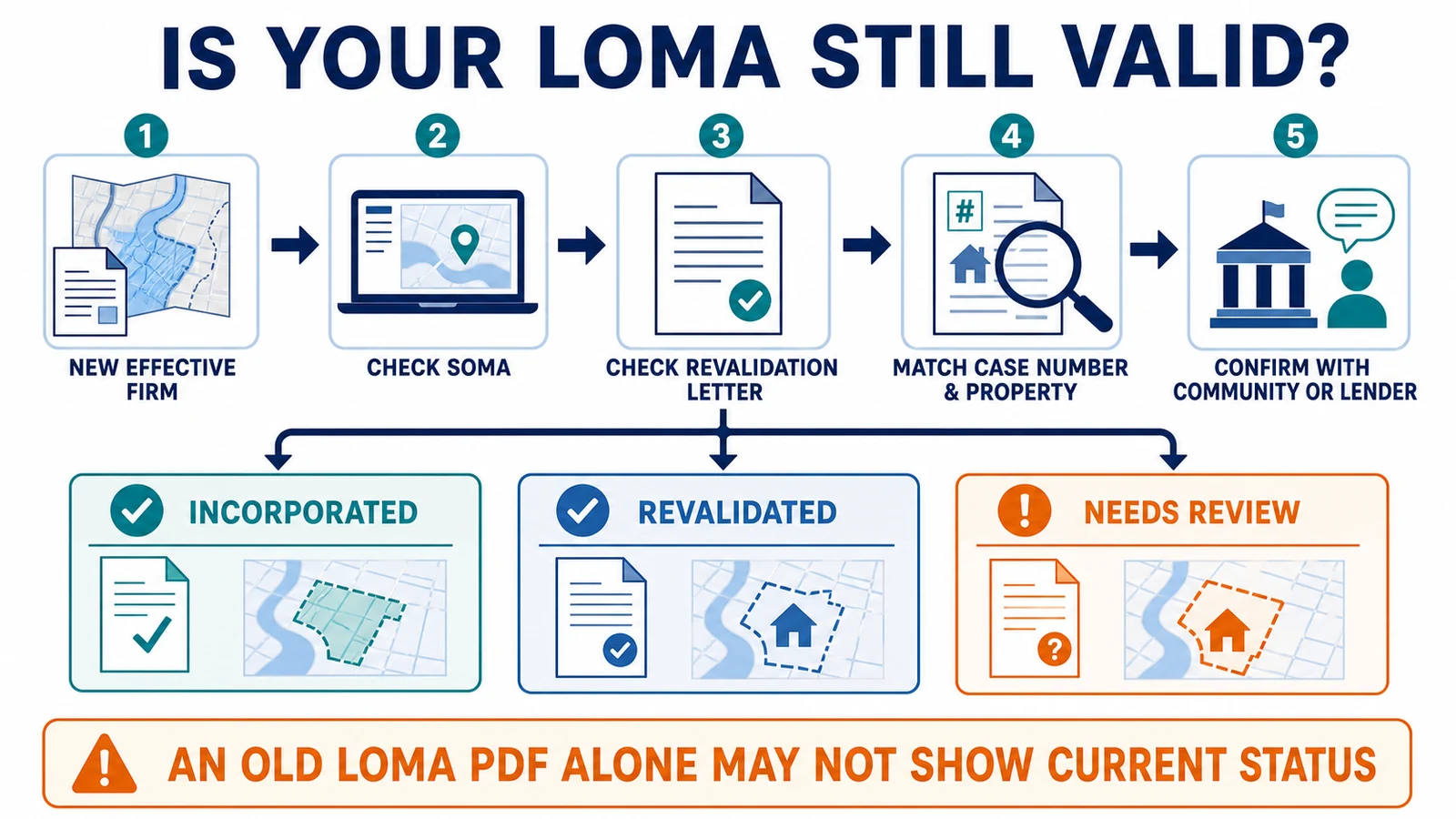
Workflow from a new effective FIRM through SOMA and revalidation-letter checks, matching the case and property, and confirming current status with the community or lender

Check whether an earlier FEMA LOMA remains valid after a revised FIRM by matching the case to the current panel, SOMA, and revalidation letter.

Categories Fema Flood Maps

How to Find a Base Flood Elevation in a FEMA FIRM and Flood Insurance Study

August 5, 2026July 28, 2026 by Flood Map Check
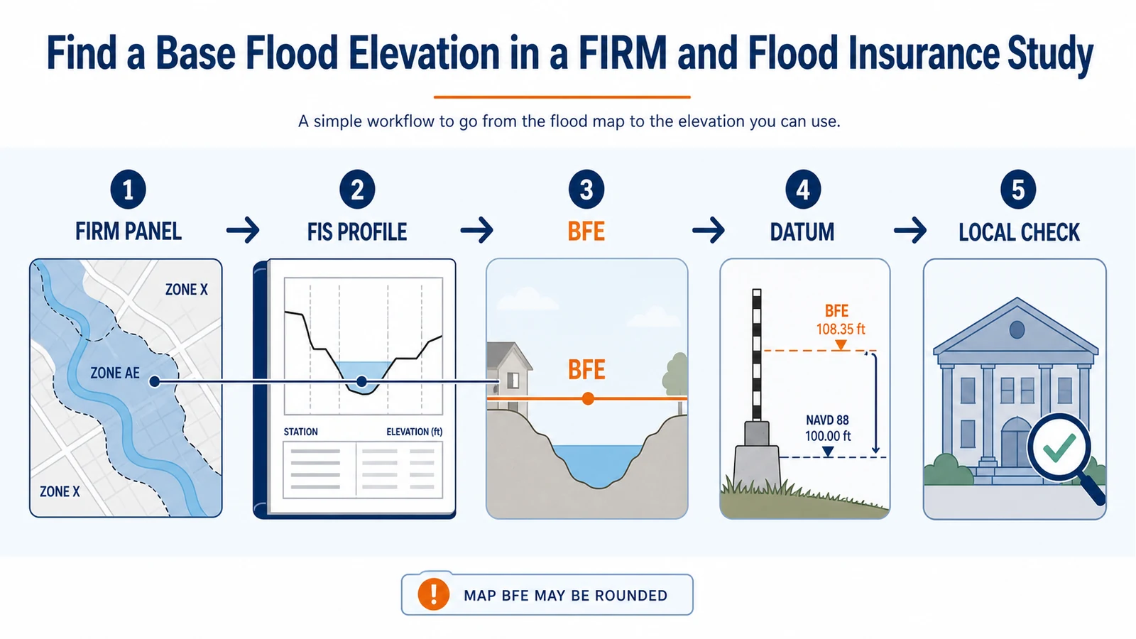
Workflow from a FIRM panel to an FIS flood profile, Base Flood Elevation, vertical datum check, and local verification

Find a FEMA BFE by pairing the effective FIRM panel with its Flood Insurance Study, flood profile, cross sections, vertical datum, and local verification.

Categories Fema Flood Maps

How to Appeal a Preliminary FEMA Flood Map During the 90-Day Period

July 28, 2026 by Flood Map Check
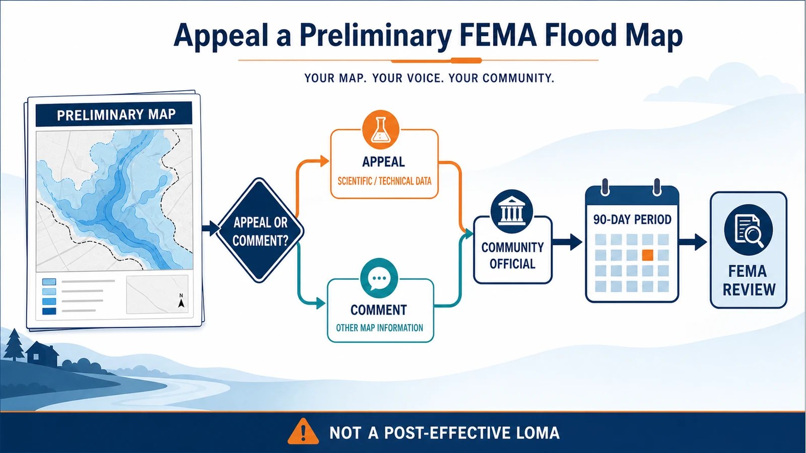
Decision flow separating a scientific or technical appeal from a map comment, submitted through the community official during the 90-day period for FEMA review

File a preliminary FEMA flood-map appeal or comment through your community, with the right evidence and a traceable 90-day deadline record.

Categories Fema Flood Maps

FEMA LOMR vs CLOMR: When a Project Needs a Map Revision Review

July 28, 2026July 28, 2026 by Flood Map Check
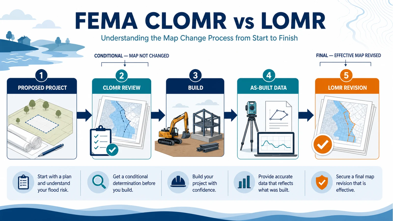
Five-step project map revision workflow from proposed project and CLOMR review through construction, as-built data, and final LOMR revision

Compare FEMA CLOMR and LOMR requests, choose the correct project stage, and prepare the MT-2 evidence, community review and as-built record.

Categories Fema Flood Maps

FEMA Preliminary vs Effective Flood Maps: Check Your Address

August 24, 2026July 27, 2026 by Flood Map Check
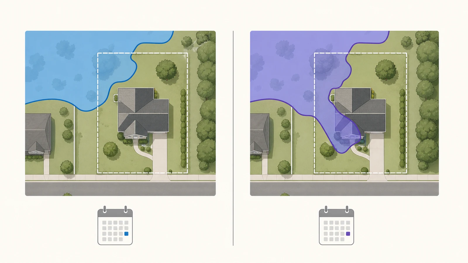
One property compared on current effective and proposed preliminary flood-map boundaries

Compare effective and preliminary FEMA flood maps for one address, see proposed changes, and learn which source applies to federal map and local permit decisions.

Categories Fema Flood Maps

FEMA LOMA and LOMR-F Lookup: Check a Letter of Map Change

August 24, 2026July 13, 2026 by Flood Map Check

Find an existing FEMA Letter of Map Change, distinguish LOMA from LOMR-F, and check the case against the current effective flood map.

Categories Fema Flood Maps

FEMA FIRM Panel and FIRMette Guide

August 5, 2026June 18, 2026 by Flood Map Check

Create a FEMA FIRMette from the correct effective panel, keep the building, panel number, date, legend, scale, north arrow, and title block, and understand what it does not decide.

Categories Fema Flood Maps
Older posts
Newer posts
← Previous Page1 … Page5 Page6 Page7 Next →

Recent Posts

  • Sarasota County Flood Zone and Elevation Certificate Search
  • Charlotte County FL Elevation Certificate Search
  • Palm Beach County Flood Zone and Elevation Certificate Search
  • Collier County Flood Map and Elevation Certificate Search
  • Disaster Declaration Incident Type vs Assistance Programs: Filter Flood Events Correctly

Recent Comments

No comments to show.
© 2026 Flood Map Check • Built with GeneratePress