CBRS Property Map Check: Get Official Documentation
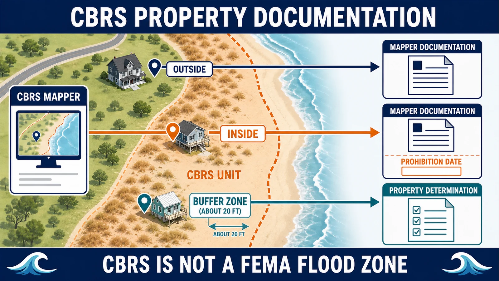
Use the USFWS CBRS Validation Tool, recognize the 20-foot buffer, and request a property determination without confusing CBRS with a FEMA flood zone.
Property Checks guides.
Use the USFWS CBRS Validation Tool, recognize the 20-foot buffer, and request a property determination without confusing CBRS with a FEMA flood zone.
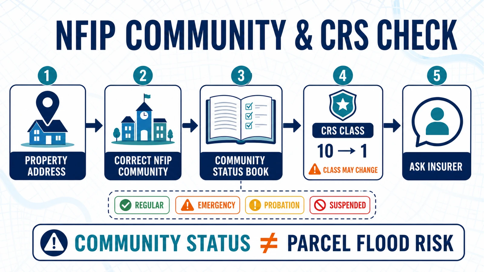
Find the correct NFIP community, CID, participation status, map date, CRS class and potential discount without confusing them with a property flood zone.
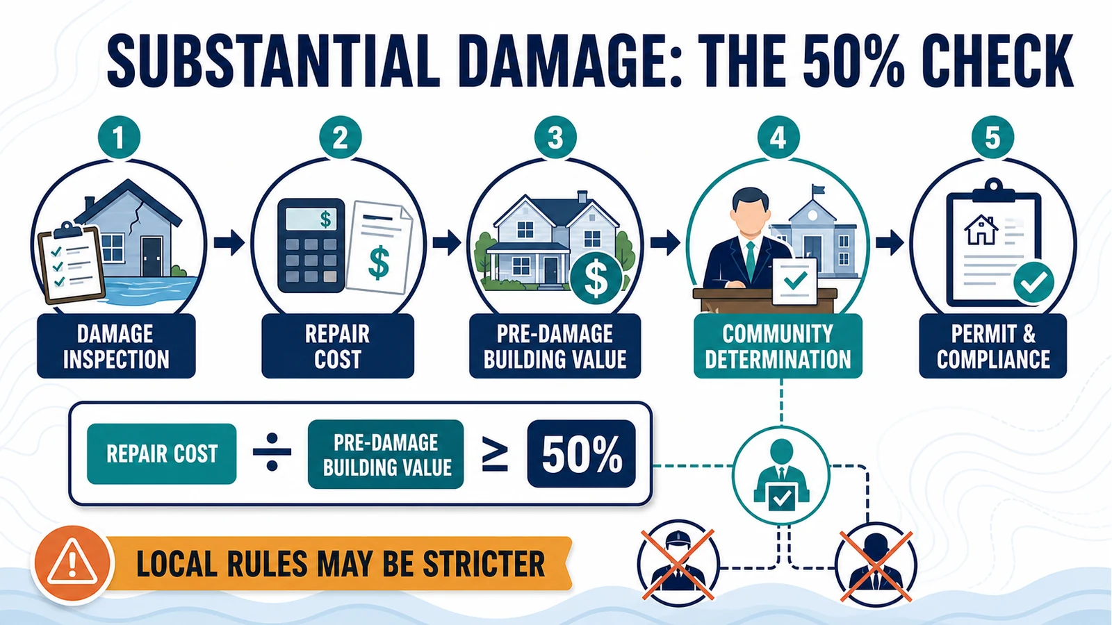
Understand who makes a substantial-damage determination, how the 50% test uses repair cost and pre-damage building value, and what to do before repairs.
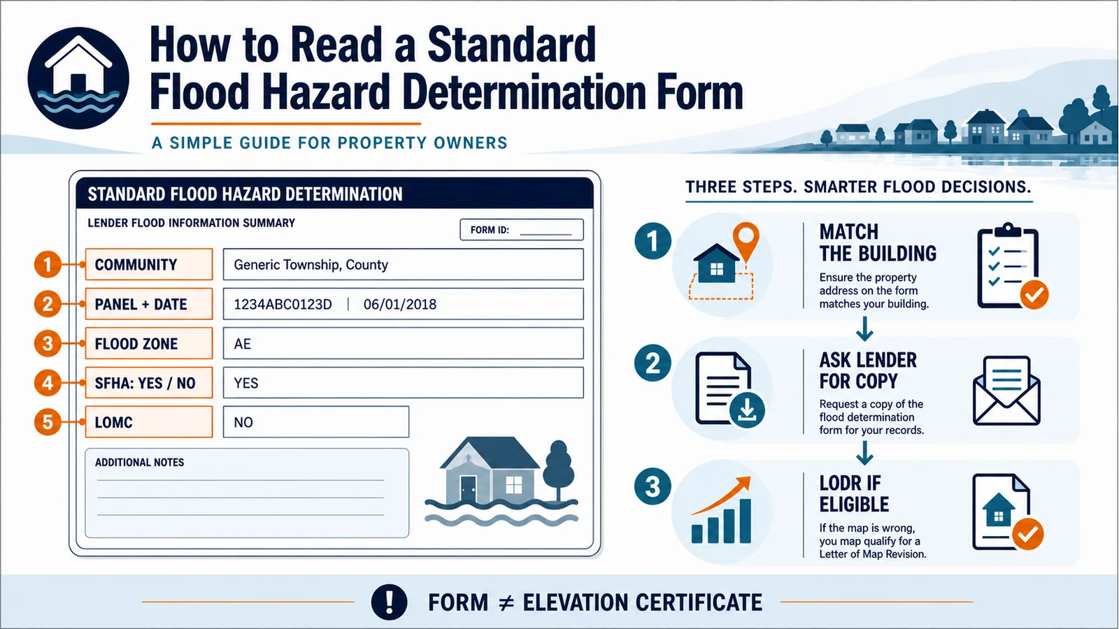
Read the SFHDF building, community, FIRM panel, map date, flood zone, LOMC and SFHA decision before asking a lender to correct an error.
Use public flood maps as one check before leasing, but confirm disclosure, insurance, and safety questions through the proper local path.
Send an Elevation Certificate to the local office, insurer, lender, or complete FEMA map-change application that requested it. Use this routing and file checklist before submitting.
Renters can use official flood maps for location context, but lease, insurance, and safety questions need separate confirmation.
Before buying, use official flood map sources to identify map labels, update dates, and questions to ask next.