FEMA LOMC Case Status: Completeness, Review, Data or Fee, and Letter Sent
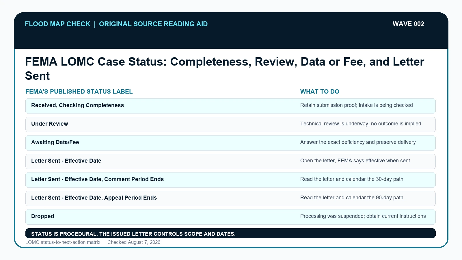
A FEMA LOMC status describes where a request sits in the review process; it does not predict whether FEMA will grant the map change.
A FEMA LOMC status describes where a request sits in the review process; it does not predict whether FEMA will grant the map change.
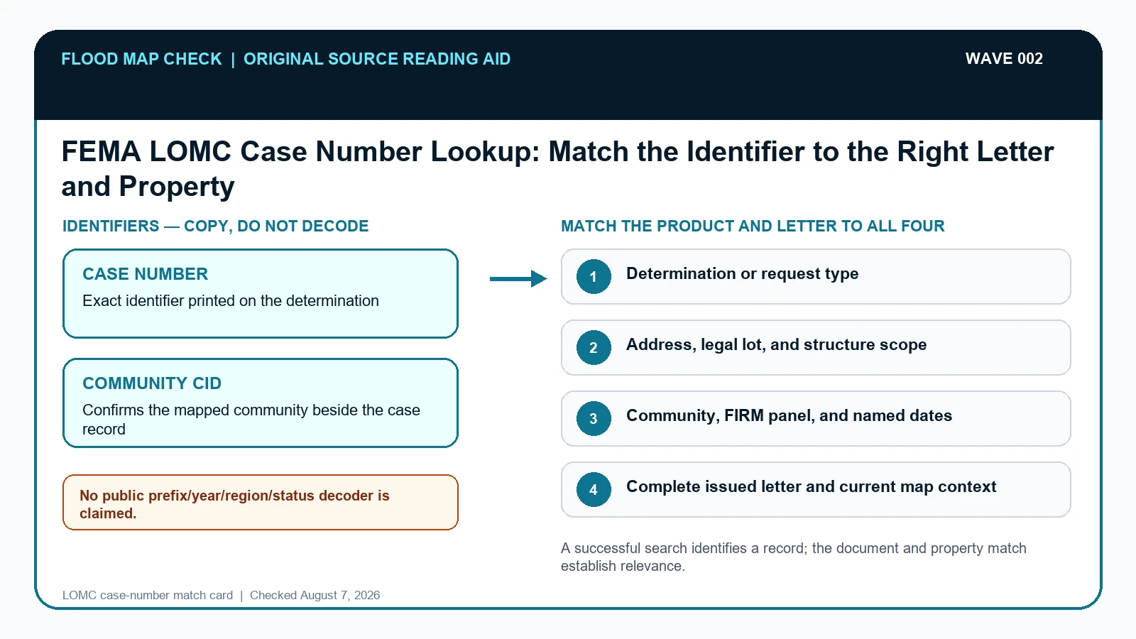
A FEMA Letter of Map Change case number is a tracking key, not proof that a letter covers a particular building.
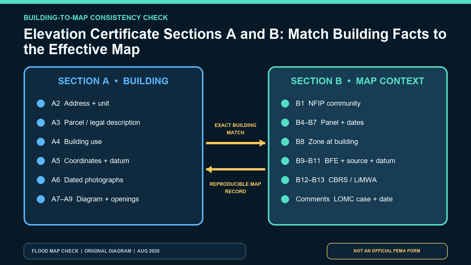
Cross-check Elevation Certificate Sections A and B from building identity through NFIP community, effective panel, zone, BFE source, and datum.
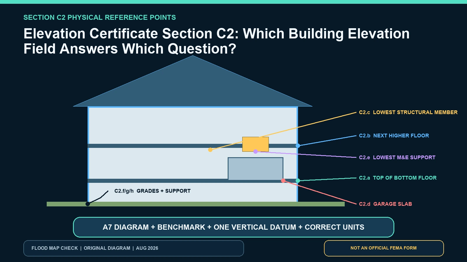
Decode FEMA Elevation Certificate C2.a-h by matching every elevation to the building diagram, physical point, datum, and units.
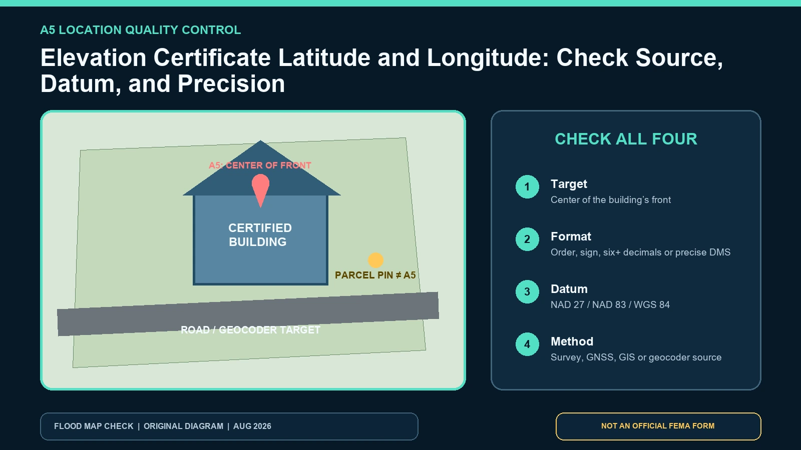
Check Elevation Certificate latitude and longitude against the building, coordinate format, horizontal datum, and documented source method.
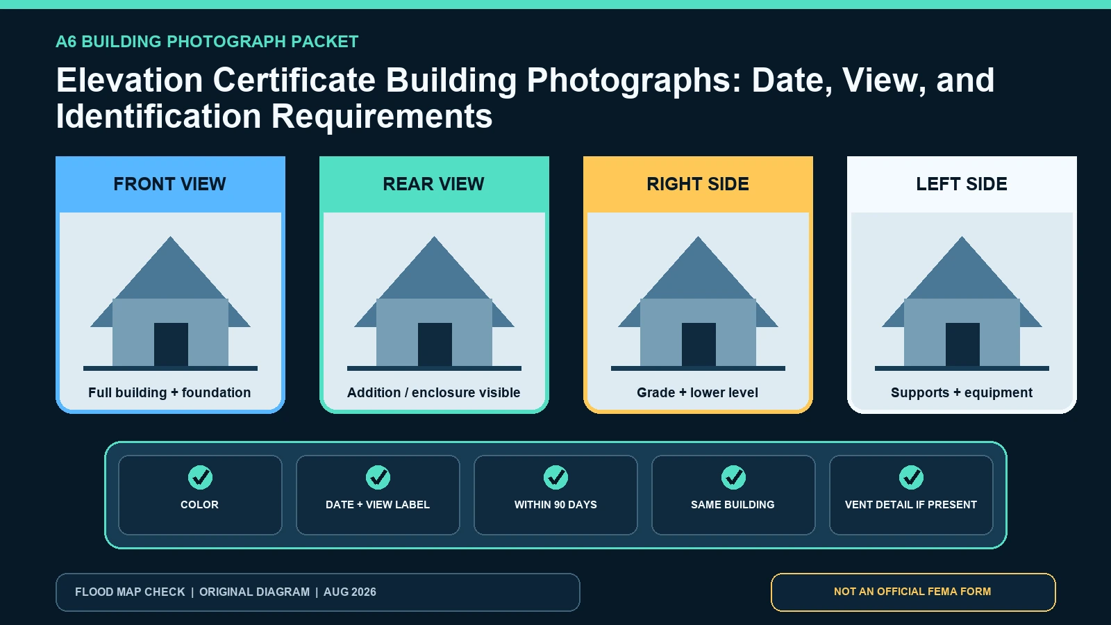
Build an Elevation Certificate photo packet with current color views, dates, building identification, foundation context, and vent details.
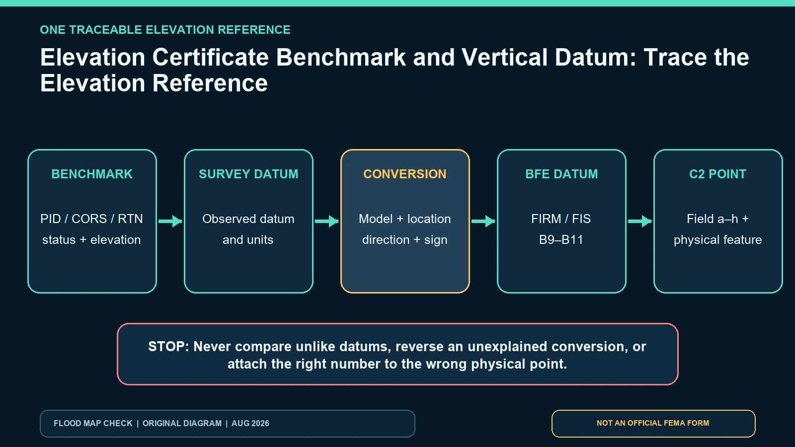
Trace an Elevation Certificate from benchmark ID through vertical datum and conversion to the BFE before comparing any C2 elevation.
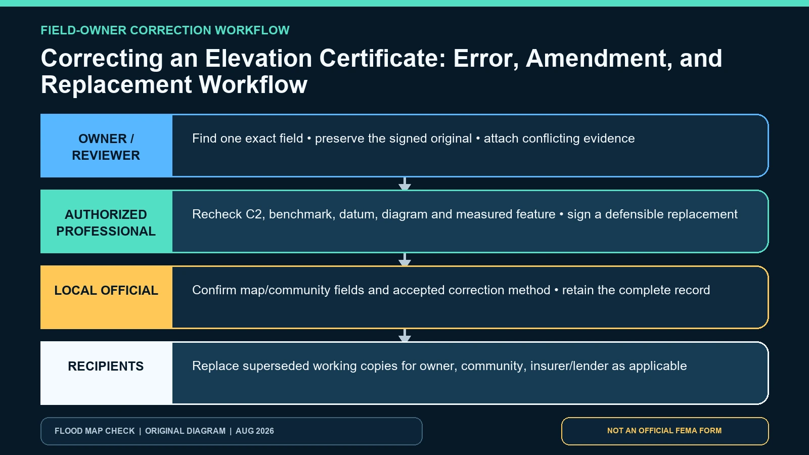
Identify the wrong Elevation Certificate field, preserve the signed original, and route the correction to the authorized professional or official.
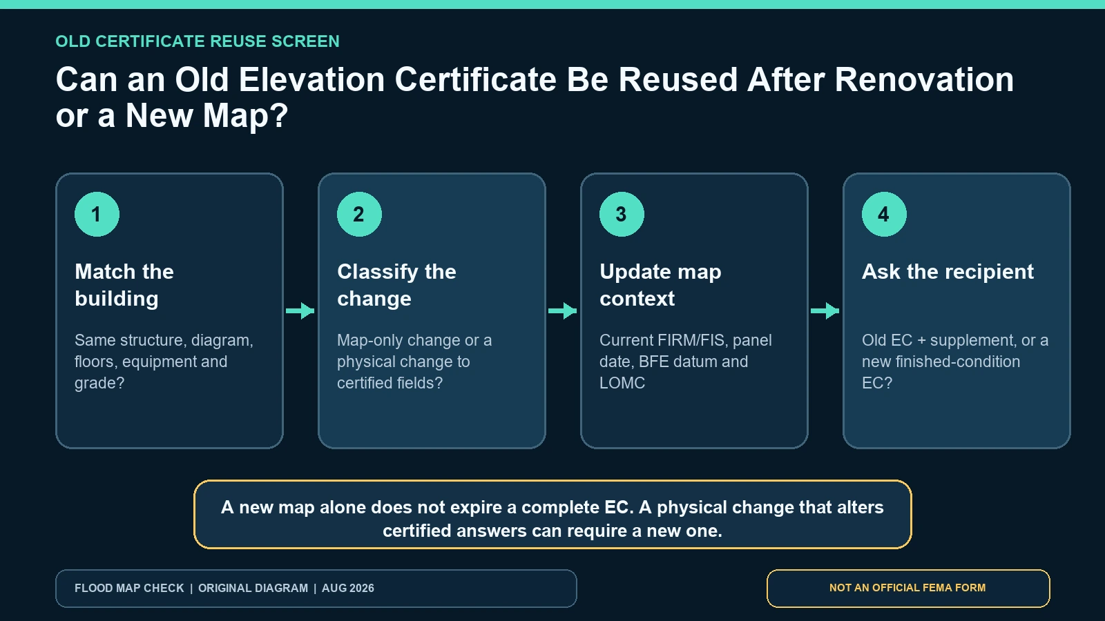
Use FEMA’s physical-change test to decide whether an old Elevation Certificate can be reused, updated with current map evidence, or replaced.
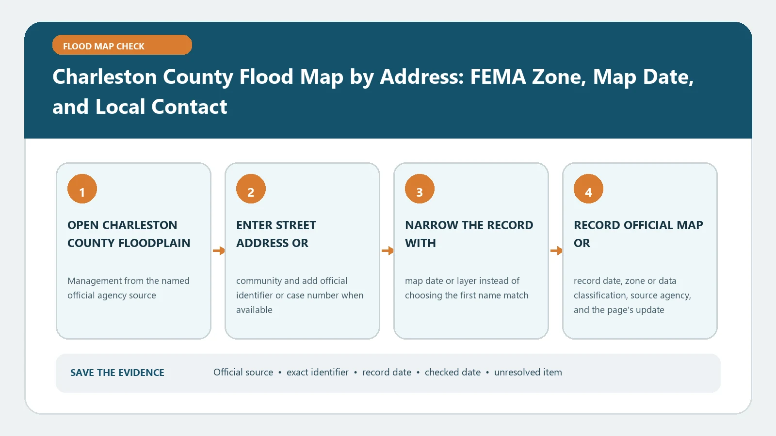
For Charleston County, save the address match, FEMA zone, panel, and effective date before contacting floodplain staff. A map result alone cannot certify elevation or authorize construction.