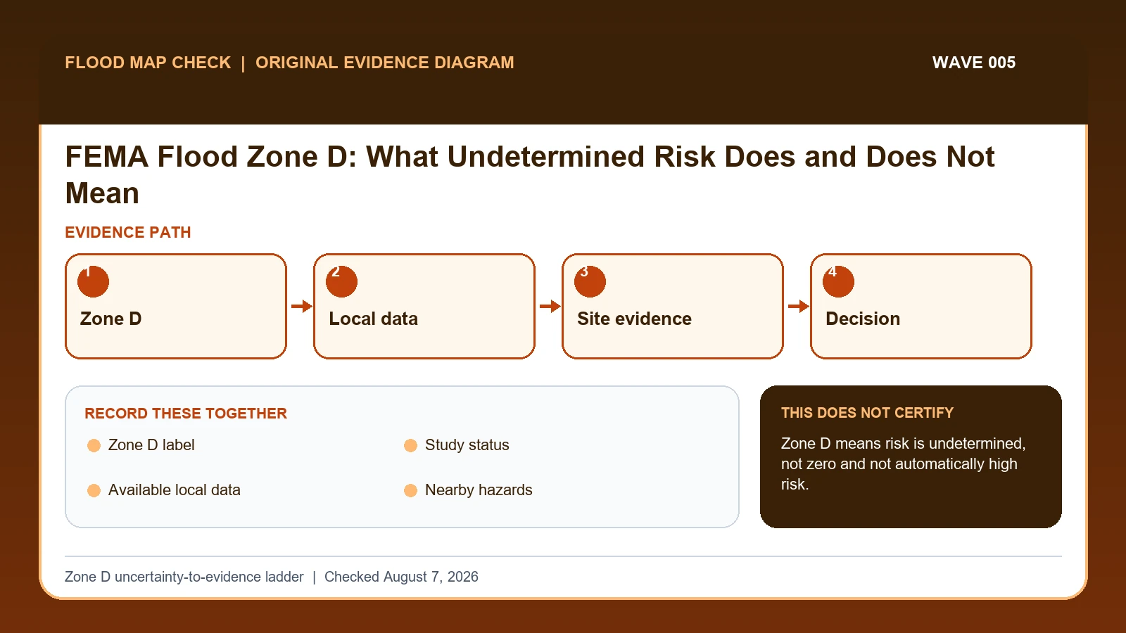
Quick answer: FEMA Flood Zone D identifies an area where possible flood hazards exist but detailed analysis has not established the level of risk. Keep the Zone D label, effective panel, and date intact and obtain additional local and site evidence for a purchase, design, insurance, or permitting decision.
Zone D means risk is undetermined, not absent
- Confirm the effective FEMA panel and that the location is actually inside the Zone D area.
- Ask the local floodplain official about available studies, historical flooding, drainage, and adopted requirements.
- Use a qualified professional when elevation, drainage, or site design could change the decision.
What this result does not prove
Zone D must not be relabeled as low risk or Zone X. A map label alone does not set an insurance quote, lender decision, or safe building elevation.
Verify the live rule at FEMA flood-zone reference. Then continue with the FEMA address lookup guide for the next step.
Treat FEMA Zone D as undetermined flood risk, then gather the effective map, local studies, terrain, drainage, flood history, and permit requirements. The label is neither a finding of minimal risk nor an automatic Special Flood Hazard Area designation, so the responsible community's evidence and rules define the next check.
Last checked: August 7, 2026.
Zone D is an information gap label. It signals that the standardized probability and elevation detail available in studied zones is not present. The absence of a mapped BFE or modeled boundary does not remove riverine, surface-water, dam, coastal, or local drainage hazards. Insurance and building requirements can still arise from lenders, communities, owners, or better available data.
Undetermined cannot be converted to low risk
Zone D means flood hazards are possible but undetermined. It is not a synonym for Zone X, minimal risk, or no insurance concern. The label reflects an information gap in FEMA's detailed hazard mapping. A missing BFE or boundary therefore cannot be converted to zero elevation or zero depth; local terrain, drainage, dams, coast, studies, and flood history can still indicate material exposure.
The practical response is an evidence ladder. Save the effective panel and Zone D label, look for preliminary mapping and active studies, ask the community for best available data, and identify site-specific drainage and topographic information. If a local study provides an elevation, record whether it has been adopted and for what purpose. A preliminary FEMA zone remains preliminary until the effective process is complete.
Decision owners can require more than FEMA's label. A lender may make an insurance decision, a community can regulate development using best available information, and an engineer may need a site analysis. None of those outcomes should be promised from this guide. If consequences are significant and reliable local evidence is absent, the honest result is unresolved risk and a recommendation for qualified hydrologic, hydraulic, or survey work.
The effective FIRM establishes the Zone D information gap
FEMA FIRM legend lesson supplies the official legend distinctions among Zone AO depth, Zone AE or AH base flood elevation, Zone D, and other mapped flood zones; this guide cites it for Zone D label. FEMA MSC Search All Products lesson supplies the current effective map plus preliminary maps, historic FIRM panels, Flood Insurance Studies, Letters of Map Change, and other community products; this guide cites it for Study status. FEMA flood-map technical references supplies current FIRM panel, database, domain-table, and Flood Insurance Study specifications; this guide cites it for Study status.
The FEMA flood zone D meaning crosswalk keeps these assignments explicit: FEMA FIRM legend lesson → Zone D label; FEMA MSC Search All Products lesson → Study status; FEMA flood-map technical references → Study status. If Zone D label or another named field is absent from its cited record, leave that fact unresolved and obtain it from the responsible official source instead of expanding a different citation beyond scope.
| Official record | What it actually supplies | Field used here |
|---|---|---|
| FEMA FIRM legend lesson | the official legend distinctions among Zone AO depth, Zone AE or AH base flood elevation, Zone D, and other mapped flood zones | Zone D label |
| FEMA MSC Search All Products lesson | the current effective map plus preliminary maps, historic FIRM panels, Flood Insurance Studies, Letters of Map Change, and other community products | Study status |
| FEMA flood-map technical references | current FIRM panel, database, domain-table, and Flood Insurance Study specifications | Study status |
Do not extend a citation beyond its mapped fields. Evidence for Zone D label cannot automatically establish Study status; keep either unanswered item visible before taking the action to route an undetermined-risk result to the best available official evidence.
FEMA explains the Zone D label and map context. Any local best-available study, permit standard, or development rule must be cited separately to the responsible local authority.
How Zone D label connects to Decision requirements
| Field | Meaning in this check | Error it exposes | Response |
|---|---|---|---|
| Zone D label | Official undetermined-risk designation | Not zero risk | Quote exactly |
| Study status | Explains missing detailed analysis | Can change with new mapping | Check current/preliminary work |
| Available local data | Studies, drainage, terrain, permits, history | Quality/scope vary | Identify owner/date |
| Nearby hazards | Streams, coast, dams, steep drainage, surface flow | May not be in FEMA label | Screen separately |
| Decision requirements | Community, lender, insurer, designer | Zone D alone cannot decide | Get written direction |
Zone D label is the starting identifier, but it is usable only when Study status and Available local data agree. Two conflicts can break that agreement: “Not zero risk” and “Quality/scope vary”. A polished screenshot cannot repair either one.
For interpretation, Study status answers “Explains missing detailed analysis”, while Nearby hazards answers “Streams, coast, dams, steep drainage, surface flow”. They are not interchangeable. A failure in the first calls for “Check current/preliminary work”; a failure in the second calls for “Screen separately”.
The final safeguard is Decision requirements, which answers “Community, lender, insurer, designer”. Its warning condition is “Zone D alone cannot decide”. At that point in the FEMA flood zone D meaning check, document the limited result or take the unresolved issue to the official decision owner.
Climb from map label to local and site evidence
Verify two checkpoints before interpreting Decision requirements: “Ask the local floodplain administrator for best available studies, elevations, and ordinance treatment”, followed by “Review terrain, drainage, nearby streams, dams, coast, and documented flood history from official sources”. If the first checkpoint fails, stop before applying the second to a possibly wrong Zone D label subject or record.
- Open the effective FIRM and verify panel, suffix, date, Zone D label, and community.
- Check preliminary map products and active mapping projects without substituting them for effective data.
- Ask the local floodplain administrator for best available studies, elevations, and ordinance treatment.
- Review terrain, drainage, nearby streams, dams, coast, and documented flood history from official sources.
- Identify what the lender, insurer, permit office, or designer requires for the particular decision.
- Commission site-specific hydrologic, hydraulic, or survey work when consequences justify it.
- State that risk remains undetermined until stronger evidence exists; never relabel the area yourself.
The file is ready for later review only after this final action: “State that risk remains undetermined until stronger evidence exists; never relabel the area yourself”. Keep Zone D label, Available local data, and Decision requirements in that record so a future update shows exactly what changed.
A buyer who must not relabel Zone D as Zone X
A buyer seeing Zone D should not replace it with Zone X in a checklist. Save the exact panel and label, then request the community's best available floodplain study, subdivision drainage report, high-water history, and development rules. A site-specific professional may be needed where topography or nearby water suggests material exposure.
In this example, Zone D label identifies the relevant record, while Available local data is the fact most likely to change the interpretation. Conclude “Risk unresolved” only when the evidence shows “No detailed FEMA result”.
For FEMA flood zone D meaning, if the facts instead fit “Development proposed”, the result changes to “Screening is insufficient”. Respond by following “Consult local official/professional”. Do not substitute the more favorable conclusion from the earlier example.
Zone D alone, local study, preliminary map, and proposed development
| Observed state | Evidence test | Limited conclusion | Next response |
|---|---|---|---|
| Zone D only | No detailed FEMA result | Risk unresolved | Gather local/best available data |
| Local study exists | Mapped elevations or boundaries | Additional evidence | Check adoption and intended use |
| Preliminary FEMA mapping | Future detailed zone proposed | Not yet effective | Track effective process |
| Development proposed | Design/permit decision needed | Screening is insufficient | Consult local official/professional |
The first decision turns on “No detailed FEMA result”, while the next turns on “Mapped elevations or boundaries”. Those tests lead to different conclusions—“Risk unresolved” and “Additional evidence”—so they should remain separate in the saved record.
“Preliminary FEMA mapping” calls for “Track effective process”, but “Development proposed” calls for “Consult local official/professional”. Reporting the Preliminary FEMA mapping and Development proposed differences is more accurate than forcing both conditions into one generalized warning.
No BFE, preliminary studies, and unresolved design questions
- Avoid calling Zone D low risk. Recheck Zone D label. The mapped warning is “Not zero risk”; the corresponding response is “Quote exactly”.
- Avoid treating no BFE as zero depth. Recheck Study status. The mapped warning is “Can change with new mapping”; the corresponding response is “Check current/preliminary work”.
- Avoid using preliminary map as effective. Recheck Study status. The mapped warning is “Can change with new mapping”; the corresponding response is “Check current/preliminary work”.
- Avoid ignoring local best-available data. Recheck Available local data. The mapped warning is “Quality/scope vary”; the corresponding response is “Identify owner/date”.
Check Zone D label when the risk is “calling Zone D low risk”, because the mapped warning is “Not zero risk”. Check Study status separately for “treating no BFE as zero depth” and use “Check current/preliminary work” as the recovery step.
Two field-specific corrections are required. For “using preliminary map as effective”, follow “Check current/preliminary work”. For “ignoring local best-available data”, follow “Identify owner/date”. Keeping Study status separate from Available local data prevents one repaired field from hiding the other error.
What this Zone D uncertainty-to-evidence ladder cannot decide
Scope: United States effective FEMA flood map products. Limitation: Zone D means risk is undetermined, not zero and not automatically high risk.
The value of the Zone D uncertainty-to-evidence ladder is traceability: it places Zone D label, Available local data, and Decision requirements beside their sources. Authority to decide the underlying Zone D label remains with the organization named in the official record.
Add local and site evidence without replacing the effective label
- Consult FEMA Flood Map Check By Address after Zone D label has been matched to the correct subject and date.
- Consult Flood Risk Map By Address for the distinct issue revealed by Available local data.
- Consult FEMA FIRM Panel Guide when Decision requirements changes the next official step beyond the action to route an undetermined-risk result to the best available official evidence.
Use this guide to route an undetermined-risk result to the best available official evidence. The linked guides address separate questions raised by Zone D label, Available local data, or Decision requirements.
Before treating undetermined risk as minimal
Does Zone D label settle the question by itself?
No. Zone D label answers “Official undetermined-risk designation”, but it can fail when “Not zero risk”. Pair it with Study status, Available local data, and the checked date.
What if the evidence shows Development proposed?
Confirm the stated evidence test: “Design/permit decision needed”. The limited conclusion is “Screening is insufficient”. The documented response is “Consult local official/professional”; a more favorable branch should not be substituted.
When should Decision requirements be checked again?
Revisit Zone D when a local study, preliminary map, newly effective FIRM, drainage analysis, or site investigation becomes available. Add the new evidence beside the effective label; do not retroactively translate the earlier undetermined designation into Zone X or a known BFE.
FEMA Flood Zone D: What Undetermined Risk Does and Does Not Mean is independent public-record guidance for the limited action to route an undetermined-risk result to the best available official evidence. The cited government records retain authority over Zone D label and Decision requirements. Last checked: August 7, 2026.