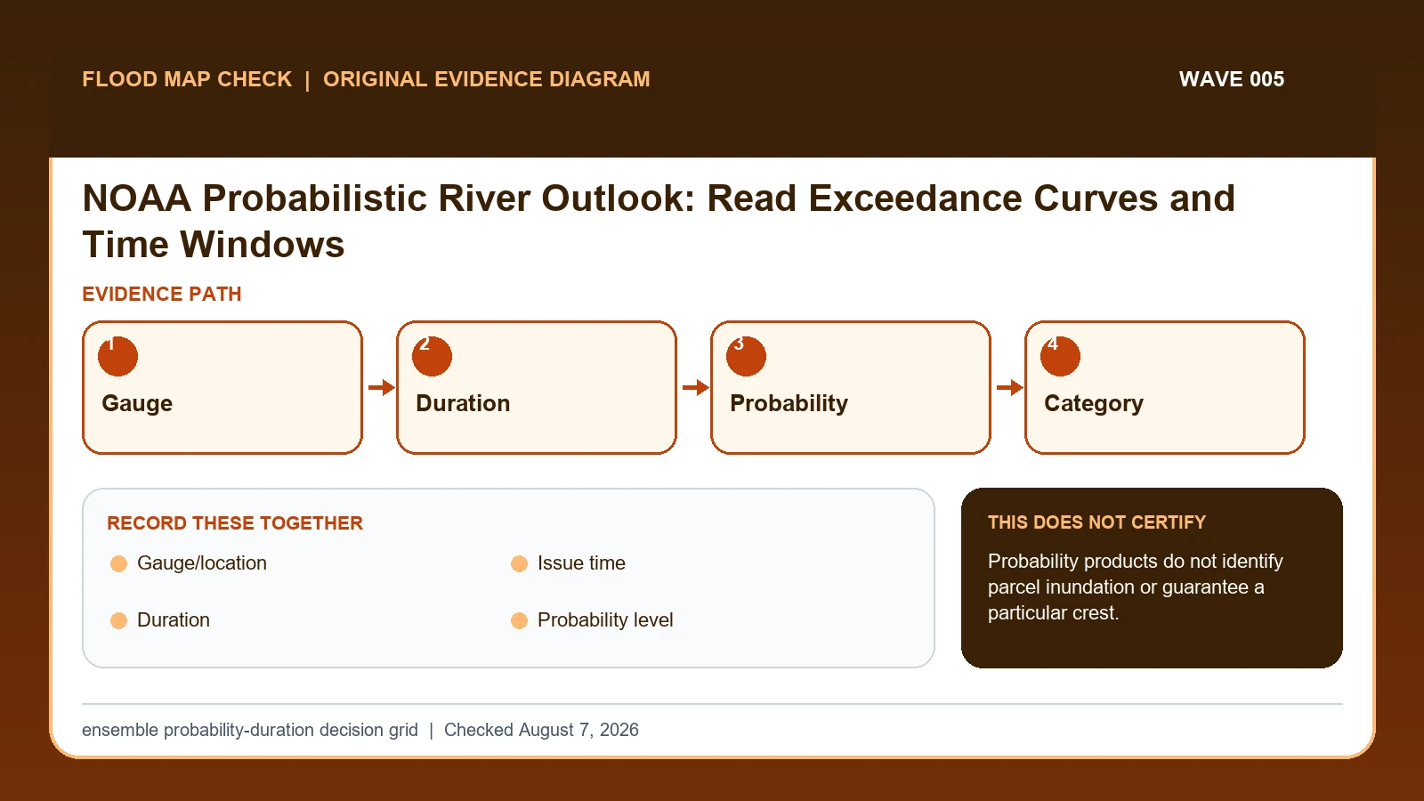
A NOAA probabilistic river outlook reports the chance that a named forecast point will exceed a selected flood category during a stated duration. Record the gauge, issue time, probability threshold, category, and experimental status; the outlook is neither a guarantee nor a parcel inundation map.
Last checked: August 7, 2026.
The Hydrologic Ensemble Forecast System runs at River Forecast Centers and represents forecast uncertainty with many members. On the display, a duration and probability level define the test: for example, whether at least the chosen percentage of the ensemble exceeds a category at any point in the period. A green result means the selected criterion was not met, not that flooding is impossible.
Duration, probability, and category form one test
A probabilistic river outlook tests an ensemble against a selected duration, probability level, and local flood category. Changing any control changes the question. A 10-percent chance of exceeding Minor Flood within 10 days is not comparable to a 50-percent chance within 3 days unless both control sets are shown. The color is the output of that selected test, not a freestanding forecast label.
Suppose 20 ensemble members are represented and 12 exceed the Minor threshold at some point in a 7-day window. The simple member fraction is 12 divided by 20, or 60 percent, subject to the product's actual method. That result meets a 50-percent display criterion but not a 70-percent criterion. It still does not say flooding will occur on 60 percent of parcels or for 60 percent of the week.
A green or below-category result means the chosen criterion was not met. Lower-probability members, another duration, an ungauged tributary, rainfall flooding, or a later forecast cycle can still matter. Save the issue time and experimental status, then move toward official location forecasts, watches, warnings, observations, and local instructions as an event approaches. A planning outlook should not be turned into a parcel inundation boundary.
HEFS controls define the probability question
NOAA Hydrologic Ensemble Forecast System supplies probability, duration, category, and experimental-product interpretation; this guide cites it for Duration / Probability level / Flood category / Experimental label. NOAA National Water Prediction Service supplies official NWS gauge observations, forecasts, thresholds, impacts, and supplemental model guidance; this guide cites it for Gauge/location / Issue time / Flood category. NOAA NWPS API information supplies the fields exposed for locations, observations, forecasts, flood categories, crests, and NWM output; this guide cites it for Gauge/location / Issue time / Duration / Probability level / Flood category / Experimental label.
The probabilistic river forecast crosswalk keeps these assignments explicit: NOAA Hydrologic Ensemble Forecast System → Duration / Probability level / Flood category / Experimental label; NOAA National Water Prediction Service → Gauge/location / Issue time / Flood category; NOAA NWPS API information → Gauge/location / Issue time / Duration / Probability level / Flood category / Experimental label. If Duration or another named field is absent from its cited record, leave that fact unresolved and obtain it from the responsible official source instead of expanding a different citation beyond scope.
| Official record | What it actually supplies | Field used here |
|---|---|---|
| NOAA Hydrologic Ensemble Forecast System | probability, duration, category, and experimental-product interpretation | Duration / Probability level / Flood category / Experimental label |
| NOAA National Water Prediction Service | official NWS gauge observations, forecasts, thresholds, impacts, and supplemental model guidance | Gauge/location / Issue time / Flood category |
| NOAA NWPS API information | the fields exposed for locations, observations, forecasts, flood categories, crests, and NWM output | Gauge/location / Issue time / Duration / Probability level / Flood category / Experimental label |
For this check, the cited evidence is limited to Duration, Experimental label, and Issue time plus the other fields named in the crosswalk. Record a changed or missing Experimental label value with the retrieval date before taking the action to translate the outlook into conditional probabilities without calling it a deterministic crest, then request clarification from its publishing agency.
How Gauge/location connects to Spatial decision scope
| Field | Meaning in this check | Error it exposes | Response |
|---|---|---|---|
| Gauge/location | Forecast point represented | Not every stream reach | Keep ID/name |
| Issue time | Forecast cycle | Outlook changes | Record time zone |
| Duration | Window searched for exceedance | Longer window changes result | Save selection |
| Probability level | Ensemble agreement threshold | Not event certainty | Report percentage |
| Flood category | Local threshold exceeded in ensemble | Location-specific | Pair with impacts |
| Experimental label | Service may change/not be 24×7 | Operational limit | Check current status |
| Spatial decision scope | Limits the probability to the named forecast point, duration, and category | A gauge probability is not a parcel inundation probability or site-specific flood depth | Use mapped and site-specific evidence for parcel decisions |
Read the table in two passes. First confirm Gauge/location, Issue time, and Duration. They answer “Forecast point represented”, “Forecast cycle”, and “Window searched for exceedance”. Any disagreement among Gauge/location, Issue time, and Duration should remain visible rather than being blended into one result.
Next test for two different problems: “Not every stream reach” and “Longer window changes result”. They require different corrections. For the first, follow “Keep ID/name”; for the second, follow “Save selection”.
Experimental label and Spatial decision scope show when to stop. The warning conditions are “Operational limit” and “A gauge probability is not a parcel inundation probability or site-specific flood depth”. The limits on Experimental label and Spatial decision scope keep the evidence useful without making the broader decision reserved for the named authority or professional.
Save the ensemble controls with every outlook result
Build the evidence from Gauge/location outward. The middle of the review should move from “Select and save the outlook duration and probability level” to “Read the highest category meeting that criterion rather than only the map color”. Record any conflict before continuing to the remaining checks.
- Choose the exact NOAA forecast location and verify its local category thresholds.
- Record the HEFS issue time and experimental-service notice.
- Select and save the outlook duration and probability level.
- Read the highest category meeting that criterion rather than only the map color.
- Compare several probability/duration settings only when each is labeled.
- Open the official NWS hydrograph, forecast discussion, watches, and warnings as the event nears.
- Use local emergency information for roads, evacuations, and property impacts.
After the comparison, “Use local emergency information for roads, evacuations, and property impacts”. The saved evidence should let another reader retrace Gauge/location through Duration without guessing which limitation applied.
Twelve of twenty ensemble members exceed a threshold
Selecting 10 days and 50 percent answers a different question from selecting 3 days and 10 percent. Save the controls with the map; otherwise a screenshot cannot be interpreted later. As the event approaches, move from the outlook to official location forecasts, watches/warnings, observed gauges, and local instructions.
In this example, Gauge/location identifies the relevant record, while Duration is the fact most likely to change the interpretation. Conclude “Elevated outlook signal” only when the evidence shows “Many members exceed soon”.
For probabilistic river forecast, if the facts instead fit “No gauge/experimental gap”, the result changes to “Risk unresolved”. Respond by following “Use RFC/NWS/local products”. Do not substitute the more favorable conclusion from the earlier example.
Near-term signal, low-probability tail, green criterion, and missing outlook
| Observed state | Evidence test | Limited conclusion | Next response |
|---|---|---|---|
| High probability/short window | Many members exceed soon | Elevated outlook signal | Check official forecast/warnings |
| Low probability/long window | Tail risk across longer period | Uncertain planning signal | Monitor updates |
| Green/no flooding category | Chosen criterion not met | Not zero probability | Check other thresholds/products |
| No gauge/experimental gap | Outlook unavailable | Risk unresolved | Use RFC/NWS/local products |
Use “Many members exceed soon” to recognize “High probability/short window”. If the facts instead meet “Tail risk across longer period”, report “Uncertain planning signal” and follow “Monitor updates”.
If the observation matches “Chosen criterion not met”, stop at “Not zero probability”. If it matches “Outlook unavailable”, stop at “Risk unresolved”. The corresponding actions are “Check other thresholds/products” and “Use RFC/NWS/local products”.
Green cells, experimental gaps, and later forecast cycles
- Avoid cropping out controls. Recheck Issue time / Duration / Probability level / Flood category / Experimental label. The mapped warning is “Outlook changes; Longer window changes result; Not event certainty; Location-specific; Operational limit”; the corresponding response is “Record time zone; Save selection; Report percentage; Pair with impacts; Check current status”.
- Avoid calling probability certainty. Recheck Probability level. The mapped warning is “Not event certainty”; the corresponding response is “Report percentage”.
- Avoid reading green as impossible. Recheck Probability level / Flood category. The mapped warning is “Not event certainty; Location-specific”; the corresponding response is “Report percentage; Pair with impacts”.
- Avoid mapping a gauge probability to parcels. Recheck Spatial decision scope. The mapped warning is “A gauge probability is not a parcel inundation probability or site-specific flood depth”; the corresponding response is “Use mapped and site-specific evidence for parcel decisions”.
Check Issue time / Duration / Probability level / Flood category / Experimental label when the risk is “cropping out controls”, because the mapped warning is “Outlook changes; Longer window changes result; Not event certainty; Location-specific; Operational limit”. Check Probability level separately for “calling probability certainty” and use “Report percentage” as the recovery step.
Two field-specific corrections are required. For “reading green as impossible”, follow “Report percentage; Pair with impacts”. For “mapping a gauge probability to parcels”, follow “Use mapped and site-specific evidence for parcel decisions”. Keeping Probability level / Flood category separate from Spatial decision scope prevents one repaired field from hiding the other error.
What this ensemble probability-duration decision grid cannot decide
Scope: United States observed and forecast river conditions. Limitation: Probability products do not identify parcel inundation or guarantee a particular crest.
This comparison can expose a conflict between Gauge/location and Duration, but it cannot resolve “No gauge/experimental gap”. In that condition, the defensible next step remains “Use RFC/NWS/local products”.
Shift from probability planning to official event products
- Carry the verified Gauge/location to River Flood Risk Check if that linked topic is the reader’s next question.
- Keep Duration attached to its source when moving to USGS Streamstats Flood Frequency Report.
- Treat USGS Flood Event Viewer High Water Marks as a separate review triggered by Spatial decision scope while working to translate the outlook into conditional probabilities without calling it a deterministic crest, not as confirmation of the result here.
Use this guide to translate the outlook into conditional probabilities without calling it a deterministic crest. The linked guides address separate questions raised by Gauge/location, Duration, or Spatial decision scope.
Before quoting a HEFS probability
Does Gauge/location settle the question by itself?
No. Gauge/location answers “Forecast point represented”, but it can fail when “Not every stream reach”. Pair it with Issue time, Duration, and the checked date.
What if the evidence shows No gauge/experimental gap?
Confirm the stated evidence test: “Outlook unavailable”. The limited conclusion is “Risk unresolved”. The documented response is “Use RFC/NWS/local products”; a more favorable branch should not be substituted.
When should Spatial decision scope be checked again?
Save a new HEFS result for each forecast issuance and retain the duration, exceedance threshold, probability display, and issue time. Compare cycles instead of replacing them, because ensemble probabilities can move sharply as observations and meteorological inputs change.
NOAA Probabilistic River Outlook: Read Exceedance Curves and Time Windows is independent public-record guidance for the limited action to translate the outlook into conditional probabilities without calling it a deterministic crest. The cited government records retain authority over Gauge/location and Spatial decision scope. Last checked: August 7, 2026.