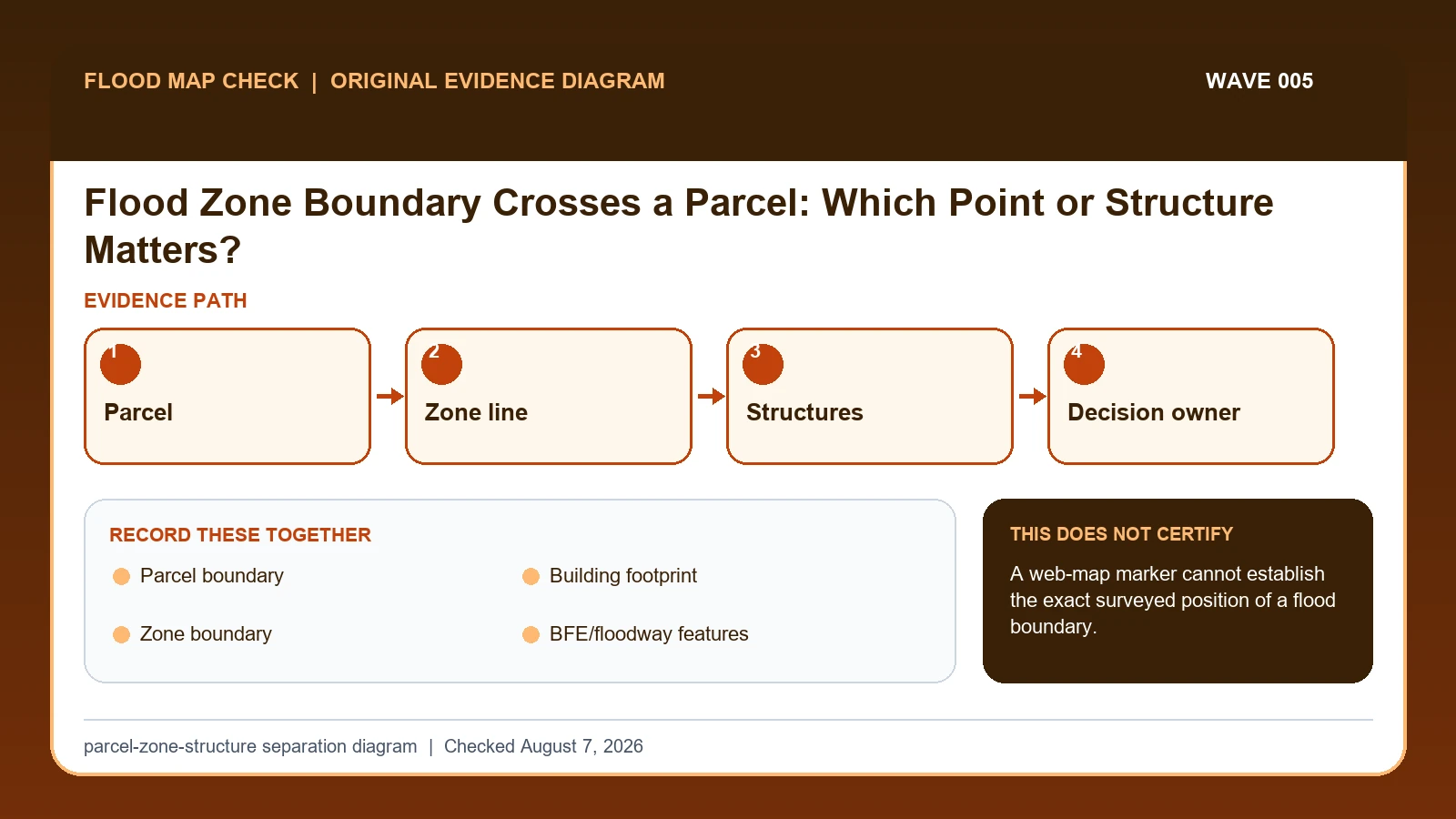
When a FEMA flood-zone boundary crosses a parcel, separate the parcel, each building footprint, and the mapped zone line. The parcel can contain multiple zones while a lender, insurer, permit office, or surveyor makes a structure-specific decision using its own authorized evidence; a web-map pin cannot establish the surveyed boundary position.
Last checked: August 7, 2026.
Flood zones describe mapped areas, not ownership units. A large parcel may span an SFHA, shaded Zone X, unshaded Zone X, floodway, or multiple detailed zones. The result for a house, detached garage, proposed addition, driveway, or vacant portion can differ. Address geocoders commonly land on a driveway, parcel centroid, or street segment rather than the actual structure.
Parcel intersection is not building location
A parcel polygon, a building footprint, and a FEMA zone boundary are three different geometries. A parcel can intersect two zones while every structure sits in one; a long driveway or vacant corner can create the intersection. The decision often concerns the building or proposed work, so a parcel-centroid result is a poor substitute for locating each relevant feature against the effective map.
A defensible screen records the panel and date, maps the parcel and building footprints, and notes which features appear on each side of the line. If 8 percent of a parcel intersects an AE polygon but the house footprint appears entirely in X, the 8-percent statistic describes the parcel overlay only. It does not determine lender treatment, insurance, permit elevation, or the surveyed position of a line relative to the house.
Map scale, georeferencing, parcel accuracy, annexation, and local overlays can shift the apparent intersection. When the outcome changes because a line is a few feet away, stop treating the screen as measurement. A surveyor, community official, lender determination, or FEMA map-change process may be needed depending on the question. Preserve the screen and uncertainty instead of moving the boundary to produce a convenient answer.
Effective FEMA geometry is only one layer in the check
FEMA flood-zone boundary lesson supplies the Flood Zone Division Line and its use as a zone break or limit-of-detailed-study line on a FIRM; this guide cites it for Zone boundary. FEMA flood-map technical references supplies current FIRM panel, database, domain-table, and Flood Insurance Study specifications; this guide cites it for Zone boundary / BFE/floodway features. FEMA MSC Search All Products lesson supplies the current effective map plus preliminary maps, historic FIRM panels, Flood Insurance Studies, Letters of Map Change, and other community products; this guide cites it for Zone boundary / BFE/floodway features.
The flood zone boundary crosses property crosswalk keeps these assignments explicit: FEMA flood-zone boundary lesson → Zone boundary; FEMA flood-map technical references → Zone boundary / BFE/floodway features; FEMA MSC Search All Products lesson → Zone boundary / BFE/floodway features. If Zone boundary or another named field is absent from its cited record, leave that fact unresolved and obtain it from the responsible official source instead of expanding a different citation beyond scope.
| Official record | What it actually supplies | Field used here |
|---|---|---|
| FEMA flood-zone boundary lesson | the Flood Zone Division Line and its use as a zone break or limit-of-detailed-study line on a FIRM | Zone boundary |
| FEMA flood-map technical references | current FIRM panel, database, domain-table, and Flood Insurance Study specifications | Zone boundary / BFE/floodway features |
| FEMA MSC Search All Products lesson | the current effective map plus preliminary maps, historic FIRM panels, Flood Insurance Studies, Letters of Map Change, and other community products | Zone boundary / BFE/floodway features |
The source boundary follows the mapped fields: Zone boundary establishes one part of the record, BFE/floodway features affects interpretation, and BFE/floodway features limits the conclusion. Document any missing fact instead of inferring a replacement value while working to separate parcel-wide screening from structure-specific determination.
FEMA sources identify mapped flood-zone and floodway features, not cadastral parcel boundaries, surveyed building footprints, or the user's Decision subject. Obtain the geometries from the responsible local official source or a qualified survey, and define the decision subject separately for the lender, insurer, permit, or project question.
How Parcel boundary connects to Decision subject
| Field | Meaning in this check | Error it exposes | Response |
|---|---|---|---|
| Parcel boundary | Ownership extent from authoritative parcel record | Not FEMA zone boundary | Use as context only |
| Building footprint | Location of each structure | Centroid may be inaccurate | Verify with imagery/survey |
| Zone boundary | Mapped FEMA feature on effective panel | Line has map-scale limits | Record panel/date |
| BFE/floodway features | Additional regulatory context | May affect part of site | Check FIS and local rules |
| Decision subject | House, unit, accessory building, or work area | Parcel-wide answer may be wrong | Name before requesting determination |
A sound flood zone boundary crosses property check pairs Parcel boundary with Zone boundary. The first answers “Ownership extent from authoritative parcel record”; the second answers “Mapped FEMA feature on effective panel”. The pair is incomplete if the evidence shows “Line has map-scale limits”, even when the first identifier looks credible.
Building footprint is not background metadata. It answers “Location of each structure”. If the contrary condition is “Centroid may be inaccurate”, correct it by following “Verify with imagery/survey”. That correction can change which official record belongs in the check.
The last comparison joins BFE/floodway features to Decision subject. They answer separate questions: “Additional regulatory context” and “House, unit, accessory building, or work area”. Keeping both in the flood zone boundary crosses property record prevents an observation from being mistaken for an agency, community, insurer, lender, or professional determination.
Map each relevant structure against both candidate zones
Build the evidence from Parcel boundary outward. The middle of the review should move from “Align the records cautiously and note geocoder, imagery, and parcel-layer offsets” to “Record the mapped relationship for each structure and site feature separately”. Record any conflict before continuing to the remaining checks.
- Confirm the effective FIRM panel, suffix, zone, date, and map scale.
- Obtain an authoritative parcel boundary and identify every relevant building or proposed work footprint.
- Align the records cautiously and note geocoder, imagery, and parcel-layer offsets.
- Record the mapped relationship for each structure and site feature separately.
- Check BFEs, floodway, coastal, and local overlay information that may affect the decision.
- Ask the lender, insurer, permit office, or local administrator which official evidence controls its decision.
- When proximity matters, obtain qualified survey evidence or use FEMA's map-change/determination process.
After the comparison, “When proximity matters, obtain qualified survey evidence or use FEMA's map-change/determination process”. The saved evidence should let another reader retrace Parcel boundary through Zone boundary without guessing which limitation applied.
Eight percent parcel overlap with the house outside the polygon
If the zone line appears between the house and a detached garage, create one row per structure and one for the proposed work area. Save the effective panel and a parcel/structure overlay, then ask the decision owner what evidence it accepts. Do not move the pin until the preferred answer appears; document geocoding uncertainty and use surveyed evidence when the line is close.
In this example, Parcel boundary identifies the relevant record, while Zone boundary is the fact most likely to change the interpretation. Conclude “Strong screening result” only when the evidence shows “Footprint and map at useful scale”.
For flood zone boundary crosses property, if the facts instead fit “Several structures”, the result changes to “One pin is inadequate”. Respond by following “Create structure-by-structure table”. Do not substitute the more favorable conclusion from the earlier example.
Whole-building match, split parcel, several structures, and uncertain line
| Observed state | Evidence test | Limited conclusion | Next response |
|---|---|---|---|
| Building clearly on one side | Footprint and map at useful scale | Strong screening result | Seek required official determination |
| Boundary touches footprint | Map line intersects/approaches structure | Survey-level question | Use qualified survey/LOMC path |
| Only vacant land in SFHA | Primary structure elsewhere | Parcel and structure answers differ | Tell decision owner both facts |
| Several structures | Each footprint has separate relationship | One pin is inadequate | Create structure-by-structure table |
“Building clearly on one side” and “Boundary touches footprint” are not better and worse versions of one answer. The former supports “Strong screening result”; the latter supports “Survey-level question”. Preserve the different evidence tests before taking either listed response.
The two unresolved branches also differ. “Only vacant land in SFHA” supports only “Parcel and structure answers differ”, whereas “Several structures” supports only “One pin is inadequate”. Apply the response shown for the matching branch.
Centroids, line accuracy, and survey-level consequences
- Avoid using parcel centroid. Recheck Parcel boundary. The mapped warning is “Not FEMA zone boundary”; the corresponding response is “Use as context only”.
- Avoid giving one answer for several buildings. Recheck Building footprint. The mapped warning is “Centroid may be inaccurate”; the corresponding response is “Verify with imagery/survey”.
- Avoid treating map line as survey line. Recheck Zone boundary. The mapped warning is “Line has map-scale limits”; the corresponding response is “Record panel/date”.
- Avoid ignoring floodway/local overlays. Recheck BFE/floodway features. The mapped warning is “May affect part of site”; the corresponding response is “Check FIS and local rules”.
“using parcel centroid” can trigger Not FEMA zone boundary; correct the mapped Parcel boundary field or fields by following “Use as context only”. “giving one answer for several buildings” affects Building footprint, so use “Verify with imagery/survey” before relying on the result.
The remedy for “treating map line as survey line” is tied to Zone boundary: “Record panel/date”. The separate mistake “ignoring floodway/local overlays” is exposed by “May affect part of site”; answer it with “Check FIS and local rules”.
What this parcel-zone-structure separation diagram cannot decide
Scope: United States effective FEMA flood map products. Limitation: A web-map marker cannot establish the exact surveyed position of a flood boundary.
Use the parcel-zone-structure separation diagram as a reading aid for Parcel boundary and Decision subject. The official source, community, insurer, surveyor, or emergency authority still controls the outcome, especially when the evidence shows “Each footprint has separate relationship”.
Continue to the appropriate panel, survey, or decision owner
- FEMA Flood Map Check By Address extends the work built from Parcel boundary; it does not replace this check.
- Flood Risk Map By Address is the next reference when the unresolved fact is Zone boundary.
- FEMA FIRM Panel Guide addresses the separate decision that may follow from Decision subject.
Use this guide to separate parcel-wide screening from structure-specific determination. The linked guides address separate questions raised by Parcel boundary, Zone boundary, or Decision subject.
Before turning a parcel intersection into a building answer
Does Parcel boundary settle the question by itself?
No. Parcel boundary answers “Ownership extent from authoritative parcel record”, but it can fail when “Not FEMA zone boundary”. Pair it with Building footprint, Zone boundary, and the checked date.
What if the evidence shows Several structures?
Confirm the stated evidence test: “Each footprint has separate relationship”. The limited conclusion is “One pin is inadequate”. The documented response is “Create structure-by-structure table”; a more favorable branch should not be substituted.
When should Decision subject be checked again?
Map the intersection again when FEMA revises the effective geometry, the parcel boundary changes, a building footprint is added, or a new survey locates the structure. A fresh parcel centroid is not a substitute for the surveyed feature that actually drives the decision.
Flood Zone Boundary Crosses a Parcel: Which Point or Structure Matters? is independent public-record guidance for the limited action to separate parcel-wide screening from structure-specific determination. The cited government records retain authority over Parcel boundary and Decision subject. Last checked: August 7, 2026.