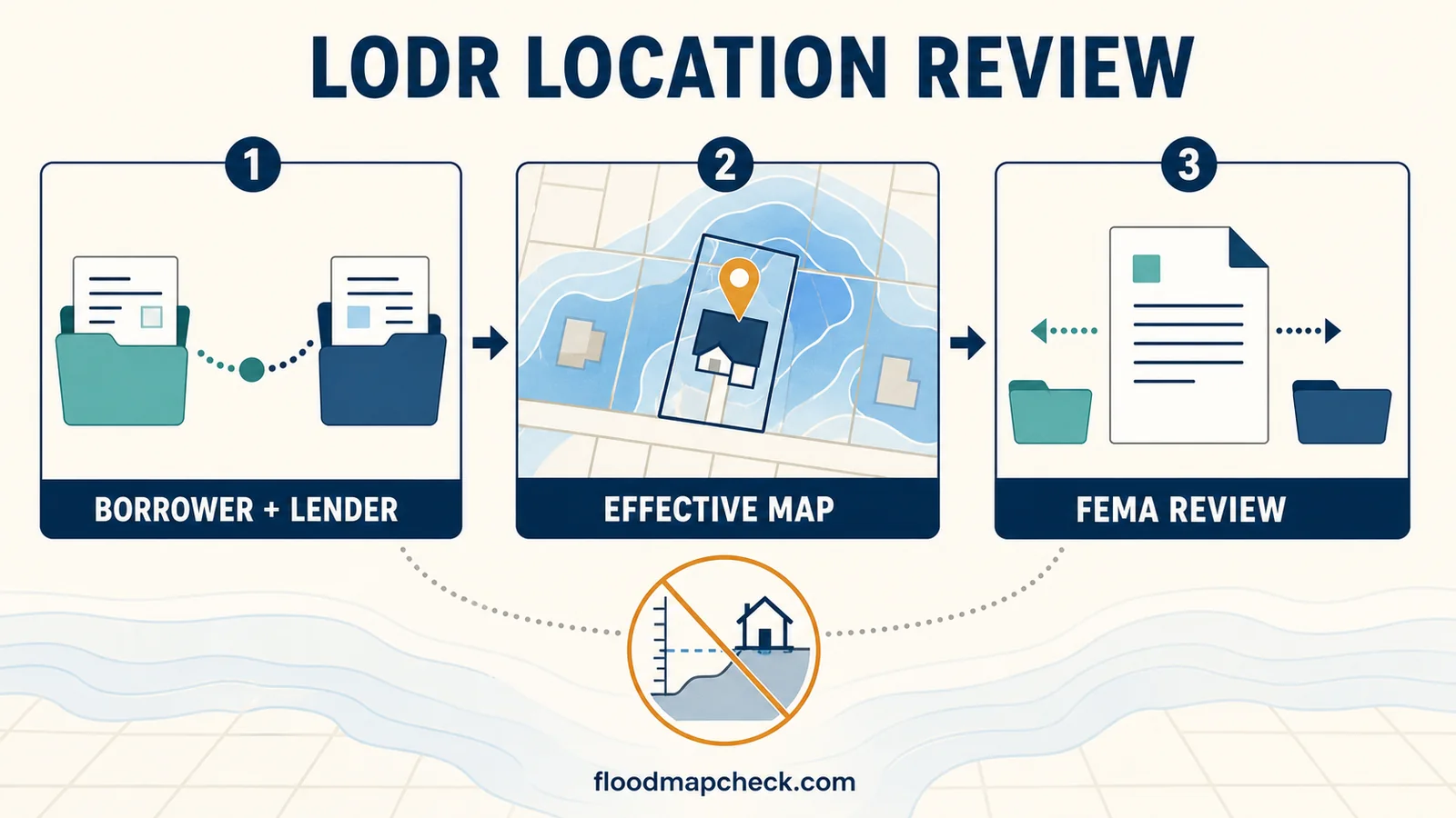
Use a FEMA Letter of Determination Review (LODR) only when the borrower and lender jointly dispute whether the lender correctly located the building or manufactured home inside the Special Flood Hazard Area on the current effective FEMA map. The joint request must be submitted within 45 days of the lender’s notice. FEMA compares map location; it does not consider the building’s elevation or change the map.
A graded or filled lot does not turn an LODR into an elevation review. If the argument is that the building or natural ground is above the Base Flood Elevation, the borrower generally needs the appropriate Letter of Map Change route and must keep following the lender’s insurance instructions until a qualifying FEMA determination and lender decision exist in writing.
Use an LODR only for the lender’s map-location decision
The FEMA LODR fact sheet describes this as a review of a lender’s determination that a building is in an SFHA. FEMA checks the building location against the applicable effective Flood Insurance Rate Map (FIRM). The review does not redraw the boundary, calculate an insurance premium, approve grading, or certify that the property cannot flood.
Ask one question before assembling the package: are the borrower and lender disputing the horizontal placement of the building footprint on the effective map? If the answer is no, identify the real dispute—elevation, fill, parcel boundary, preliminary map, wrong structure, or an outdated determination—before choosing a FEMA process.
LODR, LOMA, and LOMR-F answer different questions
| Issue | Best starting route | Why |
|---|---|---|
| Building plotted on the wrong side of the effective SFHA boundary | Joint borrower-lender LODR within 45 days | FEMA reviews the lender’s building-location determination |
| Naturally high ground is above the applicable flood elevation | LOMA or applicable Letter of Map Change request | Elevation and natural-ground evidence may support a map determination |
| Fill placed after the effective map changed the ground condition | LOMR-F or another applicable map-change process | The review depends on fill and certified elevation evidence, not LODR |
| Communitywide preliminary map data are disputed | Preliminary-map comment or appeal process | The statutory map-revision process is separate from a loan determination |
| The lender used the wrong address, structure, panel, or effective date | Ask the lender to correct the determination; consider LODR if a joint formal review is still needed | A clerical or source-data error may be resolved before a FEMA package is necessary |
For property-level map-change records, use the LOMA and LOMR-F guide. If the issue is a proposed communitywide map, use the preliminary FEMA map appeal guide. Do not attach an Elevation Certificate to an LODR expecting FEMA to weigh the building height; 44 CFR § 65.17 expressly excludes elevation data from this review.
The 45-day clock starts with the lender’s notice
Section 65.17 requires the request within 45 days of the lender notifying the borrower that the building or manufactured home is in an SFHA and flood insurance is required. The regulation also says the review request must be postmarked within that period.
- Save the lender’s notice and envelope or portal timestamp.
- Ask which date the lender treats as the formal notification date.
- Calculate the deadline conservatively and allow time for the lender’s review and signature.
- Use a delivery method that creates a postmark or acceptance record under the current FEMA instructions.
- Do not assume that a phone call, survey order, loan closing delay, or separate FEMA application pauses the deadline.
A request sent after the deadline may be returned without review. If the window has closed, ask the lender whether its technical determination can be corrected and determine whether a LOMA, LOMR-F, or another map-change route fits the actual evidence.
Get the full determination file from the lender
The FDIC Flood Disaster Protection Act examination manual explains the role of the Standard Flood Hazard Determination Form (SFHDF) in a lender’s decision. Ask for the complete form and the technical material used to make the determination, not only a portal message saying that insurance is required.
- The written notice stating that the building is in an SFHA and flood insurance is required.
- The completed SFHDF, including the building, community, map panel, zone, and determination-provider details.
- The effective FIRM or FHBM panel and any technical data the provider relied on.
- The exact building footprint used when the parcel contains a house, detached garage, accessory building, or multiple units.
- The lender contact authorized to coordinate and sign a joint request.
Compare the address, parcel context, community, building footprint, panel number, suffix, and effective date across every document. A determination can use the correct panel but still mark the wrong structure or wrong part of a large parcel. Record the mismatch before asking the lender to sign a FEMA request.
Build the joint package FEMA can actually review
Use the current FEMA fact sheet and regulation as the final checklist on the day the package is assembled. Fees and delivery instructions can change, so confirm them instead of copying an amount or mailing address from an older guide.
- The current review fee and payment in the form FEMA presently accepts.
- A written review request signed by both borrower and lender.
- A copy of the lender’s SFHA and flood-insurance notice.
- The completed SFHDF and a legible copy of all technical data used for the determination.
- The effective NFIP map panel with the building clearly indicated.
- A map excerpt that still includes the title block, effective date, bar scale, and north arrow.
Label the building, not merely the tax parcel. When an excerpt is used, keep enough surrounding streets and map features to show how the location was established. Do not crop away the panel identity or scale. A real-estate map screenshot, tax parcel layer, or hand-drawn flood boundary cannot replace the technical map material required by the regulation.
Use the SFHDF field guide to compare the lender form with the property, and the FIRM panel and FIRMette guide to preserve the effective date, title block, scale, and north arrow.
Verify the map evidence before asking the lender to sign
Open the address in the FEMA Flood Map Service Center and compare it with the technical material attached to the SFHDF. Confirm that both use the same community, effective panel, and structure. If the address pin lands on a road centerline, detached garage, neighboring house, or vacant part of a large lot, recenter the map and document the actual building footprint before describing the error to the lender.
Preserve the map context. A useful exhibit shows surrounding streets or landmarks, the building mark, SFHA boundary, north arrow, bar scale, title block, panel number, suffix, and effective date. Add a separate note explaining how the building location was established. Do not draw a new flood boundary, stretch a screenshot, or combine a tax parcel line with FEMA shading in a way that makes the layers appear to be one official map.
- The effective map—not merely the newest preliminary product—is identified.
- The full panel number, suffix, and effective or revised date match the SFHDF.
- The disputed building is marked, not only the outer parcel boundary.
- Any applicable LOMA, LOMR-F, revalidation, or later panel has been checked separately.
- The lender receives a short factual discrepancy list it can verify before signing the joint request.
This precheck can reveal a clerical problem that the lender or determination provider can correct without a federal review. If the parties still disagree about horizontal map placement, the same organized evidence makes the LODR package easier for FEMA to examine. If the disagreement changes into an elevation or fill question, stop and use the map-change route that can consider that evidence.
If the lender will not join the request
The borrower cannot convert an LODR into a unilateral FEMA appeal. Ask the lender to state whether it disagrees with the claimed map error, cannot verify the evidence, or simply has not routed the request to an authorized signer. Send a one-page comparison that identifies the building, the lender’s panel and date, the effective FEMA panel and date, the alleged plotting error, and the supporting exhibit. A focused discrepancy is easier for the lender or its determination provider to recheck than a folder of unlabeled maps.
- Request the lender’s written point of contact for flood determinations.
- Ask whether the determination provider will correct a clear address, structure, panel, or effective-date error.
- Do not remove required insurance while the lender reviews the evidence.
- Preserve the original 45-day notice date even if the lender’s internal review takes time.
- If the lender will not sign, evaluate whether a separate LOMA or LOMR-F request can address the property evidence without an LODR.
A later lender correction and a FEMA map-change letter are different records. Keep both when they exist. A lender may correct its own determination without FEMA completing an LODR, while a favorable LOMA or LOMR-F can provide a separate FEMA property determination for later transactions. Neither record by itself guarantees that every future lender will waive flood insurance.
A raised or filled property usually needs a different route
A borrower may believe flood insurance should not be required because a building was elevated, the lot was graded, or fill was placed above the Base Flood Elevation. Those facts concern elevation or changed ground conditions. Section 65.17 says FEMA will not consider elevation data in an LODR, so a survey or Elevation Certificate cannot convert the joint location review into a map amendment.
The lender should not rely solely on a borrower’s statement that the property was raised. Until FEMA issues an applicable map-change determination and the lender makes its own written decision, the effective map and lender determination continue to control the mandatory-purchase workflow. The appropriate request may be a LOMA when qualifying natural ground is involved or a LOMR-F when fill is central, but the correct route depends on the site history and FEMA’s current application criteria.
Keep the Elevation Certificate for the process that can use it. The Elevation Certificate routing guide explains whether to send it to the local permit office, insurer, lender, or a complete FEMA map-change application.
What happens after FEMA receives the package
FEMA’s regulatory response period runs from receipt of the request, and a complete package matters. Section 65.17 says FEMA will notify the applicants in writing within 45 days after receipt. The fact sheet describes a determination within 45 days after FEMA has all necessary data. Do not treat that period as an automatic pause on the loan, closing, escrow, or insurance requirement.
| Possible FEMA response | What it means | Next action |
|---|---|---|
| Request was late | No review is performed and the materials may be returned | Work with the lender and evaluate another correction or map-change path |
| Information is insufficient | The lender’s determination stands until a complete submittal is received | Answer the missing-item request promptly and keep proof of delivery |
| FEMA completes the review | The letter states whether the building is within the SFHA on the identified effective map | Compare all identifiers, then send the result to the lender and insurer |
If the loan closes before the review is complete, follow the lender’s insurance instructions. Do not cancel, reduce, or allow coverage to lapse merely because an LODR was mailed. A pending request is not a favorable determination.
Read the final letter field by field
A completed result identifies the NFIP community, property or building, map panel and effective date, whether the structure is in the SFHA, and the period during which the determination is effective. Confirm that the letter covers the exact building used as collateral and the same map version used in the lender’s notice.
- Borrower and lender names match the joint request.
- Property address and building description identify the correct structure.
- NFIP community and map panel match the effective product.
- The effective date is the one relevant to the lender’s determination.
- The inside-or-outside SFHA conclusion is explicit.
- The determination’s stated effective period and any conditions are understood.
A favorable LODR does not automatically cancel insurance
A favorable LODR can remove the federal statutory basis for the lender’s mandatory-purchase requirement when FEMA finds the building outside the SFHA. The lender may still require flood insurance under its own risk policy. The letter does not declare the property flood-free, price a policy, or guarantee a refund.
Ask the lender for a written decision on its insurance requirement. Then ask the insurer what cancellation or refund documents are needed. FEMA’s fact sheet describes a possible current-term premium refund when the structure is found outside the SFHA, the lender waives the requirement, and no claim has been made, but that is conditional—not automatic.
The map versus flood-insurance guide explains why map status, lender compliance, policy coverage, and premium are related but separate decisions.
Keep a record that survives a refinance or map update
- The lender’s notice and evidence of the notification date.
- The signed joint request and every attachment.
- The current FEMA instructions, fee record, delivery address, and postmark or acceptance evidence.
- Every request for additional information and the response sent.
- FEMA’s final letter and the lender’s written decision.
- Any insurer cancellation, retention, or refund correspondence.
A later refinance, sale, new map effective date, or different building used as collateral can generate a new determination. Keep the original package together so the next reviewer can see exactly which building and map version FEMA reviewed.
Questions borrowers still have
Can I request an LODR without the lender?
No. The regulation requires a joint request signed by both borrower and lender. Ask the lender who is authorized to review and sign the package.
Can an Elevation Certificate prove the lender is wrong?
Not through LODR. FEMA does not consider elevation data in this review. Elevation may support a separate LOMA, LOMR-F, local permit, or insurance process.
Does an LODR change the FEMA map?
No. It reviews the lender’s location determination against the effective map. A separate Letter of Map Change process is used for a FEMA property or structure determination based on qualifying evidence.
What if the 45-day deadline has passed?
FEMA may return a late LODR request without review. Ask the lender to examine any technical or clerical error and determine whether another FEMA map-change route fits the evidence.
Should I stop paying for flood insurance while FEMA reviews?
No. Follow the lender’s current written requirement until FEMA completes the review and the lender and insurer issue any resulting instructions in writing.
The FEMA fact sheet, 44 CFR § 65.17, FDIC manual, and Map Service Center route were rechecked August 1, 2026. Verify the current FEMA fee and delivery instructions before submission. Flood Map Check provides source routing and interpretation, not legal, lending, insurance, surveying, or FEMA services.