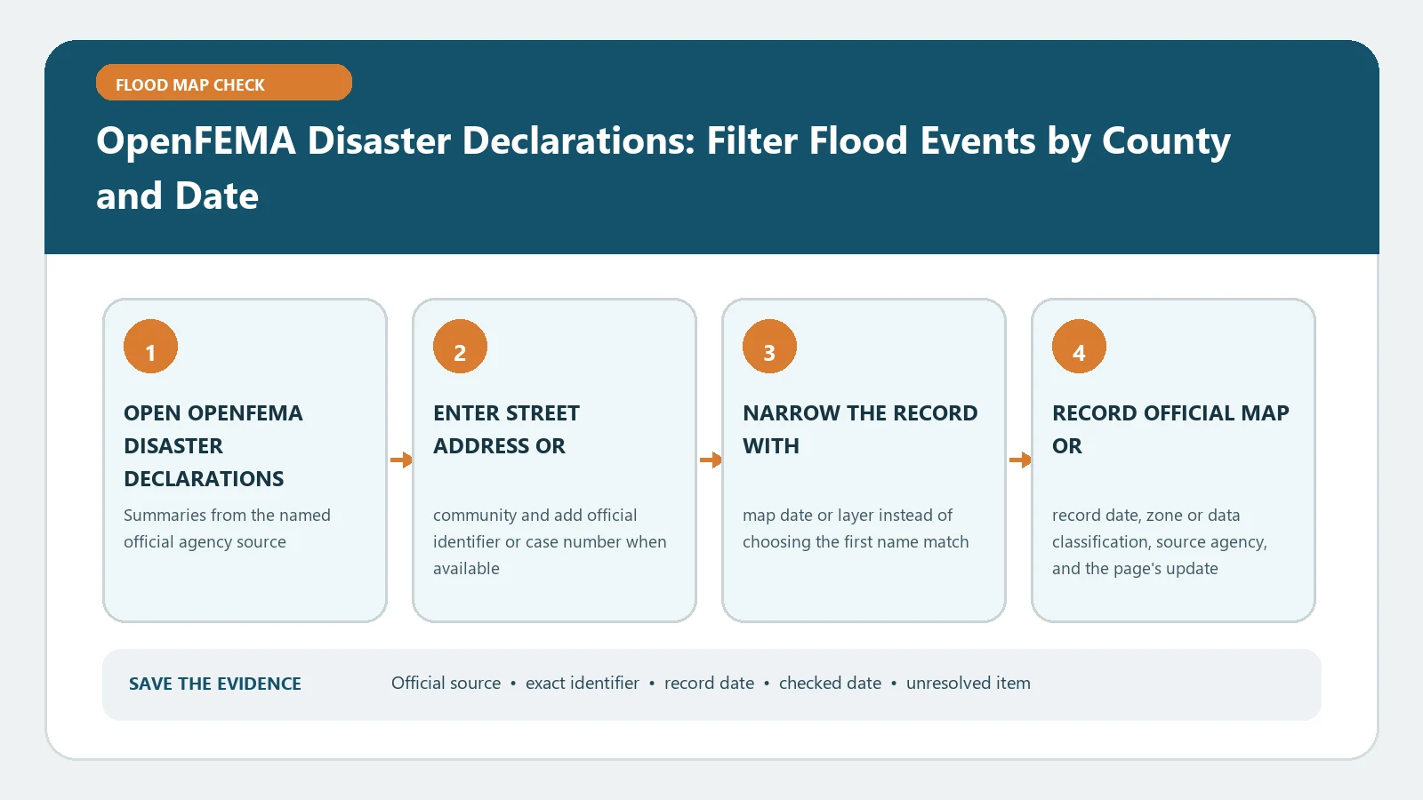
Use OpenFEMA Disaster Declarations Summaries to locate the dated official flood record for United States historical federal disaster declarations, then compare the map, identifier, and effective date before acting. The result is a screening record, not a survey, lender determination, insurance quote, or local permit decision.
A useful OpenFEMA flood disaster declarations result needs more than a screenshot of the first result. Use FEMA and FEMA, verify the matched subject, and preserve enough context for another person to reproduce the lookup.
Choose the record system before entering data
| Official source | Use it for | Save with the result |
|---|---|---|
| FEMA | Start the lookup and identify the current public record | Input used, matched subject, record identifier, status, and displayed date |
| FEMA | Read definitions, instructions, dates, and scope limitations | Authority name, page title, definition relied on, and review date |
Do not cite every official link as though it proved the same proposition. Use the search system for identity, its instructions for field meaning, and the controlling document for the dated decision. A record for United States historical federal disaster declarations is easier to audit when each observation names its source and access date.
Collect identifiers before opening the search form
Write the subject record before searching. At minimum capture street address or community, official identifier or case number, and map date or layer. This makes alternate searches comparable and exposes a change in spelling or jurisdiction. A nearby address, related company, similar model, or shared name is not a match merely because it appears first.
| Input to collect | How to record it | Mistake to avoid |
|---|---|---|
| street address or community | Record the value before the lookup so search changes remain visible. | The field may be optional for search but necessary for confirmation. |
| official identifier or case number | Copy it from the original record; do not normalize it from memory. | A close match can still belong to a different record. |
| map date or layer | Keep a second corroborating identifier when names or addresses can repeat. | A close match can still belong to a different record. |
When OpenFEMA Disaster Declarations Summaries accepts a sensitive identifier, use it in the official system but omit it from a shared worksheet unless disclosure is necessary and lawful. A safe citation normally uses the public record number, jurisdiction, and checked date. Also retain enough detail to explain why other similar results were rejected.
A step-by-step verification workflow
The workflow creates an audit trail for OpenFEMA flood disaster declarations: who was searched, where, with which value, what matched, and what the authority said next. Keeping those steps in order reveals whether a later difference is an updated record or merely a different query.
Translate the result one field at a time
Transcribe official map or record date, zone or data classification, and other labels exactly as displayed. Words such as active, effective, closed, pending, corrected, failed, recalled, or eligible acquire their meaning from the issuing authority. Read the legend or linked instruction before turning a database label into an action.
| Result field | Verification action | Interpretation limit |
|---|---|---|
| official map or record date | Open the detailed record or linked document before interpreting it. | Address geocoding and parcel boundaries can place the marker on the wrong structure or lot. |
| zone or data classification | Keep current and historical entries in separate rows. | Only the responsible agency, lender, insurer, surveyor, or floodplain administrator can make the decision within its authority. |
| source agency | Compare it with the identifier and jurisdiction already confirmed. | A public map can be preliminary, effective, advisory, or locally modeled; those labels are not interchangeable. |
| next verification step | Open the detailed record or linked document before interpreting it. | Address geocoding and parcel boundaries can place the marker on the wrong structure or lot. |
A dated evidence card needs more than an access date. Copy every date that controls official map or record date, then add the checked date in its own column. This makes an expired, superseded, preliminary, historical, or later-corrected record visible.
Use the crosswalk as a field map for OpenFEMA Disaster Declarations Summaries, not as a substitute for the live record. Each row shows what to locate, which input confirms it, and the conclusion that remains safe. Add a new row when the authority exposes a local field not covered here.
The evidence card makes OpenFEMA Disaster Declarations: Filter Flood Events by County and Date independently repeatable. It preserves the target, authority, query, match, status, dates, and unresolved question. That is more useful to a reader than an isolated screenshot because every field has a source and can be checked again.
| Evidence field | What to enter | Why it matters |
|---|---|---|
| Target | OpenFEMA Disaster Declarations: Filter Flood Events by County and Date | Names the exact record or decision being checked |
| Official source | FEMA | Preserves the issuing authority rather than a copied summary |
| Search input | Exact name, address, number, parcel, model, route, or other identifier used | Makes the result reproducible |
| Matched record | Displayed identifier, jurisdiction, and record type | Shows why the result belongs to the intended subject |
| Observed result | Status or field copied without expanding its meaning | Separates evidence from interpretation |
| Dates | Record date, effective date, and checked date in separate fields | Exposes stale or superseded information |
| Unresolved item | Specific missing field, conflict, or agency question | Prevents silence from becoming a false conclusion |
Preserve only the material needed for verification and respect access or privacy restrictions. A short source-type note—index, detail, attachment, map, or direct reply—helps a later reader judge the strength of the evidence for OpenFEMA Disaster Declarations: Filter Flood Events by County and Date.
Resolve missing, stale, or conflicting records
A missing OpenFEMA flood disaster declarations record may reflect spelling, publication delay, jurisdiction, an archive, or an identifier change. Try one alternate official field and verify the system boundary. If official pages disagree, retain both URLs and dates, identify the controlling authority, and ask a focused question when the discrepancy affects a deadline, cost, safety, property use, or eligibility.
- A public map can be preliminary, effective, advisory, or locally modeled; those labels are not interchangeable.
- Address geocoding and parcel boundaries can place the marker on the wrong structure or lot.
- Only the responsible agency, lender, insurer, surveyor, or floodplain administrator can make the decision within its authority.
- State the exact unresolved question and include the record identifier in a private agency inquiry.
- Recheck after an agency update, correction, inspection, filing, map revision, or policy effective date.
- Keep the earlier result when change history matters; label it superseded rather than silently replacing it.
For surrounding preparation, consult flood risk map by address, river flood risk check and flood map update date check. Do not use those summaries to fill a blank in OpenFEMA Disaster Declarations Summaries. Missing or conflicting official evidence should remain visible and go back to the responsible authority.
Related official record checks
Use the guide that matches the exact agency, jurisdiction, tool, product, program, or record type; verify the live official source before acting.
Use the guide that matches the exact agency, jurisdiction, tool, product, program, or record type; verify the live official source before acting.
- USGS High-Water Mark Quality Codes: Use Elevation and Uncertainty Together
- Disaster Declaration Incident Type vs Assistance Programs: Filter Flood Events Correctly
Use the guide that matches the exact agency, jurisdiction, tool, product, program, or record type; verify the live official source before acting.
Does an official search result prove the final outcome?
The system output is one documented observation. Preserve it exactly, then complete any separate check named by the authority. Do not turn a database label into a guarantee the issuing page never offers.
First rule out an input mismatch and the wrong geographic or program boundary. Then check the official help page for historical records or publication delays. State ‘not found with this query’ instead of ‘no record exists.’
How often should the result be checked again?
Check again near the decision date and after any filing, policy change, map update, inspection, recall expansion, renewal, correction, or agency notice relevant to United States historical federal disaster declarations. A saved capture does not refresh itself.
Cite OpenFEMA Disaster Declarations Summaries and the matched detail record, not this summary alone. A complete reference for OpenFEMA Disaster Declarations: Filter Flood Events by County and Date identifies the issuer, subject or record number, date, URL, and the day accessed.
Last reviewed August 6, 2026.