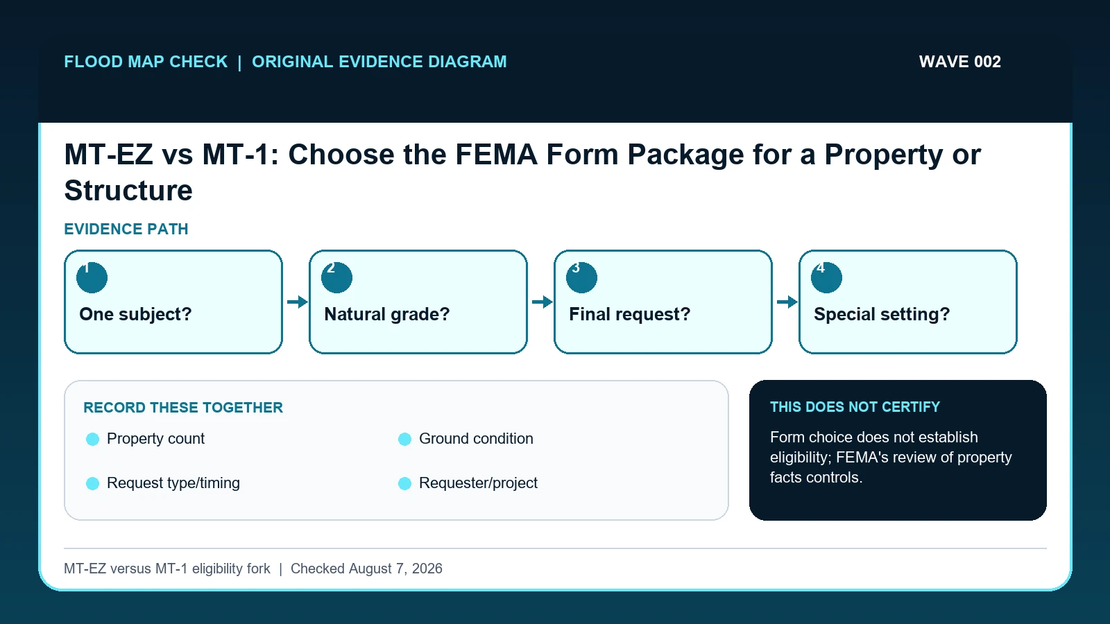
Use MT-EZ only for a qualifying single residential structure or legally recorded lot on natural ground. Use the MT-1 package when the request involves fill, multiple structures or lots, conditional treatment, a developer, a regulatory floodway, or other situations excluded from MT-EZ; confirm the current FEMA instructions before assembling evidence.
Last checked: August 7, 2026.
Form choice is a scope decision, not a convenience decision. FEMA describes MT-EZ as a condensed route for a single residential lot or structure seeking a LOMA where natural ground is the basis. MT-1 covers LOMA, CLOMA, LOMR-F, and CLOMR-F requests and carries the property and elevation forms needed for broader or fill-related circumstances. MT-2 is a separate route for revisions to effective studies or maps and should not be pulled into a simple natural-grade amendment merely because the packet looks more comprehensive.
Form choice turns on property facts
The decisive facts belong above the form name: one residential structure or one legally recorded lot, natural ground rather than placed fill, existing rather than proposed conditions, and no broader condition that requires the MT-1 route. MT-EZ is a condensed LOMA application for a qualifying single residential subject. MT-1 covers LOMA and conditional or fill-based amendment requests and supplies additional property and elevation forms. Choosing the shorter packet because it is easier can produce a complete but ineligible submission.
Consider a parcel with a house and detached workshop. If the request concerns only the house and the surveyed lowest adjacent grade is on natural ground, the facts may fit the single-structure screen. If the owner asks FEMA to address both structures, relies on fill placed around the building, or requests a conditional answer before construction, the scope changes. The correct comparison is not page count; it is whether every subject, grading fact, and requested determination is supported by the selected package.
Special settings require extra care. A property in a regulatory floodway, a V zone near the primary frontal dune, or a project that changes an effective flood study may trigger evidence or a route beyond an ordinary MT-EZ filing. Current FEMA instructions and the responsible professional should resolve those cases. Use the facts only as a screening step: selecting MT-1 does not cure an unsupported survey, missing community acknowledgment, or technically unsuitable request.
Current FEMA instructions that separate MT-EZ and MT-1
FEMA Letter of Map Change application forms supplies current MT-EZ, MT-1, and MT-2 purposes, eligibility distinctions, instructions, fees, and submission routes; this guide cites it for Property count / Ground condition / Request type/timing / Requester/project / Floodway or V-zone context. FEMA MT-1 Technical Guidance supplies current MT-EZ and MT-1 eligibility, excluded situations, evidence, and online submission details; this guide cites it for Property count / Ground condition / Request type/timing / Requester/project / Floodway or V-zone context. FEMA Change Your Flood Zone supplies LOMA, LOMR-F, CLOMR, and LOMR request routes and limitations; this guide cites it for Request type/timing.
The MT-EZ vs MT-1 crosswalk keeps these assignments explicit: FEMA Letter of Map Change application forms → Property count / Ground condition / Request type/timing / Requester/project / Floodway or V-zone context; FEMA MT-1 Technical Guidance → Property count / Ground condition / Request type/timing / Requester/project / Floodway or V-zone context; FEMA Change Your Flood Zone → Request type/timing. If Property count or another named field is absent from its cited record, leave that fact unresolved and obtain it from the responsible official source instead of expanding a different citation beyond scope.
| Official record | What it actually supplies | Field used here |
|---|---|---|
| FEMA Letter of Map Change application forms | current MT-EZ, MT-1, and MT-2 purposes, eligibility distinctions, instructions, fees, and submission routes | Property count / Ground condition / Request type/timing / Requester/project / Floodway or V-zone context |
| FEMA MT-1 Technical Guidance | current MT-EZ and MT-1 eligibility, excluded situations, evidence, and online submission details | Property count / Ground condition / Request type/timing / Requester/project / Floodway or V-zone context |
| FEMA Change Your Flood Zone | LOMA, LOMR-F, CLOMR, and LOMR request routes and limitations | Request type/timing |
The source boundary follows the mapped fields: Property count establishes one part of the record, Request type/timing affects interpretation, and Floodway or V-zone context limits the conclusion. Document any missing fact instead of inferring a replacement value while working to select the correct property map-change form package.
How Property count connects to Floodway or V-zone context
| Field | Meaning in this check | Error it exposes | Response |
|---|---|---|---|
| Property count | One residential lot or structure versus multiple lots/structures | MT-EZ is narrow | Move to MT-1 when scope exceeds one qualifying subject |
| Ground condition | Natural grade versus placed fill | Fill changes the determination route | Use the LOMR-F/CLOMR-F path where applicable |
| Request type/timing | Existing determination versus conditional or revision request | MT-EZ is not for conditional or hydraulic-revision requests | Use the FEMA package assigned to the actual request and proposed condition |
| Requester/project | Individual existing property versus developer or broader project | Project scope affects forms and review | Confirm professional and community documentation |
| Floodway or V-zone context | Check the effective FIRM and technical guidance | Special settings can exclude the condensed route | Ask FEMA or the community before filing |
A sound MT-EZ vs MT-1 check pairs Property count with Request type/timing. The first answers “One residential lot or structure versus multiple lots/structures”; the second answers “Existing determination versus conditional or revision request”. The pair is incomplete if the evidence shows “MT-EZ is not for conditional or hydraulic-revision requests”, even when the first identifier looks credible.
Ground condition is not background metadata. It answers “Natural grade versus placed fill”. If the contrary condition is “Fill changes the determination route”, correct it by following “Use the LOMR-F/CLOMR-F path where applicable”. That correction can change which official record belongs in the check.
The last comparison joins Requester/project to Floodway or V-zone context. They answer separate questions: “Individual existing property versus developer or broader project” and “Check the effective FIRM and technical guidance”. Keeping both in the MT-EZ vs MT-1 record prevents an observation from being mistaken for an agency, community, insurer, lender, or professional determination.
Screen natural grade, subject count, fill, and request timing
Build the evidence from Property count outward. The middle of the review should move from “Document whether the relevant ground is natural or was raised with fill” to “Mark whether the request is final/as-built or conditional/proposed”. Record any conflict before continuing to the remaining checks.
- Write the requested FEMA determination in one sentence before choosing a form.
- Count the lots and structures and identify exactly which ones the request covers.
- Document whether the relevant ground is natural or was raised with fill.
- Mark whether the request is final/as-built or conditional/proposed.
- Check the effective zone, regulatory floodway, coastal setting, and community requirements.
- Use FEMA's current form page and technical guidance to choose MT-EZ, MT-1, or a different route.
- Before submission, crosswalk every required form, signature, seal, map, deed, plat, elevation, fee, and attachment.
After the comparison, “Before submission, crosswalk every required form, signature, seal, map, deed, plat, elevation, fee, and attachment”. The saved evidence should let another reader retrace Property count through Request type/timing without guessing which limitation applied.
One house on natural grade versus a broader request
A homeowner with one existing house and no placed fill may start with the MT-EZ screen. The same parcel can leave MT-EZ if the request covers several structures, relies on fill, touches a regulatory floodway, or asks for a conditional determination before work. Write those facts at the top of the file before downloading forms; otherwise a beautifully completed packet can be the wrong packet.
In this example, Property count identifies the relevant record, while Request type/timing is the fact most likely to change the interpretation. Conclude “Possible MT-EZ candidate” only when the evidence shows “No fill, conditional request, developer, or floodway issue”.
For MT-EZ vs MT-1, if the facts instead fit “Hydraulic map revision”, the result changes to “Potential MT-2 matter”. Respond by following “Get professional and community direction”. Do not substitute the more favorable conclusion from the earlier example.
Single subject, expanded scope, fill, and special settings
| Observed state | Evidence test | Limited conclusion | Next response |
|---|---|---|---|
| One existing residential structure on natural grade | No fill, conditional request, developer, or floodway issue | Possible MT-EZ candidate | Complete the current eligibility screen |
| Fill supports the removal request | Elevation depends on placed material | MT-1 LOMR-F route | Assemble fill and elevation evidence |
| Several lots or structures | Packet covers more than one subject | MT-1 scope | Create a property/structure inventory |
| Hydraulic map revision | Effective FIS/FIRM data would change | Potential MT-2 matter | Get professional and community direction |
“One existing residential structure on natural grade” and “Fill supports the removal request” are not better and worse versions of one answer. The former supports “Possible MT-EZ candidate”; the latter supports “MT-1 LOMR-F route”. Preserve the different evidence tests before taking either listed response.
The two unresolved branches also differ. “Several lots or structures” supports only “MT-1 scope”, whereas “Hydraulic map revision” supports only “Potential MT-2 matter”. Apply the response shown for the matching branch.
When a short packet is the wrong packet
- Avoid choosing the shortest form. Recheck Request type/timing. The mapped warning is “MT-EZ is not for conditional or hydraulic-revision requests”; the corresponding response is “Use the FEMA package assigned to the actual request and proposed condition”.
- Avoid calling placed fill natural grade. Recheck Ground condition. The mapped warning is “Fill changes the determination route”; the corresponding response is “Use the LOMR-F/CLOMR-F path where applicable”.
- Avoid using MT-EZ for multiple structures. Recheck Property count. The mapped warning is “MT-EZ is narrow”; the corresponding response is “Move to MT-1 when scope exceeds one qualifying subject”.
- Avoid confusing an amendment with a hydraulic revision. Recheck Request type/timing. The mapped warning is “MT-EZ is not for conditional or hydraulic-revision requests”; the corresponding response is “Use the FEMA package assigned to the actual request and proposed condition”.
“choosing the shortest form” can trigger MT-EZ is not for conditional or hydraulic-revision requests; correct the mapped Request type/timing field or fields by following “Use the FEMA package assigned to the actual request and proposed condition”. “calling placed fill natural grade” affects Ground condition, so use “Use the LOMR-F/CLOMR-F path where applicable” before relying on the result.
The remedy for “using MT-EZ for multiple structures” is tied to Property count: “Move to MT-1 when scope exceeds one qualifying subject”. The separate mistake “confusing an amendment with a hydraulic revision” is exposed by “MT-EZ is not for conditional or hydraulic-revision requests”; answer it with “Use the FEMA package assigned to the actual request and proposed condition”.
What this MT-EZ versus MT-1 eligibility fork cannot decide
Scope: United States FEMA mapping projects and formal map-change cases. Limitation: Form choice does not establish eligibility; FEMA's review of property facts controls.
Use the MT-EZ versus MT-1 eligibility fork as a reading aid for Property count and Floodway or V-zone context. The official source, community, insurer, surveyor, or emergency authority still controls the outcome, especially when the evidence shows “Effective FIS/FIRM data would change”.
Continue separately to case status and map-change effects
- FEMA LOMA LOMR F Lookup extends the work built from Property count; it does not replace this check.
- FEMA Preliminary vs. Effective Flood Map is the next reference when the unresolved fact is Request type/timing.
- FEMA LOMR CLOMR Map Revision addresses the separate decision that may follow from Floodway or V-zone context.
Use this guide to select the correct property map-change form package. The linked guides address separate questions raised by Property count, Request type/timing, or Floodway or V-zone context.
Before downloading the FEMA application packet
Does Property count settle the question by itself?
No. Property count answers “One residential lot or structure versus multiple lots/structures”, but it can fail when “MT-EZ is narrow”. Pair it with Ground condition, Request type/timing, and the checked date.
What if the evidence shows Hydraulic map revision?
Confirm the stated evidence test: “Effective FIS/FIRM data would change”. The limited conclusion is “Potential MT-2 matter”. The documented response is “Get professional and community direction”; a more favorable branch should not be substituted.
When should Floodway or V-zone context be checked again?
Screen the form choice again if the request adds a structure or lot, relies on placed fill, becomes conditional, enters a floodway or V-zone issue, or FEMA revises the packet instructions. A change in property facts can move the request out of MT-EZ even when the downloaded form itself is unchanged.
MT-EZ vs MT-1: Choose the FEMA Form Package for a Property or Structure is independent public-record guidance for the limited action to select the correct property map-change form package. The cited government records retain authority over Property count and Floodway or V-zone context. Last checked: August 7, 2026.