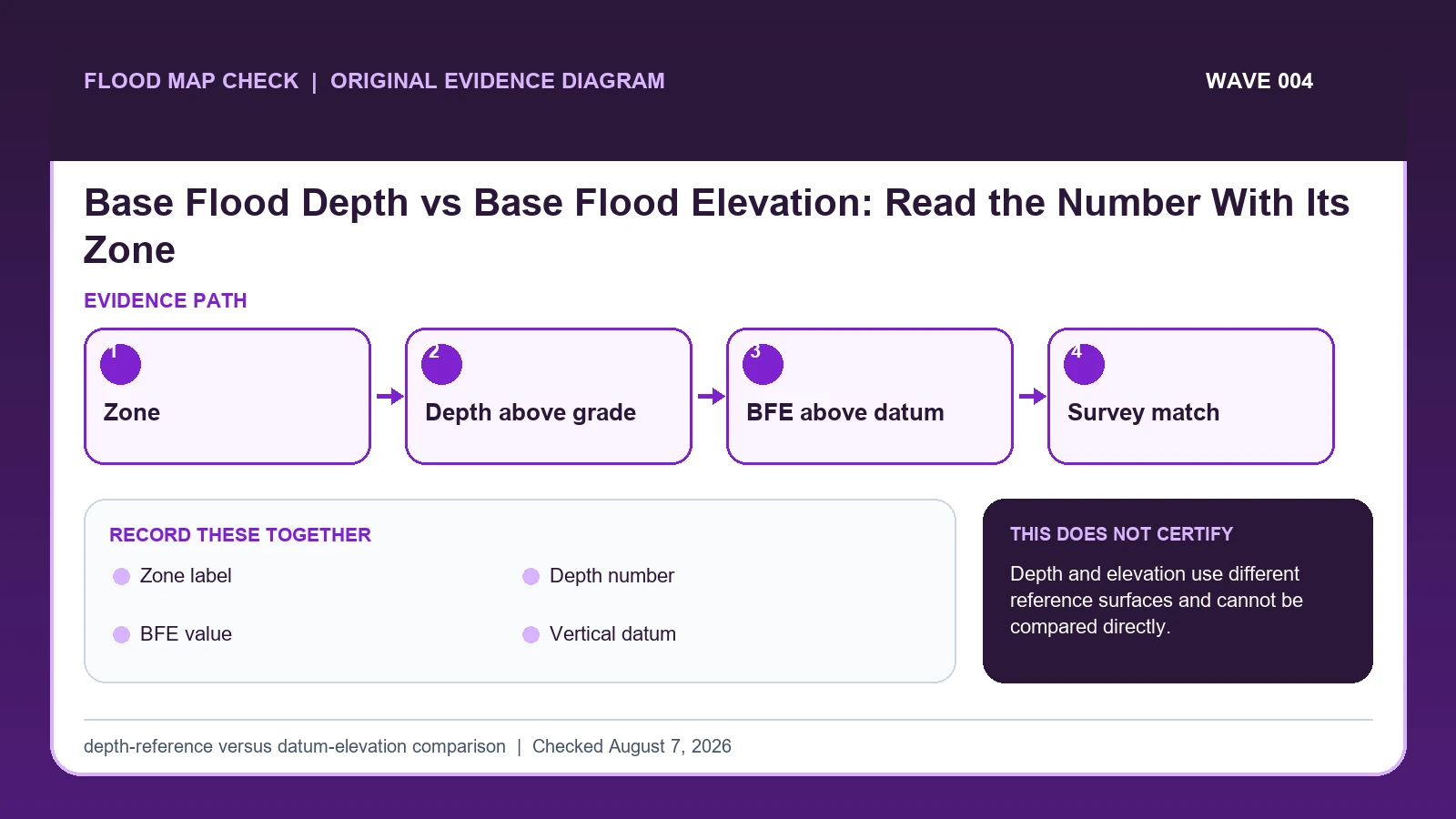
A base flood depth is a vertical distance above a local ground reference, while a Base Flood Elevation is an elevation above a named vertical datum. Read the zone label first: an AO depth number cannot be compared directly with an AE or AH BFE or a surveyed NAVD 88 elevation until the reference surfaces and datum are made compatible.
Last checked: August 7, 2026.
FIRMs use different number types because flood analyses and terrain conditions differ. Zone AO commonly shows average depths above the highest adjacent grade, while detailed zones such as AE or AH can show BFEs tied to the map's vertical datum. A plain number without its zone, units, source, and datum is not usable engineering evidence.
Convert AO depth only from a valid grade reference
A base flood elevation is an elevation in a named vertical datum. A base flood depth, commonly shown in Zone AO, is a depth above the highest adjacent natural grade rather than a ready-made elevation. If an authoritative grade is 102.4 feet NAVD 88 and the mapped AO depth is 2 feet, a screening sum is 104.4 feet NAVD 88. That result is only as sound as the grade, datum, location, and rule used for the calculation.
Do not subtract a floor elevation from an AO depth or compare a depth directly with a BFE. First classify the map label, then retain the panel, zone, effective date, mapped depth or BFE, and reference datum. For development, the community may prescribe how highest adjacent grade is established and may add freeboard. A private terrain raster or an old spot elevation is not automatically acceptable for that regulatory input.
Boundary and cross-section references can complicate the reading. A cross section or BFE line may control in an AE zone, while AO uses depth notation and AH generally supplies elevations. If the building lies near a zone transition, a map screen cannot establish the exact grade or line position. Preserve the uncertainty and ask the local floodplain administrator or qualified survey professional which evidence and design standard apply.
The FIRM label determines whether the value is depth or elevation
FEMA FIRM legend lesson supplies the official legend distinctions among Zone AO depth, Zone AE or AH base flood elevation, Zone D, and other mapped flood zones; this guide cites it for Zone label / Depth number / BFE value. FEMA flood-map technical references supplies current FIRM panel, database, domain-table, and Flood Insurance Study specifications; this guide cites it for Zone label / Depth number / BFE value / Vertical datum. FEMA MSC Search All Products lesson supplies the current effective map plus preliminary maps, historic FIRM panels, Flood Insurance Studies, Letters of Map Change, and other community products; this guide cites it for Zone label / Depth number / BFE value / Vertical datum.
The base flood depth vs elevation crosswalk keeps these assignments explicit: FEMA FIRM legend lesson → Zone label / Depth number / BFE value; FEMA flood-map technical references → Zone label / Depth number / BFE value / Vertical datum; FEMA MSC Search All Products lesson → Zone label / Depth number / BFE value / Vertical datum. If Zone label or another named field is absent from its cited record, leave that fact unresolved and obtain it from the responsible official source instead of expanding a different citation beyond scope.
| Official record | What it actually supplies | Field used here |
|---|---|---|
| FEMA FIRM legend lesson | the official legend distinctions among Zone AO depth, Zone AE or AH base flood elevation, Zone D, and other mapped flood zones | Zone label / Depth number / BFE value |
| FEMA flood-map technical references | current FIRM panel, database, domain-table, and Flood Insurance Study specifications | Zone label / Depth number / BFE value / Vertical datum |
| FEMA MSC Search All Products lesson | the current effective map plus preliminary maps, historic FIRM panels, Flood Insurance Studies, Letters of Map Change, and other community products | Zone label / Depth number / BFE value / Vertical datum |
Do not extend a citation beyond its mapped fields. Evidence for Zone label cannot automatically establish Vertical datum; keep either unanswered item visible before taking the action to determine whether a printed number is depth above grade or elevation above datum.
The FIRM legend and map can identify a mapped depth or BFE. Actual ground elevation requires an appropriate survey or other authoritative elevation record.
How Zone label connects to Ground elevation
| Field | Meaning in this check | Error it exposes | Response |
|---|---|---|---|
| Zone label | AO, AH, AE, or other mapped zone | Controls number interpretation | Copy before number |
| Depth number | Distance above designated ground reference | Not datum elevation | Keep units/reference surface |
| BFE value | Base flood water-surface elevation | Needs vertical datum | Record source and FIS table/map context |
| Vertical datum | NAVD 88, NGVD 29, or stated map reference | Different datums cannot be mixed | Transform only with approved method |
| Ground elevation | Surveyed grade in compatible datum | Map marker cannot supply survey | Use qualified field evidence |
Zone label is the starting identifier, but it is usable only when Depth number and BFE value agree. Two conflicts can break that agreement: “Controls number interpretation” and “Needs vertical datum”. A polished screenshot cannot repair either one.
For interpretation, Depth number answers “Distance above designated ground reference”, while Vertical datum answers “NAVD 88, NGVD 29, or stated map reference”. They are not interchangeable. A failure in the first calls for “Keep units/reference surface”; a failure in the second calls for “Transform only with approved method”.
The final safeguard is Ground elevation, which answers “Surveyed grade in compatible datum”. Its warning condition is “Map marker cannot supply survey”. At that point in the base flood depth vs elevation check, document the limited result or take the unresolved issue to the official decision owner.
Keep zone, datum, grade, freeboard, and result separate
Treat “Record the reference surface: grade for depth or named vertical datum for elevation” as a prerequisite for “Use the Flood Insurance Study when a cross section or table controls the detailed BFE”. Together they determine whether BFE value belongs to the same subject, period, and official product as Zone label.
- Open the full effective panel and identify zone, legend, map datum, panel, and date.
- Determine whether the printed number is explicitly a depth or a Base Flood Elevation.
- Record the reference surface: grade for depth or named vertical datum for elevation.
- Use the Flood Insurance Study when a cross section or table controls the detailed BFE.
- Collect surveyed building and grade elevations in the same vertical datum.
- Do not perform arithmetic until units, datum, and reference surfaces align.
- Confirm permit/design requirements with the local floodplain administrator and qualified professional.
Do not close the file at the first plausible result. Carry out “Confirm permit/design requirements with the local floodplain administrator and qualified professional”, then preserve the version of Ground elevation that was current on the checked date.
Turning an AO depth into a screened elevation
A map label '2' in Zone AO typically describes depth above the relevant grade reference, not an elevation of 2 feet NAVD 88. A nearby 'BFE 12' in Zone AE or AH is an elevation in the map datum. Subtracting 2 from 12 would be meaningless. Instead, document each reference and ask the local administrator or qualified professional how design elevations are established.
In this example, Zone label identifies the relevant record, while BFE value is the fact most likely to change the interpretation. Conclude “Relative depth result” only when the evidence shows “Number tied to zone-depth convention”.
For base flood depth vs elevation, if the facts instead fit “Datum mismatch”, the result changes to “Direct comparison invalid”. Respond by following “Obtain documented conversion/professional review”. Do not substitute the more favorable conclusion from the earlier example.
Mapped depth, published BFE, incompatible datum, and boundary uncertainty
| Observed state | Evidence test | Limited conclusion | Next response |
|---|---|---|---|
| AO depth displayed | Number tied to zone-depth convention | Relative depth result | Apply local floodplain rules to surveyed grade |
| AE/AH BFE displayed | Elevation tied to FIRM/FIS datum | Datum-based result | Compare with compatible surveyed elevations |
| Number without legend | Screenshot omits zone/reference | Meaning unresolved | Open full panel and legend |
| Datum mismatch | Map and survey use different references | Direct comparison invalid | Obtain documented conversion/professional review |
The first decision turns on “Number tied to zone-depth convention”, while the next turns on “Elevation tied to FIRM/FIS datum”. Those tests lead to different conclusions—“Relative depth result” and “Datum-based result”—so they should remain separate in the saved record.
“Number without legend” calls for “Open full panel and legend”, but “Datum mismatch” calls for “Obtain documented conversion/professional review”. Reporting the Number without legend and Datum mismatch differences is more accurate than forcing both conditions into one generalized warning.
Boundary uncertainty and unsupported terrain inputs
- Avoid treating an AO depth as BFE. Recheck Zone label / Depth number. The mapped warning is “Controls number interpretation; Not datum elevation”; the corresponding response is “Copy before number; Keep units/reference surface”.
- Avoid ignoring the zone label. Recheck Zone label. The mapped warning is “Controls number interpretation”; the corresponding response is “Copy before number”.
- Avoid mixing NAVD88 and NGVD29. Recheck Vertical datum. The mapped warning is “Different datums cannot be mixed”; the corresponding response is “Transform only with approved method”.
- Avoid using web-map elevation as a survey. Recheck Ground elevation. The mapped warning is “Map marker cannot supply survey”; the corresponding response is “Use qualified field evidence”.
The remedy for “treating an AO depth as BFE” is tied to Zone label / Depth number: “Copy before number; Keep units/reference surface”. The separate mistake “ignoring the zone label” is exposed by “Controls number interpretation”; answer it with “Copy before number”.
Check Vertical datum when the risk is “mixing NAVD88 and NGVD29”, because the mapped warning is “Different datums cannot be mixed”. Check Ground elevation separately for “using web-map elevation as a survey” and use “Use qualified field evidence” as the recovery step.
What this depth-reference versus datum-elevation comparison cannot decide
Scope: United States effective FEMA flood map products. Limitation: Depth and elevation use different reference surfaces and cannot be compared directly.
The value of the depth-reference versus datum-elevation comparison is traceability: it places Zone label, BFE value, and Ground elevation beside their sources. Authority to decide the underlying Zone label remains with the organization named in the official record.
Take the result to survey and local-rule checks
- Consult FEMA Flood Map Check By Address after Zone label has been matched to the correct subject and date.
- Consult Flood Risk Map By Address for the distinct issue revealed by BFE value.
- Consult FEMA FIRM Panel Guide when Ground elevation changes the next official step beyond the action to determine whether a printed number is depth above grade or elevation above datum.
Use this guide to determine whether a printed number is depth above grade or elevation above datum. The linked guides address separate questions raised by Zone label, BFE value, or Ground elevation.
Before comparing a FIRM number with a floor
Does Zone label settle the question by itself?
No. Zone label answers “AO, AH, AE, or other mapped zone”, but it can fail when “Controls number interpretation”. Pair it with Depth number, BFE value, and the checked date.
What if the evidence shows Datum mismatch?
Confirm the stated evidence test: “Map and survey use different references”. The limited conclusion is “Direct comparison invalid”. The documented response is “Obtain documented conversion/professional review”; a more favorable branch should not be substituted.
When should Ground elevation be checked again?
Redo the comparison when the effective panel, zone label, mapped depth, BFE, datum, surveyed grade, or local freeboard rule changes. A small margin near a boundary should also be revisited with survey-grade evidence instead of a new map screenshot alone.
Base Flood Depth vs Base Flood Elevation: Read the Number With Its Zone is independent public-record guidance for the limited action to determine whether a printed number is depth above grade or elevation above datum. The cited government records retain authority over Zone label and Ground elevation. Last checked: August 7, 2026.