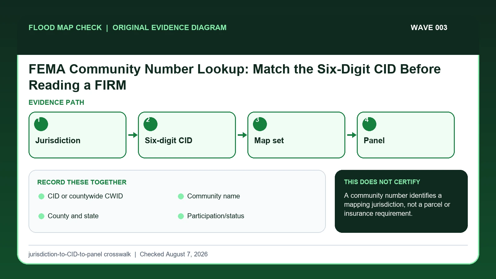
Use the FEMA CID or countywide CWID to identify the correct mapped jurisdiction and map set before selecting a FIRM panel for a property. Match the identifier to the complete community name, county and state, incorporation status, and current product; it does not identify a parcel, assign a flood zone, or set an insurance requirement.
Last checked: August 7, 2026.
The community named in a postal address is not always the community responsible for floodplain management. Incorporated cities and unincorporated county areas can have separate CIDs and separate map histories. On community-format maps the CID is commonly the first six digits of the map number; countywide identifiers use a different displayed convention. The panel title block and current community status evidence are safer than reconstructing the number from memory.
Jurisdiction comes before the six digits
FEMA defines a CID as a six-digit identifier for a mapped community; a countywide identifier uses five digits followed by C. The first task is therefore jurisdiction, not address spelling. The postal city can differ from the incorporated city, county, parish, tribal government, or unincorporated area responsible for floodplain management. The correct identifier is the one attached to the governing mapped community and map set.
For example, a home can receive mail under a nearby city's name while tax and permit records place it outside that city's boundary. Searching the postal city may return a genuine six-digit CID and a polished FIRM Index, but the product belongs to the wrong jurisdiction. Confirm the parcel's governing boundary, then match the complete community name, state, county, CID or CWID, and current effective map date before selecting a panel.
Leading zeros and countywide formats are common transcription traps. Do not convert an identifier to a number in a spreadsheet if that would strip a leading zero, and do not force a five-digit-plus-C countywide code into a six-digit community pattern. A CID narrows the map inventory; it does not identify a parcel, assign a flood zone, prove NFIP participation on a historical date, or answer an insurance requirement by itself.
FEMA's CID and countywide-number definitions
FEMA community-number lesson supplies the six-digit CID, the five-digit countywide identifier plus C, and where those identifiers appear in a map number and panel title block; this guide cites it for CID or countywide CWID / Community name. FEMA FIRM panel-number lesson supplies the complete panel-code structure: six-digit CID or five-digit CWID plus C, four-digit panel number, and trailing revision suffix; this guide cites it for CID or countywide CWID. FEMA MSC Search All Products lesson supplies the current effective map plus preliminary maps, historic FIRM panels, Flood Insurance Studies, Letters of Map Change, and other community products; this guide cites it for Community name / County and state / Map set/effective date.
The FEMA community number lookup crosswalk keeps these assignments explicit: FEMA community-number lesson → CID or countywide CWID / Community name; FEMA FIRM panel-number lesson → CID or countywide CWID; FEMA MSC Search All Products lesson → Community name / County and state / Map set/effective date. If CID or countywide CWID or another named field is absent from its cited record, leave that fact unresolved and obtain it from the responsible official source instead of expanding a different citation beyond scope.
| Official record | What it actually supplies | Field used here |
|---|---|---|
| FEMA community-number lesson | the six-digit CID, the five-digit countywide identifier plus C, and where those identifiers appear in a map number and panel title block | CID or countywide CWID / Community name |
| FEMA FIRM panel-number lesson | the complete panel-code structure: six-digit CID or five-digit CWID plus C, four-digit panel number, and trailing revision suffix | CID or countywide CWID |
| FEMA MSC Search All Products lesson | the current effective map plus preliminary maps, historic FIRM panels, Flood Insurance Studies, Letters of Map Change, and other community products | Community name / County and state / Map set/effective date |
The source boundary follows the mapped fields: CID or countywide CWID establishes one part of the record, County and state affects interpretation, and Map set/effective date limits the conclusion. Document any missing fact instead of inferring a replacement value while working to select the correct community before downloading its map products.
How CID or countywide CWID connects to Map set/effective date
| Field | Meaning in this check | Error it exposes | Response |
|---|---|---|---|
| CID or countywide CWID | Six-digit community identifier, or five-digit countywide identifier followed by C | Leading zeros and the countywide C are part of the official format; neither code is a parcel number | Copy the full identifier exactly and use it for the correct community or countywide map search |
| Community name | Incorporated jurisdiction or unincorporated county area | Mailing city may differ | Match legal jurisdiction |
| County and state | Geographic cross-check | Names can repeat nationally | Keep both with the CID |
| Participation/status | NFIP community context | Does not assign a property zone | Record status and checked date |
| Map set/effective date | Current FIRM inventory for that community | CID alone does not select a panel | Continue to index and panel |
A sound FEMA community number lookup check pairs CID or countywide CWID with County and state. The first answers “Six-digit community identifier, or five-digit countywide identifier followed by C”; the second answers “Geographic cross-check”. The pair is incomplete if the evidence shows “Names can repeat nationally”, even when the first identifier looks credible.
Community name is not background metadata. It answers “Incorporated jurisdiction or unincorporated county area”. If the contrary condition is “Mailing city may differ”, correct it by following “Match legal jurisdiction”. That correction can change which official record belongs in the check.
The last comparison joins Participation/status to Map set/effective date. They answer separate questions: “NFIP community context” and “Current FIRM inventory for that community”. Keeping both in the FEMA community number lookup record prevents an observation from being mistaken for an agency, community, insurer, lender, or professional determination.
Move from governing boundary to map set and panel
Treat “Copy the CID or countywide identifier from the official record and panel title block” as a prerequisite for “Compare participation/status and map effective date with the intended research date”. Together they determine whether County and state belongs to the same subject, period, and official product as CID or countywide CWID.
- Start with the parcel's governing jurisdiction, not the city written in the mailing address.
- Search FEMA's community/map records by state, county, and complete community name.
- Copy the CID or countywide identifier from the official record and panel title block.
- Compare participation/status and map effective date with the intended research date.
- Open the matching FIRM Index and choose the panel using the parcel/building location.
- Preserve old and new identifiers when annexation or map conversion explains a mismatch.
- Do not carry the CID into a statement about a structure's zone, lender determination, or premium.
Do not close the file at the first plausible result. Carry out “Do not carry the CID into a statement about a structure's zone, lender determination, or premium”, then preserve the version of Map set/effective date that was current on the checked date.
A postal city that points to the wrong mapped community
A property can carry a city mailing address while lying in the county's unincorporated area. If the wrong CID is used, the researcher can retrieve a credible-looking but irrelevant index and panel. Confirm the municipal boundary or parcel jurisdiction first, then use the complete community name and CID shown on FEMA records.
In this example, CID or countywide CWID identifies the relevant record, while County and state is the fact most likely to change the interpretation. Conclude “Correct community candidate” only when the evidence shows “Same complete name, state, county, boundary”.
For FEMA community number lookup, if the facts instead fit “Recently annexed area”, the result changes to “Older records may use prior CID”. Respond by following “Check map date and local confirmation”. Do not substitute the more favorable conclusion from the earlier example.
Community match, countywide format, annexation, and name conflict
| Observed state | Evidence test | Limited conclusion | Next response |
|---|---|---|---|
| CID and jurisdiction match | Same complete name, state, county, boundary | Correct community candidate | Open its current index |
| Postal city differs | Parcel lies outside incorporated boundary | Mailing label is not map authority | Use county/unincorporated CID |
| Countywide map set | Map number uses countywide convention | Do not force six-digit pattern | Use title block and FEMA inventory |
| Recently annexed area | Boundary or community responsibility changed | Older records may use prior CID | Check map date and local confirmation |
“CID and jurisdiction match” and “Postal city differs” are not better and worse versions of one answer. The former supports “Correct community candidate”; the latter supports “Mailing label is not map authority”. Preserve the different evidence tests before taking either listed response.
The two unresolved branches also differ. “Countywide map set” supports only “Do not force six-digit pattern”, whereas “Recently annexed area” supports only “Older records may use prior CID”. Apply the response shown for the matching branch.
Postal-city traps, leading zeros, and countywide formats
- Avoid using the ZIP city. Recheck Community name. The mapped warning is “Mailing city may differ”; the corresponding response is “Match legal jurisdiction”.
- Avoid dropping leading zeros. Recheck CID or countywide CWID. The mapped warning is “Leading zeros and the countywide C are part of the official format; neither code is a parcel number”; the corresponding response is “Copy the full identifier exactly and use it for the correct community or countywide map search”.
- Avoid forcing a countywide code into a community pattern. Recheck CID or countywide CWID. The mapped warning is “Leading zeros and the countywide C are part of the official format; neither code is a parcel number”; the corresponding response is “Copy the full identifier exactly and use it for the correct community or countywide map search”.
- Avoid calling the CID a flood-zone result. Recheck Map set/effective date. The mapped warning is “CID alone does not select a panel”; the corresponding response is “Continue to index and panel”.
The remedy for “using the ZIP city” is tied to Community name: “Match legal jurisdiction”. The separate mistake “dropping leading zeros” is exposed by “Leading zeros and the countywide C are part of the official format; neither code is a parcel number”; answer it with “Copy the full identifier exactly and use it for the correct community or countywide map search”.
Check CID or countywide CWID when the risk is “forcing a countywide code into a community pattern”, because the mapped warning is “Leading zeros and the countywide C are part of the official format; neither code is a parcel number”. Check Map set/effective date separately for “calling the CID a flood-zone result” and use “Continue to index and panel” as the recovery step.
What this jurisdiction-to-CID-to-panel crosswalk cannot decide
Scope: United States effective FEMA flood map products. Limitation: A community number identifies a mapping jurisdiction, not a parcel or insurance requirement.
Use the jurisdiction-to-CID-to-panel crosswalk as a reading aid for CID or countywide CWID and Map set/effective date. The official source, community, insurer, surveyor, or emergency authority still controls the outcome, especially when the evidence shows “Boundary or community responsibility changed”.
Take the confirmed CID into Index and panel selection
- FEMA Flood Map Check By Address extends the work built from CID or countywide CWID; it does not replace this check.
- Flood Risk Map By Address is the next reference when the unresolved fact is County and state.
- FEMA FIRM Panel Guide addresses the separate decision that may follow from Map set/effective date.
Use this guide to select the correct community before downloading its map products. The linked guides address separate questions raised by CID or countywide CWID, County and state, or Map set/effective date.
Before relying on a FEMA community number
Does CID or countywide CWID settle the question by itself?
No. CID or countywide CWID answers “Six-digit community identifier, or five-digit countywide identifier followed by C”, but it can fail when “Leading zeros and the countywide C are part of the official format; neither code is a parcel number”. Pair it with Community name, County and state, and the checked date.
What if the evidence shows Recently annexed area?
Confirm the stated evidence test: “Boundary or community responsibility changed”. The limited conclusion is “Older records may use prior CID”. The documented response is “Check map date and local confirmation”; a more favorable branch should not be substituted.
When should Map set/effective date be checked again?
Confirm the community identifier again after annexation, deannexation, consolidation, a countywide conversion, or a FEMA map-set update. Postal-city wording may stay the same while the floodplain-management jurisdiction and controlling CID change.
FEMA Community Number Lookup: Match the Six-Digit CID Before Reading a FIRM is independent public-record guidance for the limited action to select the correct community before downloading its map products. The cited government records retain authority over CID or countywide CWID and Map set/effective date. Last checked: August 7, 2026.