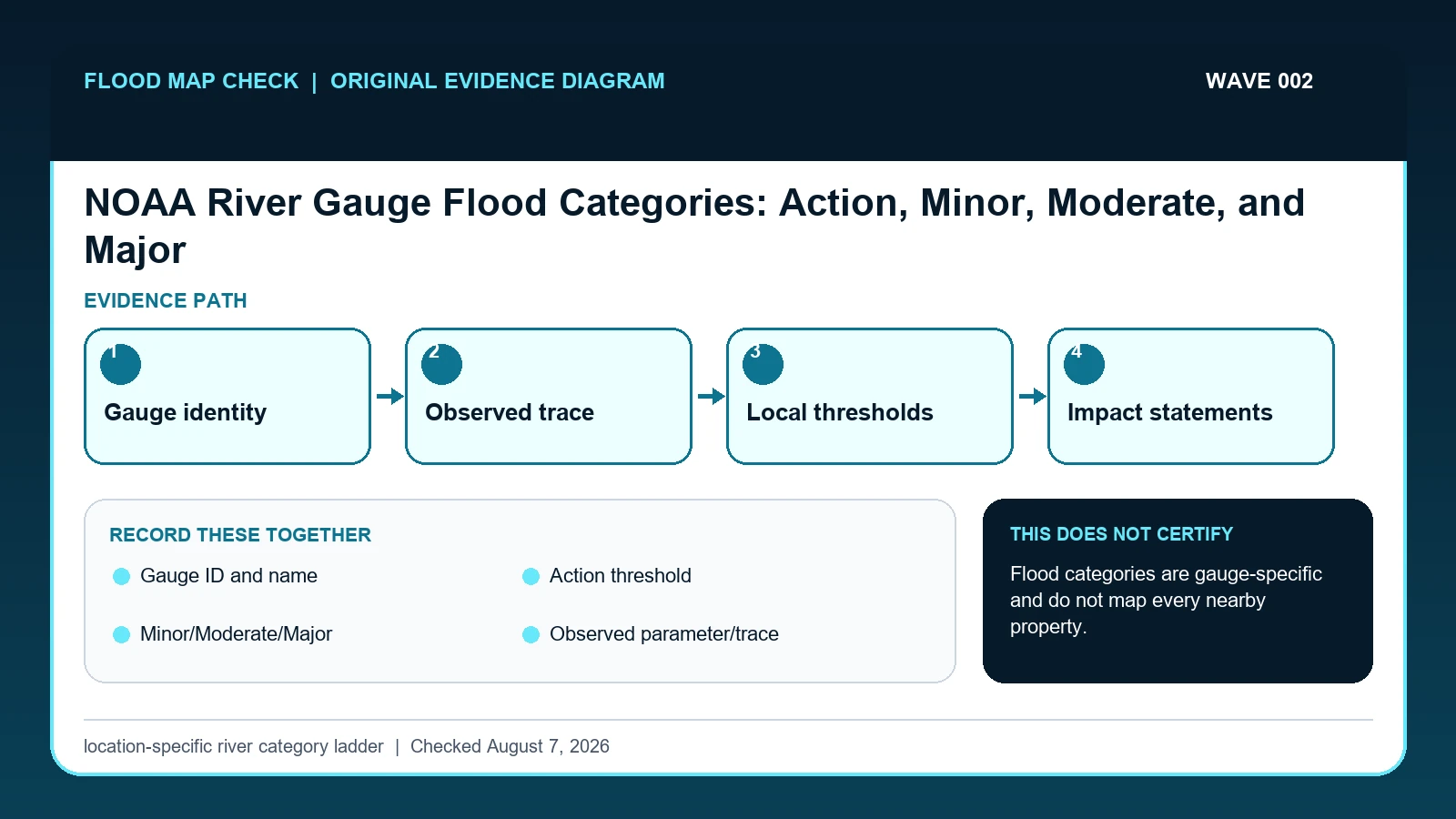
NOAA's Action, Minor, Moderate, and Major flood categories are thresholds defined for an individual forecast location. Read them with the gauge ID, measured parameter and units, observation time, forecast issuance time, and local impact statements; never transfer a stage threshold from one gauge to another or use it as a parcel flood-zone boundary.
Last checked: August 7, 2026.
A category is a local communication threshold tied to documented impacts around one forecast point. Action stage commonly signals preparation or heightened attention below flood stage. Minor, Moderate, and Major describe increasing effects, but their numeric levels and real-world consequences differ by gauge. An official NWS hydrograph can show observations and a forecast trace, while National Water Model traces are supplemental guidance rather than the official location forecast.
Category math is local to one gauge
Action, Minor, Moderate, and Major are location-specific thresholds maintained for a forecast point; they are not universal depths above a riverbank. NOAA pairs the category table with impact statements, observations, forecasts, and time stamps. Two gauges on the same river can enter Minor Flood at different stages because the channel, bridges, development, datum, and documented impacts differ. Always carry the location identifier and local category table with a copied stage value.
Suppose a forecast point reports 13.2 feet, with Action Stage at 12 feet and Minor Flood at 14 feet. The numerical comparison is 13.2 minus 12.0, or 1.2 feet above Action, while it remains 0.8 foot below the published Minor threshold. That arithmetic supports a category statement for that gauge and forecast cycle. It does not locate water on a road, predict a basement depth, or transfer the 14-foot threshold to an upstream gauge.
Thresholds and impacts can change as local knowledge and channel conditions change. Save the category values visible at the checked time and link the current hydrograph rather than embedding a threshold forever without a date. During an event, official warnings and local emergency instructions outrank a reader's private threshold calculation. A missing category table also does not mean the stream lacks flood risk; it means this particular service has not supplied that decision framework for the location.
The local NOAA forecast point owns the thresholds
NOAA National Water Prediction Service supplies official NWS gauge observations, forecasts, thresholds, impacts, and supplemental model guidance; this guide cites it for Gauge ID and name / Action threshold / Minor/Moderate/Major / Observed parameter/trace / Official forecast trace. NOAA NWPS API information supplies the fields exposed for locations, observations, forecasts, flood categories, crests, and NWM output; this guide cites it for Gauge ID and name / Action threshold / Minor/Moderate/Major / Observed parameter/trace / Official forecast trace. USGS Water Data for the Nation supplies monitoring-location metadata, instantaneous values, daily values, peaks, and qualification codes; this guide cites it for Observed parameter/trace.
The river gauge flood categories crosswalk keeps these assignments explicit: NOAA National Water Prediction Service → Gauge ID and name / Action threshold / Minor/Moderate/Major / Observed parameter/trace / Official forecast trace; NOAA NWPS API information → Gauge ID and name / Action threshold / Minor/Moderate/Major / Observed parameter/trace / Official forecast trace; USGS Water Data for the Nation → Observed parameter/trace. If Gauge ID and name or another named field is absent from its cited record, leave that fact unresolved and obtain it from the responsible official source instead of expanding a different citation beyond scope.
| Official record | What it actually supplies | Field used here |
|---|---|---|
| NOAA National Water Prediction Service | official NWS gauge observations, forecasts, thresholds, impacts, and supplemental model guidance | Gauge ID and name / Action threshold / Minor/Moderate/Major / Observed parameter/trace / Official forecast trace |
| NOAA NWPS API information | the fields exposed for locations, observations, forecasts, flood categories, crests, and NWM output | Gauge ID and name / Action threshold / Minor/Moderate/Major / Observed parameter/trace / Official forecast trace |
| USGS Water Data for the Nation | monitoring-location metadata, instantaneous values, daily values, peaks, and qualification codes | Observed parameter/trace |
For this check, the cited evidence is limited to Gauge ID and name, Minor/Moderate/Major, and Official forecast trace plus the other fields named in the crosswalk. Record a changed or missing Minor/Moderate/Major value with the retrieval date before taking the action to match current and forecast stage to locally defined impact categories, then request clarification from its publishing agency.
How Gauge ID and name connects to Spatial decision scope
| Field | Meaning in this check | Error it exposes | Response |
|---|---|---|---|
| Gauge ID and name | Identify the exact NWS forecast location | Similar river names can have several gauges | Keep the ID in every saved record |
| Action threshold | Local readiness level below or near flood stage | Not a universal warning level | Read local impacts and current NWS products |
| Minor/Moderate/Major | Location-specific increasing impact categories | Numbers cannot be copied to another gauge | Compare the trace with this gauge's thresholds |
| Observed parameter/trace | Recent observed value together with its parameter, unit, and time | Stage and discharge are different variables, and a trace may also be provisional or interrupted | Name the parameter and unit before comparing the observation with any threshold or rating |
| Official forecast trace | NWS hydrologic forecast for the location | Forecast can change with inputs | Record issuance time and monitor updates |
| Spatial decision scope | Limits the category to conditions at the forecast location and described impacts | A gauge category is not a parcel inundation map or building-level depth | Use appropriate mapped, local, and site-specific evidence for parcel questions |
Read the table in two passes. First confirm Gauge ID and name, Action threshold, and Minor/Moderate/Major. They answer “Identify the exact NWS forecast location”, “Local readiness level below or near flood stage”, and “Location-specific increasing impact categories”. Any disagreement among Gauge ID and name, Action threshold, and Minor/Moderate/Major should remain visible rather than being blended into one result.
Next test for two different problems: “Similar river names can have several gauges” and “Numbers cannot be copied to another gauge”. They require different corrections. For the first, follow “Keep the ID in every saved record”; for the second, follow “Compare the trace with this gauge's thresholds”.
Official forecast trace and Spatial decision scope show when to stop. The warning conditions are “Forecast can change with inputs” and “A gauge category is not a parcel inundation map or building-level depth”. The limits on Official forecast trace and Spatial decision scope keep the evidence useful without making the broader decision reserved for the named authority or professional.
Save stage, threshold, time, and impact statement together
Treat “Record Action, Minor, Moderate, Major, and record thresholds exactly as displayed” as a prerequisite for “Separate observed values from forecast values and save both timestamps”. Together they determine whether Minor/Moderate/Major belongs to the same subject, period, and official product as Gauge ID and name.
- Search by location, then confirm the gauge ID, waterbody, state, and map position.
- Check whether the hydrograph is stage, flow, or another parameter and copy the units.
- Record Action, Minor, Moderate, Major, and record thresholds exactly as displayed.
- Separate observed values from forecast values and save both timestamps.
- Read the local flood-impact statements associated with the relevant stages.
- Check current NWS watches, warnings, advisories, and local emergency instructions.
- Recheck as new observations and forecasts arrive; do not preserve an old category as a current condition.
Do not close the file at the first plausible result. Carry out “Recheck as new observations and forecasts arrive; do not preserve an old category as a current condition”, then preserve the version of Spatial decision scope that was current on the checked date.
A stage between Action and Minor at one forecast point
A river can be at 21 feet and still have different meaning at two locations because each gauge has its own datum, geometry, and impact history. Record '21 ft at gauge ABCD1' with time and category, not simply 'river at 21 ft.' Then read the local impact entries to learn which roads, low areas, or facilities are associated with that stage; those descriptions remain forecasts or observations, not guaranteed outcomes at an address.
In this example, Gauge ID and name identifies the relevant record, while Minor/Moderate/Major is the fact most likely to change the interpretation. Conclude “No category exceedance shown” only when the evidence shows “Trace remains under local threshold”.
For river gauge flood categories, if the facts instead fit “Gauge missing or stale”, the result changes to “Current state is unresolved”. Respond by following “Use another official point only with hydrologic relevance”. Do not substitute the more favorable conclusion from the earlier example.
Below Action, Action range, flood category, and missing thresholds
| Observed state | Evidence test | Limited conclusion | Next response |
|---|---|---|---|
| Below Action | Trace remains under local threshold | No category exceedance shown | Still check active warnings and local conditions |
| At or above Action | Threshold crossed or forecast to cross | Preparation signal at this gauge | Review impacts and local instructions |
| At a flood category | Observed or forecast trace reaches category line | Category is location-specific | Use NWS warnings and emergency guidance |
| Gauge missing or stale | No recent observation or forecast | Current state is unresolved | Use another official point only with hydrologic relevance |
Use “Trace remains under local threshold” to recognize “Below Action”. If the facts instead meet “Threshold crossed or forecast to cross”, report “Preparation signal at this gauge” and follow “Review impacts and local instructions”.
If the observation matches “Observed or forecast trace reaches category line”, stop at “Category is location-specific”. If it matches “No recent observation or forecast”, stop at “Current state is unresolved”. The corresponding actions are “Use NWS warnings and emergency guidance” and “Use another official point only with hydrologic relevance”.
Respond to changed thresholds and missing categories
- Avoid moving a threshold to a nearby gauge. Recheck Action threshold. The mapped warning is “Not a universal warning level”; the corresponding response is “Read local impacts and current NWS products”.
- Avoid mixing stage and discharge. Recheck Observed parameter/trace. The mapped warning is “Stage and discharge are different variables, and a trace may also be provisional or interrupted”; the corresponding response is “Name the parameter and unit before comparing the observation with any threshold or rating”.
- Avoid presenting NWM output as the official forecast. Recheck Official forecast trace. The mapped warning is “Forecast can change with inputs”; the corresponding response is “Record issuance time and monitor updates”.
- Avoid turning a gauge category into a parcel map. Recheck Spatial decision scope. The mapped warning is “A gauge category is not a parcel inundation map or building-level depth”; the corresponding response is “Use appropriate mapped, local, and site-specific evidence for parcel questions”.
Two field-specific corrections are required. For “moving a threshold to a nearby gauge”, follow “Read local impacts and current NWS products”. For “mixing stage and discharge”, follow “Name the parameter and unit before comparing the observation with any threshold or rating”. Keeping Action threshold separate from Observed parameter/trace prevents one repaired field from hiding the other error.
“presenting NWM output as the official forecast” can trigger Forecast can change with inputs; correct the mapped Official forecast trace field or fields by following “Record issuance time and monitor updates”. “turning a gauge category into a parcel map” affects Spatial decision scope, so use “Use appropriate mapped, local, and site-specific evidence for parcel questions” before relying on the result.
What this location-specific river category ladder cannot decide
Scope: United States observed and forecast river conditions. Limitation: Flood categories are gauge-specific and do not map every nearby property.
This comparison can expose a conflict between Gauge ID and name and Minor/Moderate/Major, but it cannot resolve “Gauge missing or stale”. In that condition, the defensible next step remains “Use another official point only with hydrologic relevance”.
Compare the category with separate gauge and map evidence
- Carry the verified Gauge ID and name to River Flood Risk Check if that linked topic is the reader’s next question.
- Keep Minor/Moderate/Major attached to its source when moving to USGS Streamstats Flood Frequency Report.
- Treat USGS Flood Event Viewer High Water Marks as a separate review triggered by Spatial decision scope while working to match current and forecast stage to locally defined impact categories, not as confirmation of the result here.
Use this guide to match current and forecast stage to locally defined impact categories. The linked guides address separate questions raised by Gauge ID and name, Minor/Moderate/Major, or Spatial decision scope.
Before repeating a gauge category in public
Does Gauge ID and name settle the question by itself?
No. Gauge ID and name answers “Identify the exact NWS forecast location”, but it can fail when “Similar river names can have several gauges”. Pair it with Action threshold, Minor/Moderate/Major, and the checked date.
What if the evidence shows Gauge missing or stale?
Confirm the stated evidence test: “No recent observation or forecast”. The limited conclusion is “Current state is unresolved”. The documented response is “Use another official point only with hydrologic relevance”; a more favorable branch should not be substituted.
When should Spatial decision scope be checked again?
Refresh the gauge record for every new observation and forecast issuance during an event. Also capture any NOAA revision to local category thresholds or impact statements, because a saved stage value keeps its meaning only when the same forecast point, units, issue time, and threshold table remain attached.
NOAA River Gauge Flood Categories: Action, Minor, Moderate, and Major is independent public-record guidance for the limited action to match current and forecast stage to locally defined impact categories. The cited government records retain authority over Gauge ID and name and Spatial decision scope. Last checked: August 7, 2026.