Quick answer: The NYC Flood Hazard Mapper visualizes city planning and climate-hazard information. FEMA's Map Service Center provides the effective Flood Insurance Rate Map used for National Flood Insurance Program mapping decisions. Check the same address in both, but do not substitute one for the other.
Use NYC's mapper for planning context and FEMA for the effective insurance map
- Confirm the address and parcel, selected layer, scenario, and map date in the NYC tool.
- Open the effective FEMA panel and read the zone, panel, suffix, and effective date.
- Use local officials, insurers, lenders, and FEMA processes for the decision each controls.
What this result does not prove
Neither screen alone proves parcel elevation, building-floor elevation, future flooding, insurance price, or a final permit decision.
Verify the live rule at NYC Flood Hazard Mapper. Then continue with the FEMA address map check for the next step.
The NYC Flood Hazard Mapper and the FEMA Flood Map Service Center answer different questions. The city mapper shows current and future coastal flood-hazard layers for planning and resilience, while FEMA’s effective Flood Insurance Rate Map is the federal source used for regulatory flood-zone and many flood-insurance questions. Check both when a property decision depends on present rules and future exposure.
Choose the map for the decision you are making
The NYC Flood Hazard Mapper is maintained through New York City Planning and presents coastal flood hazards today and under future sea-level-rise scenarios. The FEMA Map Service Center provides the effective FIRM and related federal map products by address.
| Source | Best used for | Do not treat it as |
|---|---|---|
| NYC Flood Hazard Mapper | Current and future coastal hazard planning | A flood insurance quote or single final regulatory answer |
| FEMA Map Service Center | Effective FIRM, panel, zone, and federal map products | A forecast of every future or rain-driven flood |
| NYC stormwater maps | Rainfall and drainage-related scenarios | The same hazard as coastal surge |
| Property documents | Elevation, map-change, and site-specific evidence | A replacement for confirming the current official map |
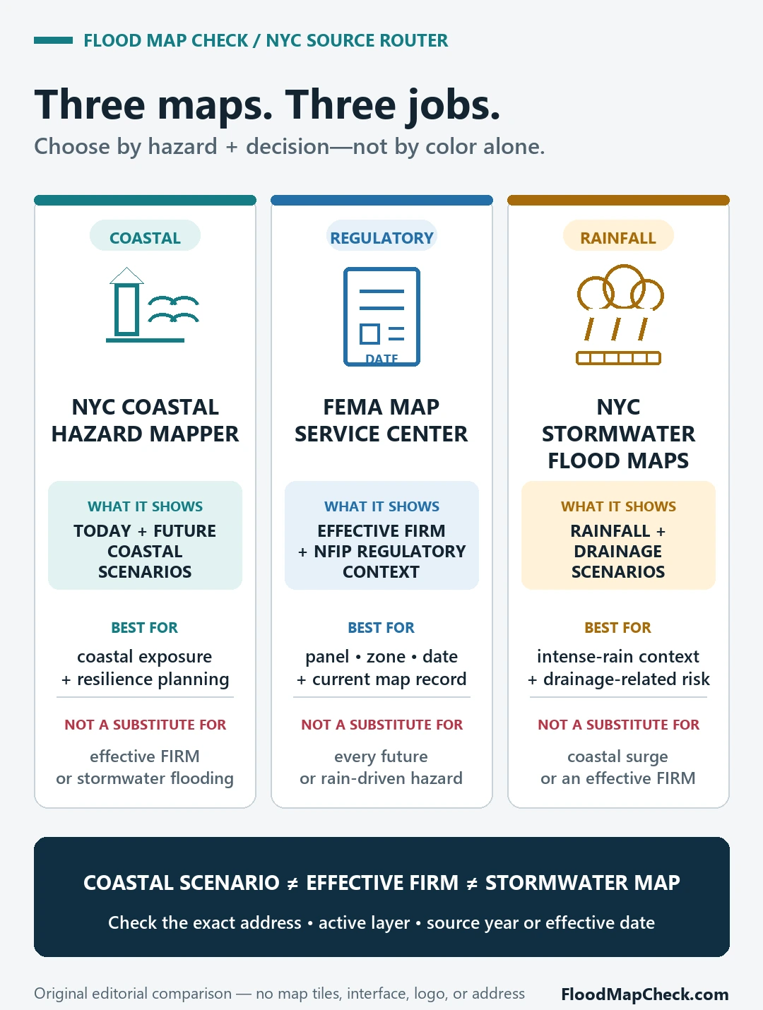
Confirm the address and layer before reading color
Search the exact property and zoom until the parcel and surrounding streets are clear. Then record the active layer, source year, scenario, and legend. A future high-tide or coastal-storm layer does not have the same meaning as an effective FEMA 1-percent-annual-chance floodplain, and a nearby colored area should not be assigned to the parcel without checking the boundary.
For a mortgage or insurance question, begin with the effective FEMA panel and the determination used by the lender or insurer. For a long-term renovation, basement, emergency plan, or property purchase, add the NYC future coastal layers and the city’s stormwater information. Keeping the purpose visible prevents a common mistake: using a future planning scenario as if it were today’s insurance zone, or using today’s regulatory map as if it described every future climate and rainfall condition.
Run the two-map check in order
- Open the NYC mapper, search the address, and confirm the parcel and active coastal-hazard layer.
- Record whether the layer describes a current floodplain, preliminary map, future storm scenario, or future high tide.
- Open FEMA’s Map Service Center for the same address and note the effective panel, flood zone, and map date.
- Check for a Letter of Map Change, Elevation Certificate, or local stormwater layer when those records affect the decision.
- Ask the insurer, lender, city agency, or qualified professional which source and date control the specific transaction or project.
Coastal, river, and stormwater flooding are not interchangeable
New York City links several map types from its flood data and maps page. The coastal mapper emphasizes coastal storm and sea-level-rise hazards. Intense rainfall can create street, drainage, or basement flooding outside a coastal layer, and an address outside a mapped zone can still experience water damage. Match the hazard source to the question.
The FEMA flood map by address guide covers effective panel and zone checks. The flood risk map by address guide explains why a mapped hazard is evidence for a defined scenario, not a prediction that a particular building will or will not flood.
What neither map proves on its own
A map does not show the exact finished-floor elevation, condition of a basement, drainage maintenance, private floodproofing, insurance price, lender decision, or future weather. It also cannot replace an elevation survey, current insurance determination, building-code review, or site-specific engineering when those are required.
NYC flood map questions
Which map should I use for flood insurance?
Start with the current effective FEMA map and ask the insurer or lender what determination and property documents they require. Use NYC future layers as additional risk context.
Why do the NYC and FEMA maps look different?
They can show different source years, hazards, scenarios, and purposes. Compare the legend and active layer rather than expecting identical boundaries.
Does being outside a FEMA zone mean no flood risk?
No. Other hazards, future conditions, local drainage, and site-specific factors can still create flood risk.
NYC and FEMA map paths were checked July 21, 2026. Map layers and effective dates can change.