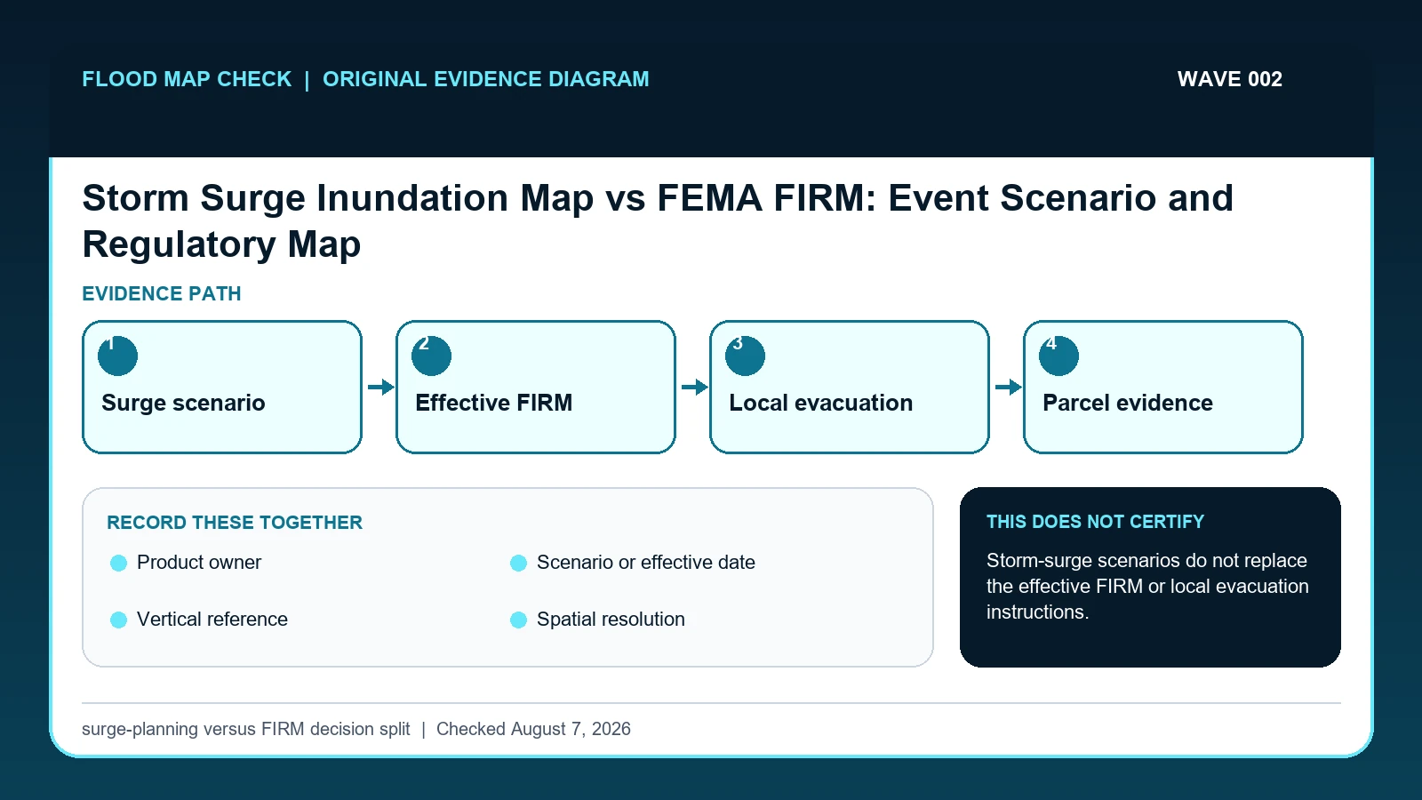
A NOAA or NHC storm-surge product shows coastal water potential for a stated scenario or event, while a FEMA FIRM supplies regulatory flood-map context. Compare them only after labeling purpose, scenario or effective date, vertical reference, resolution, and decision owner.
Last checked: August 7, 2026.
The two maps can overlap visually while answering different questions. NHC's national surge risk maps use SLOSH Maximum of MEOWs planning scenarios and are explicitly not parcel, permitting, legal, evacuation-zone, or regulatory products. FEMA FIRMs depict mapped flood-hazard zones and, where studied, base flood elevations or depths under the effective study. Neither map is a live evacuation order; local emergency management controls evacuation zones and instructions.
Scenario water and regulatory hazard are not interchangeable
A National Hurricane Center surge map and a FEMA FIRM answer different questions. Surge products describe storm-driven coastal water under stated scenarios or operational forecasts. A FIRM is a regulatory flood-hazard product built for the National Flood Insurance Program and may combine coastal, riverine, wave, and other mapped information using an effective study. Similar colors do not make the scenario, probability basis, datum, or legal role interchangeable.
For a coastal parcel, retain two evidence rows. The emergency row should name the NHC product, advisory or scenario, issue time, inundation reference, and coverage limits. The regulatory row should name the effective FIRM panel, suffix, date, zone, BFE or depth information, and any wave-related designation. A surge layer showing three feet above ground does not add three feet to a FIRM BFE, and a mapped VE zone does not predict the next storm's water level.
Coverage gaps are not negative findings. Some surge products omit certain bays, rivers, leveed areas, or small-scale terrain, while a FIRM can be old relative to recent development or erosion. When a building sits near a layer edge, neither screen should be treated as a survey. Operational decisions should follow current forecasts and emergency officials; insurance, lending, and development questions should follow the effective map, community rules, and qualified site evidence.
NHC surge products and FEMA FIRMs have separate jobs
NHC National Storm Surge Risk Maps supplies SLOSH MOM planning maps, inundation bins, coverage, and non-parcel limitations; this guide cites it for Product owner / Scenario or effective date / Spatial resolution. National Hurricane Center storm surge resources supplies operational and planning surge products and their intended use; this guide cites it for Product owner / Scenario or effective date / Decision role. FEMA MSC Search All Products lesson supplies the current effective map plus preliminary maps, historic FIRM panels, Flood Insurance Studies, Letters of Map Change, and other community products; this guide cites it for Scenario or effective date / Decision role.
The storm surge map vs FEMA flood map crosswalk keeps these assignments explicit: NHC National Storm Surge Risk Maps → Product owner / Scenario or effective date / Spatial resolution; National Hurricane Center storm surge resources → Product owner / Scenario or effective date / Decision role; FEMA MSC Search All Products lesson → Scenario or effective date / Decision role. If Product owner or another named field is absent from its cited record, leave that fact unresolved and obtain it from the responsible official source instead of expanding a different citation beyond scope.
| Official record | What it actually supplies | Field used here |
|---|---|---|
| NHC National Storm Surge Risk Maps | SLOSH MOM planning maps, inundation bins, coverage, and non-parcel limitations | Product owner / Scenario or effective date / Spatial resolution |
| National Hurricane Center storm surge resources | operational and planning surge products and their intended use | Product owner / Scenario or effective date / Decision role |
| FEMA MSC Search All Products lesson | the current effective map plus preliminary maps, historic FIRM panels, Flood Insurance Studies, Letters of Map Change, and other community products | Scenario or effective date / Decision role |
For this check, the cited evidence is limited to Product owner, Spatial resolution, and Decision role plus the other fields named in the crosswalk. Record a changed or missing Spatial resolution value with the retrieval date before taking the action to separate event-planning output from the effective insurance and building map, then request clarification from its publishing agency.
The FEMA map source supplies regulatory FIRM context only; it does not validate a storm-surge scenario or replace an evacuation map or order.
How Product owner connects to Decision role
| Field | Meaning in this check | Error it exposes | Response |
|---|---|---|---|
| Product owner | NHC/NOAA surge product versus FEMA regulatory map product | A surge scenario is not a FEMA flood zone even when colors overlap | Name the owner and product before interpreting its role |
| Scenario or effective date | Hurricane category/tide scenario versus effective FIRM date | Dates and scenarios are not interchangeable | Record exactly what was displayed |
| Vertical reference | Surge inundation assumptions versus FIRM BFE datum | Colors may use different bases | Do not compare heights without compatible datums |
| Spatial resolution | Planning grid, regulatory-map feature, coverage area, and no-data treatment | Being outside one displayed layer does not establish no coastal risk, and neither layer proves a surveyed parcel boundary | Check coverage metadata and other applicable official products; use parcel or survey evidence for exact location |
| Decision role | Awareness/planning versus NFIP/community regulation | Evacuation is a third decision | Follow the responsible local authority |
Read the table in two passes. First confirm Product owner, Scenario or effective date, and Vertical reference. They answer “NHC/NOAA surge product versus FEMA regulatory map product”, “Hurricane category/tide scenario versus effective FIRM date”, and “Surge inundation assumptions versus FIRM BFE datum”. Any disagreement among Product owner, Scenario or effective date, and Vertical reference should remain visible rather than being blended into one result.
Next test for two different problems: “A surge scenario is not a FEMA flood zone even when colors overlap” and “Colors may use different bases”. They require different corrections. For the first, follow “Name the owner and product before interpreting its role”; for the second, follow “Do not compare heights without compatible datums”.
Spatial resolution and Decision role show when to stop. The warning conditions are “Being outside one displayed layer does not establish no coastal risk, and neither layer proves a surveyed parcel boundary” and “Evacuation is a third decision”. The limits on Spatial resolution and Decision role keep the evidence useful without making the broader decision reserved for the named authority or professional.
Build parallel emergency and regulatory evidence rows
The order matters most around Vertical reference. First, “Check whether the point represents the building, parcel centroid, street, or an imprecise geocoder result”. Next, “Write the purpose of each product beside its value before comparing any colors or numbers”. Reversing those actions can attach a sound interpretation to the wrong date, place, product, or case for Vertical reference.
- Open the current NHC storm-surge risk product and record region, version, scenario, tide assumption, and legend.
- Open the FEMA Map Service Center result for the same location and record panel, suffix, zone, and effective date.
- Check whether the point represents the building, parcel centroid, street, or an imprecise geocoder result.
- Write the purpose of each product beside its value before comparing any colors or numbers.
- Verify vertical references and do not subtract heights expressed on incompatible bases.
- Open local evacuation-zone and emergency-management sources separately during a threat.
- Save screenshots or downloads with metadata and a statement of what each map cannot decide.
End with “Save screenshots or downloads with metadata and a statement of what each map cannot decide”. That preserves Decision role beside the source and date instead of leaving a detached number, color, category, or status that another reader could overinterpret.
Two coastal layers that look alike but answer different questions
A house can appear outside an effective FEMA Special Flood Hazard Area and still lie inside an NHC surge-planning footprint. That is not a contradiction. The FIRM addresses the mapped regulatory hazard and effective study, while the surge layer explores potential hurricane inundation under its model assumptions. Save both results in separate rows and never copy the color from one legend into the label of the other.
In this example, Product owner identifies the relevant record, while Vertical reference is the fact most likely to change the interpretation. Conclude “Multiple coastal concerns” only when the evidence shows “Regulatory and surge-planning evidence overlap”.
For storm surge map vs FEMA flood map, if the facts instead fit “Hatched/leveed/no-data area”, the result changes to “Risk is unresolved”. Respond by following “Ask local officials and read metadata”. Do not substitute the more favorable conclusion from the earlier example.
Operational surge, planning scenario, effective FIRM, and edge uncertainty
| Observed state | Evidence test | Limited conclusion | Next response |
|---|---|---|---|
| Inside both layers | Regulatory and surge-planning evidence overlap | Multiple coastal concerns | Review FIRM, building elevation, insurance, and local emergency plan |
| Outside FIRM, inside surge layer | Different hazard questions | Not a map error by itself | Use surge result for planning and FIRM for mapped regulatory context |
| Inside FIRM, outside shown surge | Riverine, rainfall, wave, or coverage differences may apply | Surge map is not all-flood map | Keep FEMA and local flood sources |
| Hatched/leveed/no-data area | Model or map limit is disclosed | Risk is unresolved | Ask local officials and read metadata |
Use “Regulatory and surge-planning evidence overlap” to recognize “Inside both layers”. If the facts instead meet “Different hazard questions”, report “Not a map error by itself” and follow “Use surge result for planning and FIRM for mapped regulatory context”.
If the observation matches “Riverine, rainfall, wave, or coverage differences may apply”, stop at “Surge map is not all-flood map”. If it matches “Model or map limit is disclosed”, stop at “Risk is unresolved”. The corresponding actions are “Keep FEMA and local flood sources” and “Ask local officials and read metadata”.
Coverage gaps, layer edges, and outdated screens
- Avoid calling a surge scenario a FEMA zone. Recheck Product owner / Scenario or effective date / Decision role. The mapped warning is “A surge scenario is not a FEMA flood zone even when colors overlap; Dates and scenarios are not interchangeable; Evacuation is a third decision”; the corresponding response is “Name the owner and product before interpreting its role; Record exactly what was displayed; Follow the responsible local authority”.
- Avoid using the surge map as an evacuation zone. Recheck Decision role. The mapped warning is “Evacuation is a third decision”; the corresponding response is “Follow the responsible local authority”.
- Avoid comparing incompatible heights. Recheck Vertical reference. The mapped warning is “Colors may use different bases”; the corresponding response is “Do not compare heights without compatible datums”.
- Avoid assuming outside one layer means no coastal risk. Recheck Spatial resolution. The mapped warning is “Being outside one displayed layer does not establish no coastal risk, and neither layer proves a surveyed parcel boundary”; the corresponding response is “Check coverage metadata and other applicable official products; use parcel or survey evidence for exact location”.
The remedy for “calling a surge scenario a FEMA zone” is tied to Product owner / Scenario or effective date / Decision role: “Name the owner and product before interpreting its role; Record exactly what was displayed; Follow the responsible local authority”. The separate mistake “using the surge map as an evacuation zone” is exposed by “Evacuation is a third decision”; answer it with “Follow the responsible local authority”.
Check Vertical reference when the risk is “comparing incompatible heights”, because the mapped warning is “Colors may use different bases”. Check Spatial resolution separately for “assuming outside one layer means no coastal risk” and use “Check coverage metadata and other applicable official products; use parcel or survey evidence for exact location” as the recovery step.
What this surge-planning versus FIRM decision split cannot decide
Scope: United States coastal screening and observed water levels. Limitation: Storm-surge scenarios do not replace the effective FIRM or local evacuation instructions.
This comparison can expose a conflict between Product owner and Vertical reference, but it cannot resolve “Hatched/leveed/no-data area”. In that condition, the defensible next step remains “Ask local officials and read metadata”.
Move to emergency or regulatory evidence without merging them
- Carry the verified Product owner to Coastal Flood Map Check if that linked topic is the reader’s next question.
- Keep Vertical reference attached to its source when moving to NOAA Sea Level Rise Viewer Address Guide.
- Treat Coastal A Zone LiMWA Lookup as a separate review triggered by Decision role while working to separate event-planning output from the effective insurance and building map, not as confirmation of the result here.
Use this guide to separate event-planning output from the effective insurance and building map. The linked guides address separate questions raised by Product owner, Vertical reference, or Decision role.
Before applying a coastal layer to a property
Does Product owner settle the question by itself?
No. Product owner answers “NHC/NOAA surge product versus FEMA regulatory map product”, but it can fail when “A surge scenario is not a FEMA flood zone even when colors overlap”. Pair it with Scenario or effective date, Vertical reference, and the checked date.
What if the evidence shows Hatched/leveed/no-data area?
Confirm the stated evidence test: “Model or map limit is disclosed”. The limited conclusion is “Risk is unresolved”. The documented response is “Ask local officials and read metadata”; a more favorable branch should not be substituted.
When should Decision role be checked again?
Update the emergency row for each new NHC advisory, forecast cycle, or scenario release; update the regulatory row only when FEMA issues a revised or newly effective map product. Never carry a former storm's surge layer forward as if it changed the effective FIRM.
Storm Surge Inundation Map vs FEMA FIRM: Event Scenario and Regulatory Map is independent public-record guidance for the limited action to separate event-planning output from the effective insurance and building map. The cited government records retain authority over Product owner and Decision role. Last checked: August 7, 2026.