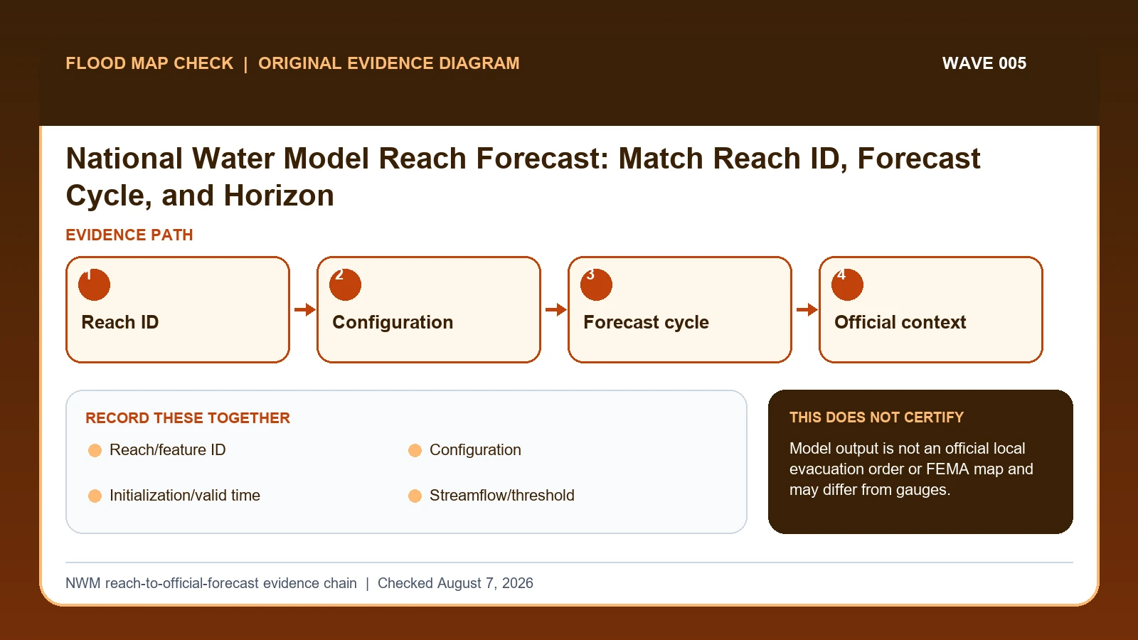
The National Water Model provides streamflow guidance for millions of river reaches, including places without a traditional forecast gauge. Match the reach, model configuration, initialization time, forecast horizon, variable, units, and threshold; NWM output supplements official NWS river forecasts and should not be presented as a certified prediction for an address.
Last checked: August 7, 2026.
NWM configurations serve different time horizons. Short-range runs update frequently, while medium-range and other products extend farther with different forcing and uncertainty. NOAA's web-service catalog also includes high-water magnitude and rapid-onset products derived from model thresholds and ensembles. The mapped reach geometry can be offset from a property or small tributary and does not create a FEMA floodplain boundary.
A model segment is not an address or official gauge forecast
The National Water Model assigns output to river-network reaches. A reach ID is a modeled stream segment, not an address, parcel, or traditional gauge. Configuration and initialization matter: short-range and medium-range products have different horizons, update schedules, forcing, and uncertainty. A value without the reach, configuration, cycle, valid time, variable, and units cannot be reproduced.
A high-flow signal should be checked for network continuity. Confirm that the selected reach follows the intended watercourse, inspect upstream and downstream reaches, compare consecutive runs or ensemble information, and look for hydrologically relevant observations. If an official NWS forecast point exists, its hydrograph and impact statements provide the operational context. The model can add spatial guidance but should not displace that official location forecast.
Small tributaries, channel geometry, dams, diversions, rapidly changing rainfall, and mapping offsets can create local differences. A threshold class derived from model climatology or reanalysis is not a FEMA flood zone. For an ungauged reach, uncertainty should be stated more strongly, not hidden. Use current warnings and local emergency messages for action, and archive the model metadata if the result will be cited after the forecast cycle has passed.
NOAA defines the reach and each model configuration
NOAA National Water Model overview supplies model reach coverage, run configurations, and the distinction between guidance and official forecasts; this guide cites it for Reach/feature ID / Configuration / Initialization/valid time / Streamflow/threshold / Ensemble/probability / Official forecast relation. NOAA water data and web services catalog supplies NWM product definitions, horizons, thresholds, ensembles, and GIS service scope; this guide cites it for Configuration / Initialization/valid time / Streamflow/threshold / Ensemble/probability. NOAA National Water Prediction Service supplies official NWS gauge observations, forecasts, thresholds, impacts, and supplemental model guidance; this guide cites it for Official forecast relation.
The National Water Model forecast crosswalk keeps these assignments explicit: NOAA National Water Model overview → Reach/feature ID / Configuration / Initialization/valid time / Streamflow/threshold / Ensemble/probability / Official forecast relation; NOAA water data and web services catalog → Configuration / Initialization/valid time / Streamflow/threshold / Ensemble/probability; NOAA National Water Prediction Service → Official forecast relation. If Reach/feature ID or another named field is absent from its cited record, leave that fact unresolved and obtain it from the responsible official source instead of expanding a different citation beyond scope.
| Official record | What it actually supplies | Field used here |
|---|---|---|
| NOAA National Water Model overview | model reach coverage, run configurations, and the distinction between guidance and official forecasts | Reach/feature ID / Configuration / Initialization/valid time / Streamflow/threshold / Ensemble/probability / Official forecast relation |
| NOAA water data and web services catalog | NWM product definitions, horizons, thresholds, ensembles, and GIS service scope | Configuration / Initialization/valid time / Streamflow/threshold / Ensemble/probability |
| NOAA National Water Prediction Service | official NWS gauge observations, forecasts, thresholds, impacts, and supplemental model guidance | Official forecast relation |
Use the cited records only to select the correct modeled reach and preserve model-run provenance. If an official page no longer publishes Reach/feature ID, save its URL and checked date, mark that fact unavailable, and ask the agency or data owner rather than borrowing it from a secondary summary.
How Reach/feature ID connects to Official forecast relation
| Field | Meaning in this check | Error it exposes | Response |
|---|---|---|---|
| Reach/feature ID | Model river segment | Not parcel or gauge | Verify geometry/network |
| Configuration | Analysis, short-, medium-, or other range | Different purpose/horizon | Name explicitly |
| Initialization/valid time | Forecast cycle and target time | Stale cycle misleads | Keep both |
| Streamflow/threshold | Modeled value or high-water class | Threshold may derive from reanalysis | Record units/method |
| Ensemble/probability | Agreement across members or lagged runs | Not deterministic | Carry percentage |
| Official forecast relation | NWM is supplemental at forecast points | Do not replace NWS forecast | Link the location hydrograph |
Begin with Reach/feature ID, which answers “Model river segment”. Check Configuration separately because it answers “Analysis, short-, medium-, or other range”. If the record instead shows “Different purpose/horizon”, use the stated correction: “Name explicitly”.
Initialization/valid time can change the interpretation because it answers “Forecast cycle and target time”. Its main warning is “Stale cycle misleads”. Read that warning beside Ensemble/probability so place, period, unit, and reference remain attached to the same evidence.
Finish the comparison with Official forecast relation. It answers “NWM is supplemental at forecast points”, while “Do not replace NWS forecast” marks the point where a broader conclusion would be unsafe. When that condition appears, follow “Link the location hydrograph” and leave the larger decision open.
Check network continuity, cycles, observations, and thresholds
The order matters most around Initialization/valid time. First, “Read the product's threshold or probability definition in NOAA's data catalog”. Next, “Compare consecutive runs and ensemble information instead of selecting one alarming trace”. Reversing those actions can attach a sound interpretation to the wrong date, place, product, or case for Initialization/valid time.
- Identify the exact model reach and confirm it is the intended watercourse segment.
- Record configuration, model version, initialization, valid time, horizon, variable, and units.
- Read the product's threshold or probability definition in NOAA's data catalog.
- Compare consecutive runs and ensemble information instead of selecting one alarming trace.
- Check nearby USGS observations and official NWS forecast locations where hydrologically relevant.
- Use watches, warnings, forecast discussions, and local emergency messages for action.
- Archive the model metadata and state that it is guidance, not a parcel flood or regulatory map.
End with “Archive the model metadata and state that it is guidance, not a parcel flood or regulatory map”. That preserves Official forecast relation beside the source and date instead of leaving a detached number, color, category, or status that another reader could overinterpret.
A high-flow reach signal beside an official forecast point
A high-flow signal on a modeled reach is a reason to find the reach ID, inspect upstream/downstream continuity, and compare nearby observations, not to claim the house beside it will flood. If an official NWS forecast point exists, use that forecast and its local impact statements as the operational authority; retain NWM as supporting guidance.
In this example, Reach/feature ID identifies the relevant record, while Initialization/valid time is the fact most likely to change the interpretation. Conclude “NWS product controls operations” only when the evidence shows “Official location forecast exists”.
For National Water Model forecast, if the facts instead fit “Runs disagree”, the result changes to “Forecast uncertainty high”. Respond by following “Avoid single-run claim”. Do not substitute the more favorable conclusion from the earlier example.
Official gauge, ungauged reach, rapid-onset signal, and disagreeing runs
| Observed state | Evidence test | Limited conclusion | Next response |
|---|---|---|---|
| Gauge with NWS forecast | Official location forecast exists | NWS product controls operations | Use NWM as context |
| Ungauged modeled reach | Only NWM guidance available | Higher uncertainty | Check network/local evidence |
| Rapid-onset signal | Model criteria met | Potential quick rise | Follow warnings and emergency sources |
| Runs disagree | Cycle/member output varies | Forecast uncertainty high | Avoid single-run claim |
When the evidence shows “Official location forecast exists”, the limited conclusion is “NWS product controls operations” and the next action is “Use NWM as context”. By contrast, “Ungauged modeled reach” requires “Check network/local evidence” because its evidence test is “Only NWM guidance available”.
For “Rapid-onset signal”, use “Follow warnings and emergency sources”. For “Runs disagree”, use “Avoid single-run claim”. Across Rapid-onset signal and Runs disagree, neither branch permits an unsupported favorable conclusion when the stated evidence is absent.
Ungauged uncertainty, offsets, and disagreeing runs
- Avoid mistaking reach for address. Recheck Reach/feature ID. The mapped warning is “Not parcel or gauge”; the corresponding response is “Verify geometry/network”.
- Avoid mixing forecast configurations. Recheck Configuration. The mapped warning is “Different purpose/horizon”; the corresponding response is “Name explicitly”.
- Avoid hiding initialization time. Recheck Initialization/valid time. The mapped warning is “Stale cycle misleads”; the corresponding response is “Keep both”.
- Avoid replacing official NWS forecast. Recheck Official forecast relation. The mapped warning is “Do not replace NWS forecast”; the corresponding response is “Link the location hydrograph”.
The remedy for “mistaking reach for address” is tied to Reach/feature ID: “Verify geometry/network”. The separate mistake “mixing forecast configurations” is exposed by “Different purpose/horizon”; answer it with “Name explicitly”.
Check Initialization/valid time when the risk is “hiding initialization time”, because the mapped warning is “Stale cycle misleads”. Check Official forecast relation separately for “replacing official NWS forecast” and use “Link the location hydrograph” as the recovery step.
What this NWM reach-to-official-forecast evidence chain cannot decide
Scope: United States observed and forecast river conditions. Limitation: Model output is not an official local evacuation order or FEMA map and may differ from gauges.
The NWM reach-to-official-forecast evidence chain keeps Reach/feature ID, Initialization/valid time, and Official forecast relation in one comparison; it does not select the correct modeled reach and preserve model-run provenance on the reader’s behalf. If the facts match “Runs disagree”, follow “Avoid single-run claim” with the responsible agency or professional.
Connect model guidance to observations and warnings
- After confirming Reach/feature ID, continue to River Flood Risk Check only for the separate question named there.
- Use USGS Streamstats Flood Frequency Report when Initialization/valid time raises an issue outside this article’s evidence test.
- Open USGS Flood Event Viewer High Water Marks if Official forecast relation requires a broader official-record review.
Use this guide to select the correct modeled reach and preserve model-run provenance. The linked guides address separate questions raised by Reach/feature ID, Initialization/valid time, or Official forecast relation.
Before mapping NWM output to an address
Does Reach/feature ID settle the question by itself?
No. Reach/feature ID answers “Model river segment”, but it can fail when “Not parcel or gauge”. Pair it with Configuration, Initialization/valid time, and the checked date.
What if the evidence shows Runs disagree?
Confirm the stated evidence test: “Cycle/member output varies”. The limited conclusion is “Forecast uncertainty high”. The documented response is “Avoid single-run claim”; a more favorable branch should not be substituted.
When should Official forecast relation be checked again?
Refresh the record for each NWM cycle, configuration, and horizon, and verify that the reach identifier has not changed. Reconcile the new model signal with current observations, official gauge forecasts, warnings, and local reports before using it operationally.
National Water Model Reach Forecast: Match Reach ID, Forecast Cycle, and Horizon is independent public-record guidance for the limited action to select the correct modeled reach and preserve model-run provenance. The cited government records retain authority over Reach/feature ID and Official forecast relation. Last checked: August 7, 2026.