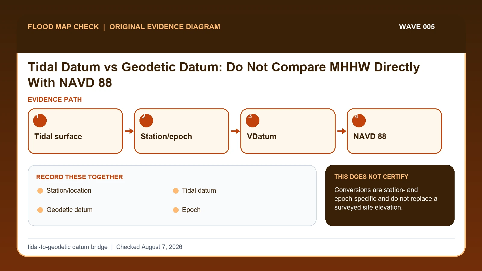
MHHW, MSL, and other tidal datums are local reference surfaces derived from water-level observations at a tide station, while NAVD 88 is a geodetic vertical datum used for land elevations. Do not compare them directly; use NOAA VDatum or a documented survey transformation for the location, epoch, realization, units, and uncertainty.
Last checked: August 7, 2026.
Tidal datums represent phases or statistics of the tide over the National Tidal Datum Epoch and vary spatially. NAVD 88 is a continent-scale orthometric reference. A value of 3 feet MHHW and 3 feet NAVD 88 do not describe the same physical level. VDatum models transformations only in supported regions and supplies uncertainty that belongs with the result.
Equal numbers in different datums are unequal heights
MHHW, MSL, and other tidal datums are station-related surfaces derived from observed tides over a tidal datum epoch. NAVD 88 is a geodetic vertical datum used for land elevations. Equal numbers in the two systems do not represent equal physical heights. The comparison requires a location-specific transformation, supported datum pair, coordinates, model version, units, and uncertainty.
If a threshold is 3.4 feet MHHW and VDatum reports that the corresponding surface is 5.1 feet NAVD 88 at the selected coordinates, compare 5.1 with the surveyed NAVD 88 elevation, not 3.4. If a floor is 5.3 feet NAVD 88, the nominal margin is 0.2 foot. That margin may be inconclusive when transformation and survey uncertainties approach or exceed 0.2 foot.
A conversion from another harbor is not portable, and VDatum does not cover every place or every datum combination. Tidal epochs and geodetic realizations can also change. Outside supported coverage, or where a legal or high-precision decision depends on a small margin, obtain survey or geodetic expertise. Keep storm surge, tide prediction, wave effects, and regulatory freeboard separate from the datum transformation itself.
NOAA datum definitions and VDatum set the conversion frame
NOAA tidal datum information supplies station-specific tidal reference surfaces and National Tidal Datum Epoch context; this guide cites it for Station/location / Tidal datum / Epoch. NOAA VDatum supplies location-specific transformation among tidal, orthometric, and ellipsoidal vertical datums; this guide cites it for Geodetic datum / Transformation / Uncertainty. NOAA sea level and coastal flooding information supplies station observations, trends, high-tide flooding, extreme water levels, and coastal tools; this guide cites it for Station/location.
The tidal datum vs NAVD 88 crosswalk keeps these assignments explicit: NOAA tidal datum information → Station/location / Tidal datum / Epoch; NOAA VDatum → Geodetic datum / Transformation / Uncertainty; NOAA sea level and coastal flooding information → Station/location. If Station/location or another named field is absent from its cited record, leave that fact unresolved and obtain it from the responsible official source instead of expanding a different citation beyond scope.
| Official record | What it actually supplies | Field used here |
|---|---|---|
| NOAA tidal datum information | station-specific tidal reference surfaces and National Tidal Datum Epoch context | Station/location / Tidal datum / Epoch |
| NOAA VDatum | location-specific transformation among tidal, orthometric, and ellipsoidal vertical datums | Geodetic datum / Transformation / Uncertainty |
| NOAA sea level and coastal flooding information | station observations, trends, high-tide flooding, extreme water levels, and coastal tools | Station/location |
For this check, the cited evidence is limited to Station/location, Geodetic datum, and Uncertainty plus the other fields named in the crosswalk. Record a changed or missing Geodetic datum value with the retrieval date before taking the action to verify datum compatibility before comparing water and land elevations, then request clarification from its publishing agency.
The NOAA coastal overview supplies station context only. It does not perform or certify a tidal-to-geodetic transformation.
How Station/location connects to Uncertainty
| Field | Meaning in this check | Error it exposes | Response |
|---|---|---|---|
| Station/location | Controls local tidal surfaces | Conversion varies spatially | Use exact coordinates |
| Tidal datum | MHHW, MSL, MLLW, etc. | Different phases | Name source/epoch |
| Geodetic datum | NAVD 88/other land reference | Not sea level | Name realization where relevant |
| Epoch | Observation period defining tidal datum | Can be updated | Record NTDE |
| Transformation | Modeled/surveyed offset | Not a universal constant | Save tool/version |
| Uncertainty | Transformation/model limit | Affects comparison margin | Carry into decision |
Read the table in two passes. First confirm Station/location, Tidal datum, and Geodetic datum. They answer “Controls local tidal surfaces”, “MHHW, MSL, MLLW, etc”, and “NAVD 88/other land reference”. Any disagreement among Station/location, Tidal datum, and Geodetic datum should remain visible rather than being blended into one result.
Next test for two different problems: “Conversion varies spatially” and “Not sea level”. They require different corrections. For the first, follow “Use exact coordinates”; for the second, follow “Name realization where relevant”.
Transformation and Uncertainty show when to stop. The warning conditions are “Not a universal constant” and “Affects comparison margin”. The limits on Transformation and Uncertainty keep the evidence useful without making the broader decision reserved for the named authority or professional.
Transform at the location and carry combined uncertainty
Build the evidence from Station/location outward. The middle of the review should move from “Confirm the land survey's geodetic datum and any geoid/model information” to “Check NOAA VDatum coverage and select exact input and output datums”. Record any conflict before continuing to the remaining checks.
- Write each elevation with value, units, datum, epoch or realization, source, and coordinates.
- Confirm the NOAA tide station and local tidal datum definition.
- Confirm the land survey's geodetic datum and any geoid/model information.
- Check NOAA VDatum coverage and select exact input and output datums.
- Save coordinates, transformation value, uncertainty, tool version, and run date.
- Compare elevations only after conversion and include combined uncertainty in the margin.
- Use a qualified surveyor or geodesist when coverage, precision, or legal use exceeds the tool.
After the comparison, “Use a qualified surveyor or geodesist when coverage, precision, or legal use exceeds the tool”. The saved evidence should let another reader retrace Station/location through Geodetic datum without guessing which limitation applied.
A 0.2-foot margin after a location-specific conversion
To compare a tide threshold in MHHW with a surveyed floor in NAVD 88, identify the controlling NOAA station and both input/output datums, run the location-specific transformation, preserve the model version and uncertainty, then compare. A generic conversion found for another harbor can be wrong even when the cities are close.
In this example, Station/location identifies the relevant record, while Geodetic datum is the fact most likely to change the interpretation. Conclude “Direct numeric comparison possible” only when the evidence shows “Both elevations share verified reference”.
For tidal datum vs NAVD 88, if the facts instead fit “Small margin”, the result changes to “Conclusion unstable”. Respond by following “Obtain better evidence”. Do not substitute the more favorable conclusion from the earlier example.
Same datum, supported transform, no coverage, and uncertain margin
| Observed state | Evidence test | Limited conclusion | Next response |
|---|---|---|---|
| Same datum | Both elevations share verified reference | Direct numeric comparison possible | Still retain units/source |
| Different supported datums | VDatum coverage/model available | Transform with uncertainty | Document inputs/output |
| Outside coverage | No supported transformation | Comparison unresolved | Use survey/geodetic professional |
| Small margin | Difference near combined uncertainty | Conclusion unstable | Obtain better evidence |
Use “Both elevations share verified reference” to recognize “Same datum”. If the facts instead meet “VDatum coverage/model available”, report “Transform with uncertainty” and follow “Document inputs/output”.
If the observation matches “No supported transformation”, stop at “Comparison unresolved”. If it matches “Difference near combined uncertainty”, stop at “Conclusion unstable”. The corresponding actions are “Use survey/geodetic professional” and “Obtain better evidence”.
Outside coverage, changed epochs, and small margins
- Avoid using sea level as datum. Recheck Tidal datum. The mapped warning is “Different phases”; the corresponding response is “Name source/epoch”.
- Avoid copying another harbor's offset. Recheck Station/location / Transformation. The mapped warning is “Conversion varies spatially; Not a universal constant”; the corresponding response is “Use exact coordinates; Save tool/version”.
- Avoid dropping epoch. Recheck Epoch. The mapped warning is “Can be updated”; the corresponding response is “Record NTDE”.
- Avoid ignoring transformation uncertainty. Recheck Uncertainty. The mapped warning is “Affects comparison margin”; the corresponding response is “Carry into decision”.
Check Tidal datum when the risk is “using sea level as datum”, because the mapped warning is “Different phases”. Check Station/location / Transformation separately for “copying another harbor's offset” and use “Use exact coordinates; Save tool/version” as the recovery step.
Two field-specific corrections are required. For “dropping epoch”, follow “Record NTDE”. For “ignoring transformation uncertainty”, follow “Carry into decision”. Keeping Epoch separate from Uncertainty prevents one repaired field from hiding the other error.
What this tidal-to-geodetic datum bridge cannot decide
Scope: United States coastal screening and observed water levels. Limitation: Conversions are station- and epoch-specific and do not replace a surveyed site elevation.
This comparison can expose a conflict between Station/location and Geodetic datum, but it cannot resolve “Small margin”. In that condition, the defensible next step remains “Obtain better evidence”.
Keep transformation separate from surge and freeboard
- Carry the verified Station/location to Coastal Flood Map Check if that linked topic is the reader’s next question.
- Keep Geodetic datum attached to its source when moving to NOAA Sea Level Rise Viewer Address Guide.
- Treat Coastal A Zone LiMWA Lookup as a separate review triggered by Uncertainty while working to verify datum compatibility before comparing water and land elevations, not as confirmation of the result here.
Use this guide to verify datum compatibility before comparing water and land elevations. The linked guides address separate questions raised by Station/location, Geodetic datum, or Uncertainty.
Before comparing MHHW with NAVD 88
Does Station/location settle the question by itself?
No. Station/location answers “Controls local tidal surfaces”, but it can fail when “Conversion varies spatially”. Pair it with Tidal datum, Geodetic datum, and the checked date.
What if the evidence shows Small margin?
Confirm the stated evidence test: “Difference near combined uncertainty”. The limited conclusion is “Conclusion unstable”. The documented response is “Obtain better evidence”; a more favorable branch should not be substituted.
When should Uncertainty be checked again?
Run the transformation again if the coordinates, tidal epoch, geodetic realization, VDatum version, or surveyed elevation changes. When the decision margin is close to the combined uncertainty, stop using the screening conversion and obtain qualified survey or geodetic review.
Tidal Datum vs Geodetic Datum: Do Not Compare MHHW Directly With NAVD 88 is independent public-record guidance for the limited action to verify datum compatibility before comparing water and land elevations. The cited government records retain authority over Station/location and Uncertainty. Last checked: August 7, 2026.