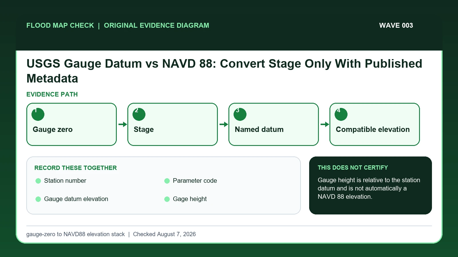
A USGS gauge height is normally measured above the station's local gauge datum, not directly above NAVD 88. To express water-surface elevation, add the gauge height to the documented elevation of the gauge datum only when the station metadata, datum, units, and period support that calculation; do not combine values from different datum eras.
Last checked: August 7, 2026.
Gauge zero is a stable station reference maintained through level surveys. Station metadata may state that the datum of gauge is a specific number of feet above NAVD 88, NGVD 29, or another reference. A newer conversion can change the published datum elevation without changing the physical river at that moment. Some stations also publish a separate stream-level-above-NAVD88 parameter, which should not be confused with ordinary gage height.
The addition is easy; compatibility is the real test
Ordinary gage height is measured above a station's local gauge zero. NAVD 88 is a named vertical datum. When station metadata says the gauge datum is 779.38 feet above NAVD 88 and the compatible gage height is 10.20 feet, the screened water-surface elevation is 779.38 plus 10.20, or 789.58 feet NAVD 88. The equation is simple; proving that both terms belong together is the hard part.
Before adding, match station number, parameter code, units, datum statement, and effective period. Some stations publish a separate parameter already expressed as stream level above NAVD 88. Adding the gauge datum to that value a second time would create a large false elevation. Conversely, a datum statement in NGVD 29 cannot be labeled NAVD 88 without a documented transformation appropriate to the location and survey context.
Station datums can be revised after leveling, equipment moves, or network updates. A time-series breakpoint caused by a datum change is not a sudden physical rise in the river. Retain the old and new metadata with their dates, and treat provisional values as provisional even after arithmetic. Comparing the result with a building elevation also requires compatible survey datum, uncertainty, and location; this calculation does not turn a gauge into a parcel survey.
Station metadata controls the elevation reference
USGS Water Data for the Nation supplies monitoring-location metadata, instantaneous values, daily values, peaks, and qualification codes; this guide cites it for Station number / Parameter code / Gage height / Datum history. USGS water-data datum definitions supplies the distinction between local gage datum, gage height above that datum, and conversion to NAVD 88 or NGVD 29 when the datum elevation is known; this guide cites it for Gauge datum elevation / Gage height / Datum history. USGS provisional-data statement supplies why near-real-time records are subject to review, correction, and approval; this guide cites it for Gage height / Datum history.
The USGS gauge datum NAVD 88 crosswalk keeps these assignments explicit: USGS Water Data for the Nation → Station number / Parameter code / Gage height / Datum history; USGS water-data datum definitions → Gauge datum elevation / Gage height / Datum history; USGS provisional-data statement → Gage height / Datum history. If Station number or another named field is absent from its cited record, leave that fact unresolved and obtain it from the responsible official source instead of expanding a different citation beyond scope.
| Official record | What it actually supplies | Field used here |
|---|---|---|
| USGS Water Data for the Nation | monitoring-location metadata, instantaneous values, daily values, peaks, and qualification codes | Station number / Parameter code / Gage height / Datum history |
| USGS water-data datum definitions | the distinction between local gage datum, gage height above that datum, and conversion to NAVD 88 or NGVD 29 when the datum elevation is known | Gauge datum elevation / Gage height / Datum history |
| USGS provisional-data statement | why near-real-time records are subject to review, correction, and approval | Gage height / Datum history |
For this check, the cited evidence is limited to Station number, Gage height, and Gauge datum elevation plus the other fields named in the crosswalk. Record a changed or missing Gage height value with the retrieval date before taking the action to determine whether a defensible conversion to a geodetic elevation exists, then request clarification from its publishing agency.
How Station number connects to Datum history
| Field | Meaning in this check | Error it exposes | Response |
|---|---|---|---|
| Station number | Controls the metadata and datum | Nearby gauges have different zeros | Keep with every value |
| Parameter code | Distinguishes gage height from stream elevation | Similar labels can use different references | Read definition and unit |
| Gauge datum elevation | Elevation of gauge zero in named datum | Can be revised or period-specific | Record value, datum, source, and date |
| Gage height | Water height above gauge zero | Not automatically NAVD 88 elevation | Combine only with compatible datum metadata |
| Datum history | Old and new references or conversions | Mixing eras creates a false jump | Split time series at documented changes |
Read the table in two passes. First confirm Station number, Parameter code, and Gauge datum elevation. They answer “Controls the metadata and datum”, “Distinguishes gage height from stream elevation”, and “Elevation of gauge zero in named datum”. Any disagreement among Station number, Parameter code, and Gauge datum elevation should remain visible rather than being blended into one result.
Next test for two different problems: “Nearby gauges have different zeros” and “Can be revised or period-specific”. They require different corrections. For the first, follow “Keep with every value”; for the second, follow “Record value, datum, source, and date”.
Gage height and Datum history show when to stop. The warning conditions are “Not automatically NAVD 88 elevation” and “Mixing eras creates a false jump”. The limits on Gage height and Datum history keep the evidence useful without making the broader decision reserved for the named authority or professional.
Verify parameter and datum era before calculating
Build the evidence from Station number outward. The middle of the review should move from “Copy the full gauge-datum statement, including units, vertical datum, method, and effective period” to “Check revised-record and station-specific notes for datum moves or conversions”. Record any conflict before continuing to the remaining checks.
- Open the exact USGS station page and record station number, name, location, and period of record.
- Identify the parameter code and determine whether the value is gage height or referenced stream elevation.
- Copy the full gauge-datum statement, including units, vertical datum, method, and effective period.
- Check revised-record and station-specific notes for datum moves or conversions.
- Perform any arithmetic in a worksheet that preserves source values and units.
- Compare only elevations using the same vertical datum and document any approved transformation.
- Label the result as an observational screen, not a surveyed property or regulatory flood elevation.
After the comparison, “Label the result as an observational screen, not a surveyed property or regulatory flood elevation”. The saved evidence should let another reader retrace Station number through Gauge datum elevation without guessing which limitation applied.
Adding 10.20 feet to the correct gauge zero
If a station lists gauge datum 779.38 feet above NAVD 88 and an ordinary gauge height of 10.20 feet, a simple elevation screen would be 789.58 feet NAVD 88 only if the same station, units, datum period, and parameter definitions apply. The arithmetic does not turn provisional data into a survey and should not be used against a building elevation without compatible datum evidence.
In this example, Station number identifies the relevant record, while Gauge datum elevation is the fact most likely to change the interpretation. Conclude “Needs gauge datum for elevation” only when the evidence shows “Parameter is height above local zero”.
For USGS gauge datum NAVD 88, if the facts instead fit “Datum missing”, the result changes to “NAVD calculation is unsupported”. Respond by following “Request station information”. Do not substitute the more favorable conclusion from the earlier example.
Local stage, direct NAVD 88 parameter, changed datum, and missing metadata
| Observed state | Evidence test | Limited conclusion | Next response |
|---|---|---|---|
| Ordinary gage height | Parameter is height above local zero | Needs gauge datum for elevation | Retain as stage if datum is uncertain |
| Stream level, NAVD 88 | Parameter directly reports referenced elevation | Still station- and time-specific | Do not add gauge datum again |
| Datum converted | Metadata gives update date and old/new values | Series may require adjustment | Document the breakpoint |
| Datum missing | No reliable elevation of gauge zero | NAVD calculation is unsupported | Request station information |
Use “Parameter is height above local zero” to recognize “Ordinary gage height”. If the facts instead meet “Parameter directly reports referenced elevation”, report “Still station- and time-specific” and follow “Do not add gauge datum again”.
If the observation matches “Metadata gives update date and old/new values”, stop at “Series may require adjustment”. If it matches “No reliable elevation of gauge zero”, stop at “NAVD calculation is unsupported”. The corresponding actions are “Document the breakpoint” and “Request station information”.
Prevent double addition and false jumps at datum changes
- Avoid calling gauge height NAVD 88. Recheck Gauge datum elevation / Gage height. The mapped warning is “Can be revised or period-specific; Not automatically NAVD 88 elevation”; the corresponding response is “Record value, datum, source, and date; Combine only with compatible datum metadata”.
- Avoid adding datum twice. Recheck Parameter code / Gauge datum elevation / Gage height. The mapped warning is “Similar labels can use different references; Can be revised or period-specific; Not automatically NAVD 88 elevation”; the corresponding response is “Read definition and unit; Record value, datum, source, and date; Combine only with compatible datum metadata”.
- Avoid mixing NGVD29 and NAVD88. Recheck Gauge datum elevation / Datum history. The mapped warning is “Can be revised or period-specific; Mixing eras creates a false jump”; the corresponding response is “Record value, datum, source, and date; Split time series at documented changes”.
- Avoid ignoring a station move or conversion date. Recheck Datum history. The mapped warning is “Mixing eras creates a false jump”; the corresponding response is “Split time series at documented changes”.
Check Gauge datum elevation / Gage height when the risk is “calling gauge height NAVD 88”, because the mapped warning is “Can be revised or period-specific; Not automatically NAVD 88 elevation”. Check Parameter code / Gauge datum elevation / Gage height separately for “adding datum twice” and use “Read definition and unit; Record value, datum, source, and date; Combine only with compatible datum metadata” as the recovery step.
Two field-specific corrections are required. For “mixing NGVD29 and NAVD88”, follow “Record value, datum, source, and date; Split time series at documented changes”. For “ignoring a station move or conversion date”, follow “Split time series at documented changes”. Keeping Gauge datum elevation / Datum history separate from Datum history prevents one repaired field from hiding the other error.
What this gauge-zero to NAVD88 elevation stack cannot decide
Scope: United States observed and forecast river conditions. Limitation: Gauge height is relative to the station datum and is not automatically a NAVD 88 elevation.
This comparison can expose a conflict between Station number and Gauge datum elevation, but it cannot resolve “Datum missing”. In that condition, the defensible next step remains “Request station information”.
Keep the elevation calculation separate from flood categories
- Carry the verified Station number to River Flood Risk Check if that linked topic is the reader’s next question.
- Keep Gauge datum elevation attached to its source when moving to USGS Streamstats Flood Frequency Report.
- Treat USGS Flood Event Viewer High Water Marks as a separate review triggered by Datum history while working to determine whether a defensible conversion to a geodetic elevation exists, not as confirmation of the result here.
Use this guide to determine whether a defensible conversion to a geodetic elevation exists. The linked guides address separate questions raised by Station number, Gauge datum elevation, or Datum history.
Before labeling gauge height as NAVD 88 elevation
Does Station number settle the question by itself?
No. Station number answers “Controls the metadata and datum”, but it can fail when “Nearby gauges have different zeros”. Pair it with Parameter code, Gauge datum elevation, and the checked date.
What if the evidence shows Datum missing?
Confirm the stated evidence test: “No reliable elevation of gauge zero”. The limited conclusion is “NAVD calculation is unsupported”. The documented response is “Request station information”; a more favorable branch should not be substituted.
When should Datum history be checked again?
Redo the elevation calculation if station metadata changes the gauge zero, datum, parameter code, or effective period. Before comparing with a survey, confirm that the survey still uses the same vertical datum and that the USGS value was not already published directly as NAVD 88 elevation.
USGS Gauge Datum vs NAVD 88: Convert Stage Only With Published Metadata is independent public-record guidance for the limited action to determine whether a defensible conversion to a geodetic elevation exists. The cited government records retain authority over Station number and Datum history. Last checked: August 7, 2026.