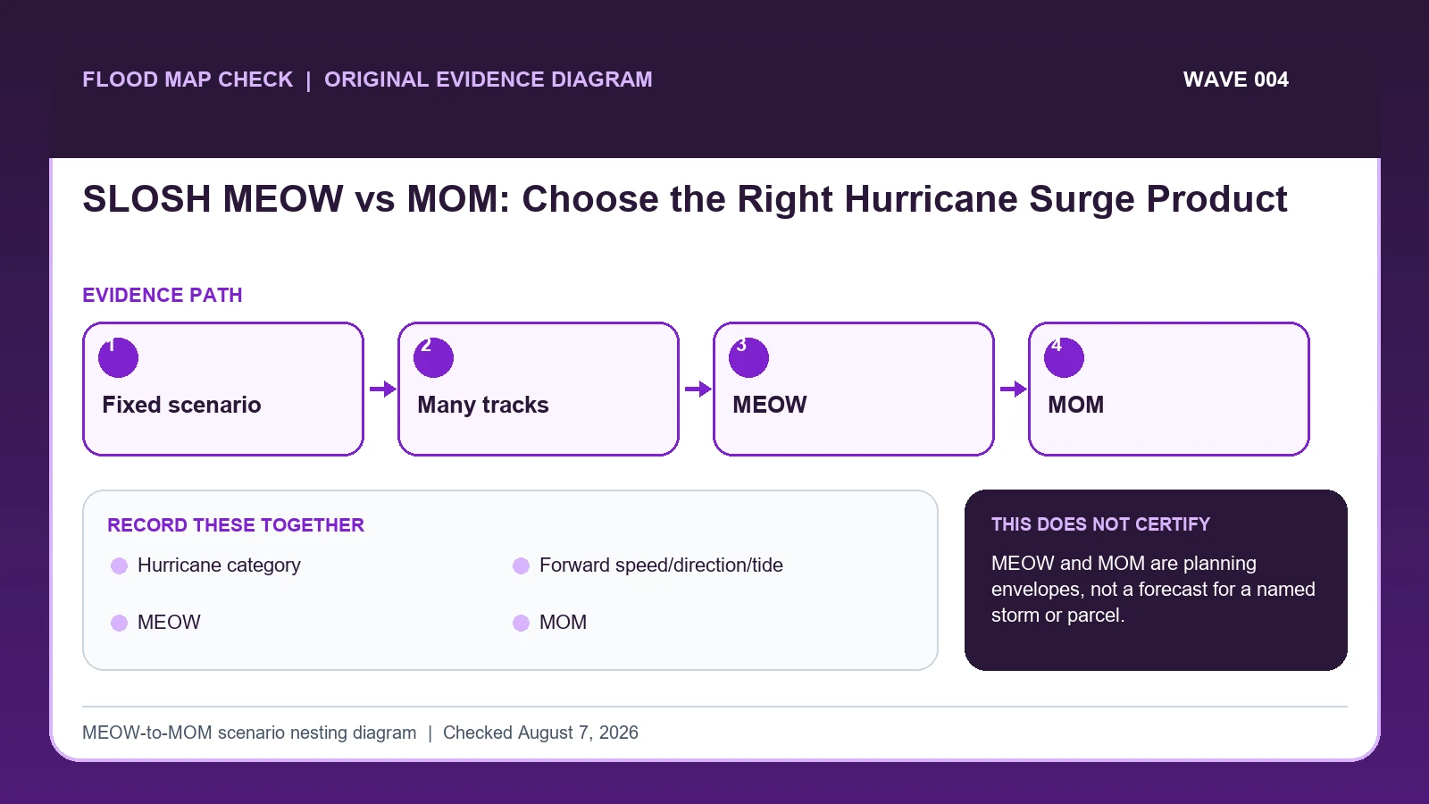
A SLOSH MEOW holds hurricane category, forward speed, direction, and tide scenario constant while compositing the maximum surge from many hypothetical tracks. A MOM takes the maximum across the MEOWs for a hurricane category, creating a broader near-worst-case planning envelope; neither is a deterministic forecast for a named storm or parcel.
Last checked: August 7, 2026.
Maximum Envelopes of Water are conditional scenario products. Maximum of MEOWs removes more scenario distinctions to show the maximum in each grid cell for a category. NHC's national surge risk maps are based on high-tide SLOSH MOM products and use inundation bins. The maps exclude some small-scale terrain and are intended for awareness and community planning, not navigation, permitting, regulatory determination, or evacuation-zone replacement.
The product takes maxima; it does not average storms
SLOSH MEOW and MOM products summarize different collections of modeled hurricane scenarios. A MEOW is the maximum envelope for storms sharing selected characteristics such as category, track direction, forward speed, and tide condition. A MOM takes the maximum across a broader set of MEOWs for a category. Because a MOM combines more scenarios, it is generally more conservative and less tied to one storm description.
The comparison is a maximum operation, not an average. If three scenario cells produce 4, 6, and 5 feet for a location, the envelope value is 6 feet for that scenario family. A broader MOM may be higher after maxima from other directions and speeds are included. Those numbers remain products of the model's assumptions and elevation reference; they are not probabilities that the next storm will produce exactly that depth.
Dry cells, leveed areas, small-scale terrain, waves, rainfall, and river flow can fall outside the intended interpretation. Operational forecast surge products and local emergency instructions should guide an approaching event. Planning layers can compare broad exposure, while a FIRM and community rules answer regulatory questions. Do not overlay a MOM color on a parcel and call it an insurance zone or guaranteed worst case.
NHC defines MEOW and MOM by the scenarios combined
NHC Maximum Envelope of Water information supplies MEOW scenario dimensions, basin availability, and operational-user caution; this guide cites it for Hurricane category / Forward speed/direction/tide / MEOW. NHC National Storm Surge Risk Maps supplies SLOSH MOM planning maps, inundation bins, coverage, and non-parcel limitations; this guide cites it for MOM / Grid/inundation bin. National Hurricane Center storm surge resources supplies operational and planning surge products and their intended use; this guide cites it for Hurricane category / Forward speed/direction/tide / MEOW / MOM / Operational/local decision role.
The SLOSH MEOW vs MOM crosswalk keeps these assignments explicit: NHC Maximum Envelope of Water information → Hurricane category / Forward speed/direction/tide / MEOW; NHC National Storm Surge Risk Maps → MOM / Grid/inundation bin; National Hurricane Center storm surge resources → Hurricane category / Forward speed/direction/tide / MEOW / MOM / Operational/local decision role. If Hurricane category or another named field is absent from its cited record, leave that fact unresolved and obtain it from the responsible official source instead of expanding a different citation beyond scope.
| Official record | What it actually supplies | Field used here |
|---|---|---|
| NHC Maximum Envelope of Water information | MEOW scenario dimensions, basin availability, and operational-user caution | Hurricane category / Forward speed/direction/tide / MEOW |
| NHC National Storm Surge Risk Maps | SLOSH MOM planning maps, inundation bins, coverage, and non-parcel limitations | MOM / Grid/inundation bin |
| National Hurricane Center storm surge resources | operational and planning surge products and their intended use | Hurricane category / Forward speed/direction/tide / MEOW / MOM / Operational/local decision role |
For this check, the cited evidence is limited to Hurricane category, MOM, and Operational/local decision role plus the other fields named in the crosswalk. Record a changed or missing MOM value with the retrieval date before taking the action to choose a scenario envelope without treating it as a deterministic forecast, then request clarification from its publishing agency.
How Hurricane category connects to Operational/local decision role
| Field | Meaning in this check | Error it exposes | Response |
|---|---|---|---|
| Hurricane category | Intensity class used in scenario set | Not expected damage at an address | Keep with product |
| Forward speed/direction/tide | Dimensions held for a MEOW | Changing them changes envelope | Record full scenario |
| MEOW | Maximum across hypothetical tracks for one parameter combination | No single storm creates whole footprint | Use conditional planning |
| MOM | Maximum across MEOWs for category | Broader near-worst-case envelope | Use community awareness |
| Grid/inundation bin | Modeled spatial output | Not survey/parcel precision | Read metadata and coverage |
| Operational/local decision role | Identifies the current forecast, evacuation order, or other authority that controls an actual event | A planning envelope cannot replace an operational warning or local order | Use current NHC products and local emergency instructions |
Read the table in two passes. First confirm Hurricane category, Forward speed/direction/tide, and MEOW. They answer “Intensity class used in scenario set”, “Dimensions held for a MEOW”, and “Maximum across hypothetical tracks for one parameter combination”. Any disagreement among Hurricane category, Forward speed/direction/tide, and MEOW should remain visible rather than being blended into one result.
Next test for two different problems: “Not expected damage at an address” and “No single storm creates whole footprint”. They require different corrections. For the first, follow “Keep with product”; for the second, follow “Use conditional planning”.
Grid/inundation bin and Operational/local decision role show when to stop. The warning conditions are “Not survey/parcel precision” and “A planning envelope cannot replace an operational warning or local order”. The limits on Grid/inundation bin and Operational/local decision role keep the evidence useful without making the broader decision reserved for the named authority or professional.
Record basin, scenario dimensions, tide, and height reference
Build the evidence from Hurricane category outward. The middle of the review should move from “Read inundation units, bins, topographic source, resolution, and no-data or leveed-area treatment” to “Use MEOWs for conditional scenario comparison and MOMs for broader category planning”. Record any conflict before continuing to the remaining checks.
- Identify whether the displayed product is a MEOW, MOM, national risk map, or operational storm forecast.
- Record basin/grid, hurricane category, tide assumption, forward speed, direction, and product version where applicable.
- Read inundation units, bins, topographic source, resolution, and no-data or leveed-area treatment.
- Use MEOWs for conditional scenario comparison and MOMs for broader category planning.
- Never interpret the composite footprint as one hurricane track or probability surface.
- During a storm, switch to current NHC advisories, operational surge products, and local orders.
- Keep FEMA regulatory maps and local evacuation maps as separate decision records.
After the comparison, “Keep FEMA regulatory maps and local evacuation maps as separate decision records”. The saved evidence should let another reader retrace Hurricane category through MEOW without guessing which limitation applied.
The maximum across scenarios is not their average
A Category 3 MOM can show water in places that no single Category 3 hurricane would flood simultaneously because each cell keeps its maximum from different hypothetical storms. A MEOW is narrower but still not one forecast track. During an actual storm, use NHC's operational surge products and local evacuation instructions.
In this example, Hurricane category identifies the relevant record, while MEOW is the fact most likely to change the interpretation. Conclude “MEOW is more specific” only when the evidence shows “Need effect of direction/speed/tide”.
For SLOSH MEOW vs MOM, if the facts instead fit “Evacuation decision”, the result changes to “SLOSH map is not order”. Respond by following “Follow emergency management”. Do not substitute the more favorable conclusion from the earlier example.
Single run, MEOW family, MOM envelope, and unsupported location
| Observed state | Evidence test | Limited conclusion | Next response |
|---|---|---|---|
| Scenario comparison | Need effect of direction/speed/tide | MEOW is more specific | Compare like-for-like settings |
| Broad category planning | Need near-worst-case envelope | MOM fits | Do not call forecast |
| Named storm operations | Actual advisory exists | Planning envelope is secondary | Use official operational surge forecast |
| Evacuation decision | Local zone/order applies | SLOSH map is not order | Follow emergency management |
Use “Need effect of direction/speed/tide” to recognize “Scenario comparison”. If the facts instead meet “Need near-worst-case envelope”, report “MOM fits” and follow “Do not call forecast”.
If the observation matches “Actual advisory exists”, stop at “Planning envelope is secondary”. If it matches “Local zone/order applies”, stop at “SLOSH map is not order”. The corresponding actions are “Use official operational surge forecast” and “Follow emergency management”.
Dry cells, missing processes, and parcel overreach
- Avoid calling MOM a forecast. Recheck MOM. The mapped warning is “Broader near-worst-case envelope”; the corresponding response is “Use community awareness”.
- Avoid treating composite footprint as simultaneous. Recheck MEOW / MOM. The mapped warning is “No single storm creates whole footprint; Broader near-worst-case envelope”; the corresponding response is “Use conditional planning; Use community awareness”.
- Avoid using grid cell for parcel certification. Recheck Grid/inundation bin. The mapped warning is “Not survey/parcel precision”; the corresponding response is “Read metadata and coverage”.
- Avoid replacing evacuation zones. Recheck Operational/local decision role. The mapped warning is “A planning envelope cannot replace an operational warning or local order”; the corresponding response is “Use current NHC products and local emergency instructions”.
Check MOM when the risk is “calling MOM a forecast”, because the mapped warning is “Broader near-worst-case envelope”. Check MEOW / MOM separately for “treating composite footprint as simultaneous” and use “Use conditional planning; Use community awareness” as the recovery step.
Two field-specific corrections are required. For “using grid cell for parcel certification”, follow “Read metadata and coverage”. For “replacing evacuation zones”, follow “Use current NHC products and local emergency instructions”. Keeping Grid/inundation bin separate from Operational/local decision role prevents one repaired field from hiding the other error.
What this MEOW-to-MOM scenario nesting diagram cannot decide
Scope: United States coastal screening and observed water levels. Limitation: MEOW and MOM are planning envelopes, not a forecast for a named storm or parcel.
This comparison can expose a conflict between Hurricane category and MEOW, but it cannot resolve “Evacuation decision”. In that condition, the defensible next step remains “Follow emergency management”.
Move from planning envelopes to current surge guidance
- Carry the verified Hurricane category to Coastal Flood Map Check if that linked topic is the reader’s next question.
- Keep MEOW attached to its source when moving to NOAA Sea Level Rise Viewer Address Guide.
- Treat Coastal A Zone LiMWA Lookup as a separate review triggered by Operational/local decision role while working to choose a scenario envelope without treating it as a deterministic forecast, not as confirmation of the result here.
Use this guide to choose a scenario envelope without treating it as a deterministic forecast. The linked guides address separate questions raised by Hurricane category, MEOW, or Operational/local decision role.
Before describing a SLOSH product as a forecast
Does Hurricane category settle the question by itself?
No. Hurricane category answers “Intensity class used in scenario set”, but it can fail when “Not expected damage at an address”. Pair it with Forward speed/direction/tide, MEOW, and the checked date.
What if the evidence shows Evacuation decision?
Confirm the stated evidence test: “Local zone/order applies”. The limited conclusion is “SLOSH map is not order”. The documented response is “Follow emergency management”; a more favorable branch should not be substituted.
When should Operational/local decision role be checked again?
Return to the SLOSH definitions when NHC updates the basin, model version, scenario dimensions, tide assumption, or product coverage. For an active storm, replace planning envelopes with the latest official surge forecast and emergency guidance rather than refreshing a MEOW or MOM as though it were an advisory.
SLOSH MEOW vs MOM: Choose the Right Hurricane Surge Product is independent public-record guidance for the limited action to choose a scenario envelope without treating it as a deterministic forecast. The cited government records retain authority over Hurricane category and Operational/local decision role. Last checked: August 7, 2026.